Lake Volumetrics
150 likes | 290 Vues
Lake Volumetrics. Introduction. Methods: Data. DEM from USGS Digitized version of 1:24,000 topo quadrangle Vertical accuracy 5m, 30m resolution KML files, digitized from Google Earth Lake perimeter Drain line for dam Drain depth estimations in 400ft increments BING aerial imagery.

Lake Volumetrics
E N D
Presentation Transcript
Methods: Data • DEM from USGS • Digitized version of 1:24,000 topo quadrangle • Vertical accuracy 5m, 30m resolution • KML files, digitized from Google Earth • Lake perimeter • Drain line for dam • Drain depth estimations in 400ft increments • BING aerial imagery
Create DEM of Lake Bottom • Convert 30m raster DEM to center points • Edit points within the lake perimeter to reflect drain depth estimations Center-point values edited to reflect the lake bottom. Values are based on drain line depth estimations.
Lake Bottom DEM Cont’d • Points file mass points for terrain creation • Interpolate terrain to raster DEM with cell size 6.35m*
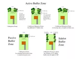
Establish shoreline • Kml shoreline doesn’t make ‘elevational’ sense... • Modified using aerial imagery, DEM • Flood level established from photos taken in Summer 2011...
Create DEM of Lake Surface • Select all points within lake perimeter at each height • Assign new value to selected points • Create terrain from points and interpolate to raster
Depth Raster • Raster subtraction using Lake bottom DEM and Lake surface DEMs Normal Height Flood Height
Analysis: Volume • Performed in Excel • Normal and flood depth rasters converted to ascii and imported to Excel • Volume: Cell Length x Width x Height (depth) • 6.35m x 6.35m x (depth) • Sum all volume calculations Normal Water Level: 85,569.16 m3 (112,095.6 yd3) Flood Water Level: 190,154.91 m3 (249,102.93 yd3)
Discussion • Data: • 30m DEM from topo contour digitization/ interpolation poor quality for scale of analysis • Lake depths estimations from lake users • Terrain to Raster • Raster grid size (6.35m): questionable • Should match input size (30m), but too coarse for lake perimeter—excludes large amounts of lake area • ESRI default: based on the overall dimensions of the minimum bounding rectangle and the number of input elevation points