Download
1 / 4
40 likes | 184 Vues
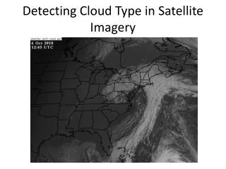
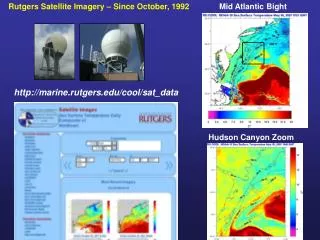
Rutgers Satellite Imagery – Since October, 1992. Mid Atlantic Bight. http://marine.rutgers.edu/cool/sat_data. Hudson Canyon Zoom. Rutgers Website Usage – Tracked since 1995. Hourly Usage – 99% External. May 2006 daily averages: 406,471 hits; 255,608 files; 22,009 pages; 6,322 visits.

E N D
Rutgers Satellite Imagery – Since October, 1992 Mid Atlantic Bight http://marine.rutgers.edu/cool/sat_data Hudson Canyon Zoom
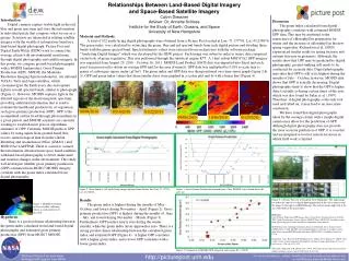
Rutgers Website Usage – Tracked since 1995 Hourly Usage – 99% External May 2006 daily averages: 406,471 hits; 255,608 files; 22,009 pages; 6,322 visits. Automatic Satellite Data Backup with U. Maine SST Regions of Interest
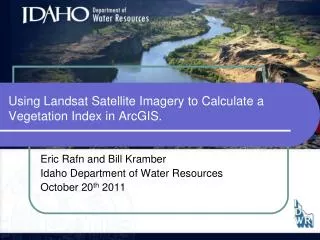
Rutgers Underwater Gliders – Since October, 2003 Temperature http://marine.rutgers.edu/cool/auvs Salinity Backscatter
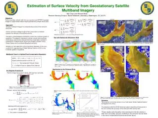
Coordination with NOAA Fisheries Programs Monthly Supplemental Finfish Surveys Fish Tracking Receivers on Gliders Glider Outbound Glider Inbound