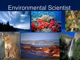
Information Scientist needs for Environmental Modeling and Understanding
140 likes | 270 Vues
This presentation highlights the essential skills and technologies required for environmental modeling and monitoring. It discusses innovative data collection methods employed by NECTEC in Thailand, including sensor technologies for measuring river levels, coral reef conditions, and urban traffic patterns. The importance of real-time data transmission and cultural tourism integration is underscored. Collaborative efforts across organizations are presented, showcasing a comprehensive approach to understanding and addressing environmental challenges, particularly for disaster prediction and urban management.

Information Scientist needs for Environmental Modeling and Understanding
E N D
Presentation Transcript
Information Scientist needs for Environmental Modeling and Understanding Virach Sornlertlamvanich virach.sornlertlamvanich@nectec.or.th National Electronics and Computer Technology Center (NECTEC), Thailand GESL Panel, APCESE-IICC, Honolulu, Hawaii, September 9-11, 2013
Gartner Top Predictions for 2012Four forces are shaping the future of IT GESL Panel, APCESE-IICC, Honolulu, Hawaii, September 9-11, 2013
What are we collecting? • Water levels in the rivers and canals in the target area are measured by sensors. • Sensors are installed in a coral reef of RachaYai Island near Phuket Island. Water conductivity, temperature and depth data are recorded. • Data of rainfall quantity, temperature, and humidity in the mountainous area of Mae Hong Son and Chiang Mai provinces are transmitted via GPRS timely to the server for landslide prediction. • Environmental cultural data are reported from provinces and school communities of border petrol police. GESL Panel, APCESE-IICC, Honolulu, Hawaii, September 9-11, 2013
Information Scientist Needs for Environmental Modeling and Understanding • Environmental Monitoring System (temperature, humidity, and rainfall quantity) • GPS-based Traffic Information Analysis & Data Mining for Urban Environment (urban taxi GPS information) • Underwater Environmental Monitoring and Analysis System (water conductivity, temperature, and depth) • Cultural Tourism with Spatial-Temporal Computing (urban taxi GPS information, Environmental cultural information) GESL Panel, APCESE-IICC, Honolulu, Hawaii, September 9-11, 2013
Underwater Environmental Monitoring and Analysis System---Coral Virtual Site at Racha Island, Phuket, Thailand--- • In this study, we collect information using all available technology e.g. temp/light intensity sensors, ecocam coral monitoring, field photos and videos, and 360 degree panoramic photos. • All of these information should provide virtual environment of the island to Thai students throughout Thailand for their learning inquiries. • Collected data : conductivity, temperature, and depth • Collaboration : Walailuk University, NECTEC GESL Panel, APCESE-IICC, Honolulu, Hawaii, September 9-11, 2013
Ecocam Data • Images were transferred real-time online into an FK-RJ2604 device. • Experimental Push and pull operations are used to transfer streaming data to Data turbine • Observation of the coral reef using the Coral Virtual Site System started on 8 February 2010 . Issue: underwater tracking and mapping system GESL Panel, APCESE-IICC, Honolulu, Hawaii, September 9-11, 2013
Environmental Monitoring System---Flash Flood and Landslide Warning System--- • 243 stations covering 22 districts in Chiang Mai • Collaboration : Chiang Mai Province, Dept. of Disaster Prevention and Mitigation, NECTEC GESL Panel, APCESE-IICC, Honolulu, Hawaii, September 9-11, 2013
Environmental Monitoring System • Collected data : temperature, humidity, and rainfall quantity Issue: site failure detection, landslide predicting and warning system GESL Panel, APCESE-IICC, Honolulu, Hawaii, September 9-11, 2013
GPS-based Traffic Information Analysis & Data Mining for Urban Environment • 10,000 taxis with GPS install • 25,000 routes in Bangkok are monitored Source: TTET for TSQUARE Traffic Information Service GESL Panel, APCESE-IICC, Honolulu, Hawaii, September 9-11, 2013
GPS-based Traffic Information Analysis & Data Mining for Urban Environment 70% Source: TTET for TSQUARE Traffic Information Service GESL Panel, APCESE-IICC, Honolulu, Hawaii, September 9-11, 2013
Cultural Tourism with Spatial-Temporal Computing • Collected data : Cultural information from 77 provinces • Collaboration : Ministry of Culture, NECTEC GESL Panel, APCESE-IICC, Honolulu, Hawaii, September 9-11, 2013
Cultural Tourism with Spatial-Temporal Computing---Cross-Border Cultural Environment--- • Cultural data 139,243spots (19 Feb2013) • Border School 169 areas GESL Panel, APCESE-IICC, Honolulu, Hawaii, September 9-11, 2013
GESL Panel, APCESE-IICC, Honolulu, Hawaii, September 9-11, 2013
Skill Needs for Environmental Scientist • Problem modeling and understanding • Data collection and analysis • Information scientist being • Innovative solution initiative Leadership Innovative Information GESL Panel, APCESE-IICC, Honolulu, Hawaii, September 9-11, 2013