Download
1 / 36
360 likes | 525 Vues
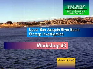
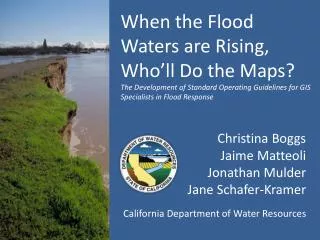
When the Flood Waters are Rising, Who’ll Do the Maps? The Development of Standard Operating Guidelines for GIS Specialists in Flood Response. Christina Boggs Jaime Matteoli Jonathan Mulder Jane Schafer-Kramer. California Department of Water Resources. Overview. Introduction (Jaime)

E N D
When the Flood Waters are Rising,Who’ll Do the Maps?The Development of Standard Operating Guidelines for GIS Specialists in Flood Response Christina Boggs Jaime Matteoli Jonathan Mulder Jane Schafer-Kramer California Department of Water Resources
Overview • Introduction (Jaime) • Purpose and Development History (CB) • Incident Command Team Environment (Jane) • Data Needs (Jane) • Answering Questions (Jon) • Mapping (Jon) • Future Resources (Jaime) • Conclusion (Jaime)
Overview • Introduction (Jaime) • Purpose and Development History (CB) • Incident Command Team Environment (Jane) • Data Needs (Jane) • Answering Questions (Jon) • Mapping (Jon) • Future Resources (Jaime) • Conclusion (Jaime)
Overview • Introduction (Jaime) • Purpose and Development History (CB) • Incident Command Team Environment (Jane) • Data Needs (Jane) • Answering Questions (Jon) • Mapping (Jon) • Future Resources (Jaime) • Conclusion (Jaime)
Nothing Ever Happens • Fall 2007 Southern California Wildfires • July 2008 Inyo County Mud Flow • January 2009 Medford Island Levee Repair • August 2009 Ship Soft Grounding – Bradford Island • October 12-13, 2009 Columbus Day Storms • Golden Guardian Exercise 2010/2011 • F-CO Exercise 2009/2010/2011
I need 4 maps in the next hour and someone needs to know what County Hamilton City is in.
Purpose • We all work differently, standardizing is good. • We have a need.
Development Historyand Process • Take something awesome • Make it fit us • Keep fixing • Repeat
Overview • Introduction (Jaime) • Purpose and Development History (CB) • Incident Command Team Environment (Jane) • Data Needs (Jane) • Answering Questions (Jon) • Mapping (Jon) • Future Resources (Jaime) • Conclusion (Jaime)
DWR Incident Command Structure Consistent with National Incident Management System (NIMS) requirement
Bacon Island Road Incident June 2004(Jones Tract Flood)
Incident Response Activity Incident Command Center California Conservation Corps Crew Reinforces At-Risk Levee ICC Planning Meeting
Incident Action Plan map created from background image and MS Word graphics Crane mounted on barge places rock to fill the breech
Then (2004) • No internet connectivity • Limited cell phone coverage • Limited computer hardware • No GIS software available • Data acquired via CD, flashdrive, paper, and phone calls • IC planning staff recruited on-the-fly, no advance training • Planning Section staff worked 14+ hour shifts to produce daily Incident Action Plan
Now (2012) • 3 communication trailers staged to provide instant connectivity • ArcGIS pre-installed on dedicated laptops • GIS data pre-loaded on hard drives • 6 Incident Command Teams formed • Periodic readiness exercises • Annual GISS training course established • DWR Field Operations Guide map symbology updated • GISS Standard Operating Guidelines written • GISS are ready for the next flood
Overview • Introduction (Jaime) • Purpose and Development History (CB) • Incident Command Team Environment (Jane) • Data Needs (Jane) • Answering Questions (Jon) • Mapping (Jon) • Future Resources (Jaime) • Conclusion (Jaime)
Flood Fight Data Needs • Hydrography • California LeveeDatabase • Civil boundaries • Transportation andInfrastructure • Elevation (high resolution) • Environmental (sensitive habitats) • USGS Topo Maps and NAIP Imagery for basemaps • Weather Reports and Tide Tables
Emergency Response GIS Subcommittee meets throughout the year with staff of DWR’s Division of Flood Management
Overview • Introduction (Jaime) • Purpose and Development History (CB) • Incident Command Team Environment (Jane) • Data Needs (Jane) • Answering Questions (Jon) • Mapping (Jon) • Future Resources (Jaime) • Conclusion (Jaime)
“I know what GIS can do. I don’t just want maps; I want answers.” DWR Plans/Intel Chief
Where is the water going?
Who are at risk? Vulnerable Populations
What is at risk? Critical Infrastructure
Overview • Introduction (Jaime) • Purpose and Development History (CB) • Incident Command Team Environment (Jane) • Data Needs (Jane) • Answering Questions (Jon) • Mapping (Jon) • Future Resources (Jaime) • Conclusion (Jaime)
Overview • Introduction (Jaime) • Purpose and Development History (CB) • Incident Command Team Environment (Jane) • Data Needs (Jane) • Answering Questions (Jon) • Mapping (Jon) • Future Resources (Jaime) • Conclusion (Jaime)
Overview • Introduction (Jaime) • Purpose and Development History (CB) • Incident Command Team Environment (Jane) • Data Needs (Jane) • Answering Questions (Jon) • Mapping (Jon) • Future Resources (Jaime) • Conclusion (Jaime)
Shameless NHD Plug from Christina *The National Hydrography dataset is always relevant and important. You should support it!