Download
1 / 16
160 likes | 384 Vues
Department of Water Resources California Levee Database (CLD). An ongoing Initiative to Collect and Catalog Data for California’s Levees and Flood Control Structures by Floodplain Management Branch. Purpose.

E N D
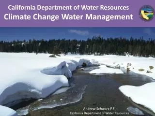
Department of Water ResourcesCalifornia Levee Database (CLD) An ongoing Initiative to Collect and Catalog Data for California’s Levees and Flood Control Structures by Floodplain Management Branch.
Purpose • “Better Understanding of and Reducing Risks from Reasonably Foreseeable Flooding” (Floodplain Management Task Force Report) • Levees play critical role in the State • Levee risk not well known • Influenced by Paterno decision • Greater political focus • Other potential uses • Mapping, project planning • Inspections, maintenance • Emergency management • Critical infrastructure • National interest in project • USACE • FEMA
Fundamental Benefits • Database definition of a levee (core attributes) • Current and searchable statewide inventory • Centralize data storage • Establishment of unique identification of flood control segments and systems • Provide framework for management of related information
History • 2007 • Data sharing management • NLD/MLI Data integration/model development • Web application development • Technical Resource data collection • 2008 • Web application development • Attribution data collection • 2009 • Align with NLD data model • Integrate data from FEMA MLI • Project levee attribute refinement • 2010 • Non-project levee data collection • ArcServer Web viewer (CLASIS) • CVFED, SPFC, CVFPP support • SPFC footprint refinement • NULE document integration • 1997 initial centerlines were created through the combined efforts of • USACE • FEMA • OES • 2005 • Initial data collection with funding from DWR & FEMA • Technical Resource Pilot Project (Santa Clara) • 2006 • Historic geotechnical boring location collection • Web application development • Technical Resource data collection • Continued data collection • Interagency coordination
Office of Emergency Service (OES) DWR Project levees Delta levees USACE Comprehensive Study FEMA FIRMs DFIRMs FLIS Local agencies Cities, counties Flood control districts Reclamation districts Levee maintenance districts Public maps USGS 7.5 min topo USGS digital orthophoto Other maps, aerial photos Google Initial Data Sources
Levee Database Design Technical Specification • Data stored at CDEC on a Unix server • DWR’s Levee Database is stored in an Oracle 10g Relational Database Management System (RDBMS) • Access to spatial features is conducted via ESRI’s ArcSDE (Spatial Data Engine) • Users interface spatial and tabular data through CLASIS (web based mapping website) or directly through ESRI’s ArcMap software
Database Management • CLD managed by Floodplain Management Branch • Current and previous CLD versions are stored at CDEC • Periodic updates being sent to CDEC loading into the master Oracle database • Access is maintained through CDEC
Accomplishments NLD Surveyed Levee Centerlines Included
Using the same data model as NLD and MLI Coordinated with FEMA and USACE to data share Developed process, procedures & scripts for importing and exporting data between the NLD & CLD Created schedule for data exchange between agencies Accomplishments Levee Data Model Interagency Design Collaboration
Work with DWR Northern District and CVFPP to determine SPFC footprint Coordinated USACE to ensure both agencies are in agreement Developed process, procedures & scripts for importing and exporting data between the NLD & CLD Submitted changes and recommendations to CVFPP for approval by DWR legal and the Central Valley Flood Protection Board Accomplishments State Plan of Flood Control (SPFC)
Work with counties/agencies outside the Central Valley Collect information on levees and levee-like structures Improve data and fill-in blanks in the database Establish relationships with agencies for exchange of data Improve levee alignment of non-project levees Accomplishments Data Collection for Non-Project Levees
Integrate data from MLI in to the CLD Adjust/Improve alignments of non-federal levees Integrate data about certification and accreditations Include information about Provisionally Accredited Levees (PAL) Refine data exchange process to streamline data transfer Accomplishments Integration of FEMA Midterm Levee Inventory (MLI)
Accomplishments California Levee and Stream Information System (CLASIS)
Import documents collected for ULE/ NULE programs into the CLD Link documents to levee segments Allows documents to be searched by levee segment Actual documents can be viewed through media table Accomplishments Integration of NULE Research Documents
Active Use of CLD Several Projects are using data from the CLD or data collected in conjunction with the levee database effort: • USACE NLD • FEMA MLI • DWR Urban levee program (ULE) • DWR Non-Urban levee program (NULE) • Central Valley Floodplain Evaluation and Delineation Program (CVFED) • Central Valley Flood Protection Plan (CVFPP) • State Plan of Flood Control (SPFC) • Non-project levee data collection outside central valley
Proposed Activities • Use as an emergency management tool during flood events • Use as base for levee related document management • Coordinate with FEMA RiskMAP program • Outreach to other State departments and the public • Web mapping application refinement • Integrate borehole information from ULE/NULE • Work with USACE Silver Jackets Program • Define data sharing policies and finalize agreement