Download
1 / 14
140 likes | 239 Vues
This report summarizes recent updates in operational chains, issues faced, and changes for TOA radiation input products. It discusses grid resolutions and considerations for grid implementation, as well as updates on GERB and CERES data. The text also includes plans for reprocessing data and outlines conclusions from the latest meeting.

E N D
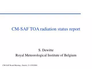
D. Caprion Royal Meteorological Institute of Belgium CM-SAF TOA radiation status report
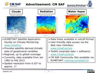
Overview • Main problems since lastest meeting • Changes to operational chains • Status input products: GERB • Status input products: CERES
Main problems • Hardware problems beginning of September • Unfortunately check our backup system Not so bad, not so good: so need of improvements ! • Consequences: delays to deliver products: High resolution: OK now TOA fluxes: July and August coming soon... • Definition of the grid: • What kind of grid shall we have to use ?
Grid ? • What do we want ? • Equal-area grid with a resolution of: either (15 km)² or (45 km)² • Answer : • Sinusoidal grid with 2N x N pixels • Tuning of N to get the resolution • But does it fully answer the requirements ?
Grid ? • Yes… And no ? Why? • The Earth is an ellipsoid • What do we need: fixed pixel location or fixed pixel size ?
Grid ? • In other words: • What kind of implementation ? DWD RMIB
Grid ? • Consequences: • DWD • Exact Equal-area grid but non-linear dependence of the latitude with the pixel index ! • RMIB • Linear dependence of the latitude with pixel index but nearly Equal-area grid ! • Open questions ?
Grid ? • Try and be a user: • 1. Do I really need an exact Equal-area grid in which geolocation is not trivial ? • 2. Do I need an easy geolocation even if I lost the exact Equal-area property of my grid ? • 3. How do I manage to pass from the low resolution to the high resolution grid ? If not implemented in the same way !
Grid ? • From RMIB point of view: • No definitive answer, except: • It is always easier to use: lat =90-180*y/N lon=(x-N)*180/(N*cos(lat)) • Than implement an elliptic integral needed to compute the fixed size of the pixels. • The user should easily go from one grid to the other one !!
Changes to operational chain • Implementation of three parallel chains: • 1 mixed (GERB/GERB-like) chain: current one • 1 pure GERB • 1 pure GERB-like test on data from May 2005 to now
Changes to operational chain GERB-like GERB-like GERB GERB Regridding Regridding Regridding + Averaging Averaging Averaging Merge with CERES Final products in HDF files
GERB status • Instrument currently in safe mode • Till mid-October (eclipse seasons) • Planned release: beginning 2006 • GIST meeting end of December 2005 to give official approval • Planned reprocessing: as soon as possible • Preliminary tests on June and July 2004 seems to be positive.
CERES status • Currently used: ES9, Terra, FM1, Edition 1 • Available up to August 2005 • More advanced: SRBAVG • Better angular models, better spatial resolution • Still waiting for ! • Decision beginning of November ?
Conclusions • Continue to check operational chains. • Should we change the grid ?!? • GERB data release planned for... Beginning 2006 • So reprocessing.....