Enhancing Geospatial Learning: The GRATI Initiative for Teachers and Students
10 likes | 124 Vues
The Geospatial Reasoning and Thinking (GRATI) Initiative, led by Bob Kolvoord, focuses on developing GIS and GPS applications for students in grades 4-12. Supported by the U.S. Department of Education and other partners, this initiative includes year-long professional development for teachers, enabling them to integrate geospatial technologies into their classrooms. A pilot study revealed that geospatial technology enhances spatial cognition skills, with significant improvements observed in students' performance. The program also develops a curriculum scope and sequence to effectively teach these skills across various educational levels.

Enhancing Geospatial Learning: The GRATI Initiative for Teachers and Students
E N D
Presentation Transcript
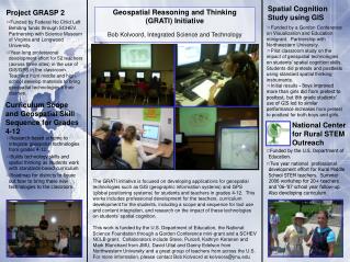
Geospatial Reasoning and Thinking (GRATI) Initiative Bob Kolvoord, Integrated Science and Technology Project GRASP 2 Spatial Cognition Study using GIS • Funded by Federal No Chlid Left Behding funds through SCHEV. Partnership with Science Museum of Virginia and Longwood University. • Year-long professional development effort for 52 teachers (across three sites) in the use of GIS/GPS in the classroom. Teachers from middle and high school develop materials to bring geospatial technologies ti their classes. • Funded by a Gordon Conference on Visualization and Education minigrant. Partnership with Northwestern University. • Pilot classroom study on the impact of geospatial technologies on students’ spatial cognition skills. Students did pretests and posttests using standard spatial thinking instruments. • Initial results - Boys improved more than girls did from pretest to posttest, but 8th grade students’ use of GIS led to similar performance increases from pretest to posttest for both boys and girls. Curriculum Scope and Geospatial Skill Sequence for Grades 4-12 National Center for Rural STEM Outreach • Research-based scheme to integrate geospatial technologies from grades 4-12. • Builds technology skills and spatial thinking as students work with standards-based curriculum • Roadmap for districts to figure out how to bring these new technologies to the classroom. • Funded by the U.S. Department of Education. • Two year national professional development effort for Rural Middle School STEM teachers. Summer 2006 workshop for 20+ teachers and ‘06-’07 school year follow-up. Also developing curriculum. The GRATI initiative is focused on developing applications for geospatial technologies such as GIS (geographic information systems) and GPS (global positioning systems) for students and teachers in grades 4-12. This works includes professional development for the teachers, curriculum development for the students, including a scope and sequence for tool use and content integration, and research on the impact of these technologies on students’ spatial cognition. This work is funded by the U.S. Department of Education, the National Science Foundation through a Gordon Conference mini-grant and a SCHEV NCLB grant. Collaborators include Steve, Purcell, Kathryn Keranen and Mark Blanchard from JMU, David Uttal and Danny Edelson from Northwestern University and a great group of teachers from across the U.S. For more information, please contact Bob Kolvoord at kolvoora@jmu.edu