Introduction to Hydrogeology
1.92k likes | 3.99k Vues
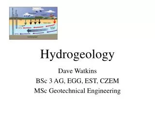
Introduction to Hydrogeology. What is Hydrology?. Study of Water Water Cycle Evaporation Condensation Precipitation Infiltration Run-off How humankind changes the water cycle. Surface Water Quality. Why Study Hydrology?. Surface Water Treatment Drinking water supplies Remediation

Introduction to Hydrogeology
E N D
Presentation Transcript
What is Hydrology? • Study of Water • Water Cycle • Evaporation • Condensation • Precipitation • Infiltration • Run-off • How humankind changes the water cycle
Surface Water Quality Why Study Hydrology? • Surface Water Treatment • Drinking water supplies • Remediation • Measurement of Water Quality • Turbidity • pH • Oxygen content • Pathogens • bacteria
Hydrogeology: What is it? • Hydrogeology examines the relationships of geologic materials and flowing water • Volume, water fluxes, and water quality are important
Groundwater • Geology controls groundwater recharge, flow, discharge and availability • Groundwater acts as a geologic agent: weathering, dissolution, volcanism, metamorphism, slope stability, earthquakes…. Hydrogeology: The study of groundwater /earth-material interactions
Hydrogeology DefinedWater/Earth Interactions Earth materials • Rock • Sediment (Soil) • Fluids (Water) Geologic processes • Form, • Distribute and • Change Earth materials • Water is a primary agent of many (all?) geologic processes
Hydrogeology DefinedWater/Earth Interactions Geology controls groundwater flow • Permeable pathways are controlled by distributions of geological materials
Hydrogeology DefinedWater/Earth Interactions Geology controls groundwater flow • Permeable pathways are controlled by distributions of geological materials • Where groundwater is available as a resource is controlled by geology
Hydrogeology DefinedWater/Earth Interactions • Permeable pathways are controlled by distributions of geological materials • Where groundwater is available as a resource is controlled by geology • Contaminant transport in the subsurface is controlled by geology Geology controls groundwater flow
Hydrogeology DefinedWater/Earth Interactions Groundwater controls geologic processes • Volcanic Processes: • Igneous Rocks: Groundwater controls water content of magmas • Metamorphic Rocks: Groundwater injected by magmas can metamorphose country rocks • Volcanism: Geysers are an example of volcanic activity interacting with groundwater
Hydrogeology DefinedWater/Earth Interactions Groundwater controls geologic processes • Earthquakes: fluids control fracturing and fault movement, lubrication and pressures • Landslides: groundwater controls slope failure • Landforms: Valley development and karst topography
Why study hydrogeology? • Water is a necessity for human life, industry, sanitatation etc. Groundwater is a major resource to meet these needs. • We must understand hydrogeology in order to understand the impact of climate and pollution and other human activities on this resource, and to manage effectively its usage. • The behaviour of subsurface water is critically important for many engineering projects.
GroundwaterThe Unseen Part of the Water Cycle Aquifer Salt Groundwater
GroundwaterThe Unseen Part of the Water Cycle • Ground water and the Water cycle • Infiltration • Overland flow • Groundwater recharge • GW flow • GW discharge
Water balance The balance between inputs and outputs in a particular water area. i.e. water input = water output +/- any change in storage. In detail for a single study area: evapotranspiration + streamflow out + interflow out + groundwater flow out + artificial abstraction) +/- (change in storage) precipitation + streamflow in + interflow in + groundwater flow in + artificial inflow =
Groundwater as a Resource • Groundwater is a major resource exploited for drinking water and agriculture
Groundwater as a Resource • On earth, the far most of the water is stored in the oceans (98%) as saline seawater. • Groundwater accounts only for 0.625%. • Water resources are not evenly distributed over the earth. • - Due to atmospheric air circulation patterns, the temperate, central tropics receive relatively high precipitation which leads to a water surplus. • - Exceptions are dry regions in the centre of the continents (e.g. Central Asia). • - The polar regions and the arid to semiarid tropics and subtropics have only low precipitation. • - However, a significant water deficit develops only in the arid to semiarid tropics and subtropics, because evapotranspiration is much higher there than in polar regions. Additionally, annual precipitation in these regions is highly variable and can be affected by severe droughts as well as heavy floods.
How much Water do We Use? • Global average per capita consumption is suggested as 50 l/d. • Consumption vary widely among different countries. • 75 % of the population in Africa live on less than 40 l/d. • 85 % of the population in Asia live on less than 80 l/d. • Consumption in Japan is between 300 – 400 l/d. • Average consumption in USA is over 700 l/d. • Consumption is related to water availability as well as economic state of a country.
Subsurface Flow • Aquifers • Porosity • Permeability slow flow through porous rock matrix fast fracture flow
Aquifer Definitions • Aquifer: A formation, group of formations, or part of a formation that contains sufficient saturated, permeable material to yield significant quantities of water to wells and springs. • Aquifer: Geologic unit that can store and transmit significant quantities of water.
Classification According to Hydraulic Conditions • Unconfined aquifer • Confined aquifer • Perched aquifer
Unconfined or Phreatic Aquifer ground surface lakes water table Sand Clay Unconfined aquifer (water table aquifer) has continuous layers of high to medium absolute permeability from the land surface to the bottom of the aquifer. The aquifer can be recharged by the downward seepage from the land surface or from lateral groundwater flow or upward seepage from underlying formations.
Confined Aquifers upland recharge area water table flowing artesian well aquiclude Clay confined aquifer Sand Clay aquiclude Confined or artesian aquifers are overlain by an impermeable or low permeable layer. The aquifer can be recharged by the downward seepage from the land surface or from lateral groundwater flow or upward seepage from underlying formations.
Relation between texture and porosity Sediment, well sorted, high porosity Sediment, poorly sorted, low porosity Consolidated (volcanic and crystalline) Karst (limestone) rock with open rocksWater flow is predominantly spaces caused by mineral in fractures dissolution
Variation of Porosity with Depth General Porosity Decrease with Depth
Porosity observed in a thin section Porosity Fife sandstone, S-W Scotland