Download
1 / 16
160 likes | 236 Vues
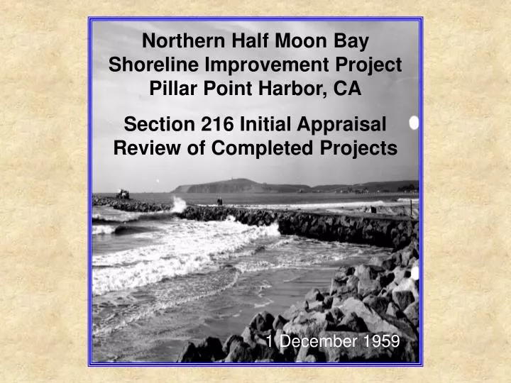
Northern Half Moon Bay Shoreline Improvement Project Pillar Point Harbor, CA Section 216 Initial Appraisal Review of Completed Projects. 1 December 1959.

E N D
Northern Half Moon BayShoreline Improvement Project Pillar Point Harbor, CA Section 216 Initial Appraisal Review of Completed Projects 1 December 1959
The purpose of this Initial Appraisal is to review the existing United States Army Corps of Engineers project at Pillar Point Harbor (authorized in 1948 with initial breakwater construction from 1959 to 1961) to determine whether it is appropriate for the Corps to participate in the resolution of documented shoreline erosion and structural damage along the northern open-ocean shoreline of Half Moon Bay. 11 November 1959
Corps participation will be based on two factors: • The extent of the post-construction shoreline change beyond the natural change that would have been expected without the Pillar Point Harbor project. • The economic viability of a potential project to mitigate for such physical changes. Based on the evaluations of these factors, the Corps will determine Federal interest, and, if positive, will recommend a further study that could lead to the design and execution of a remedial project.
In conclusion, a preponderance of evidence substantiates the claim that the construction of the East Breakwater led to a dramatically increase in the erosion rate of the shoreline between the root of the breakwater and Arroyo de en Medio. Other causal effects, such as changes in weather patterns, are thought to have made a minor contribution at best to the increased erosion rate. Parts of the shoreline in question were protected by rock and concrete periodically dumped between 1959 and 1981. However, the erosion continued and a more substantial rubble-mound revetment was constructed in 1983 to protect Highway 1 where it passes within 30 ft of the cliff edge. Erosion of the unarmored shoreline continues.
Consequently, this Initial Appraisal supports the conclusion reached by an earlier USACE study (1971): “The District Engineer finds that the erosion problem along the shores of El Granada Beach exists in two forms: (1) the direct erosion of material from the low bluffs immediately landward of the beach, and (2) the loss of littoral material from the beach backshore. He also finds that protective measures are required in the reach of coast from the Half Moon Bay East Breakwater to the mouth of the Arroyo de en Medio, approximately 4,600 feet to the southeast. No improvements are justified along the remaining coastline studied as the shoreline from Arroyo de en Medio to Miramontes Point is not eroding substantially at this time.” Note that further study will be required in any future project to confidently prove and quantify the amount of change caused by the outer breakwaters.
1971 aerial photograph of Half Moon Bay looking south with the East Breakwater in the foreground and Miramontes Point in the distance. 1971 photograph of Mirada Road looking south from near the root of the East Breakwater. Subsequently, the road was destroyed. Rip-rap can be seen along the sea cliff starting at about the white house and going south. Hypothetical log-spiral shoreline adjustment to refocusing of the incident wave energy after construction of the Pillar Point Breakwaters. Area of interest stretches from the root of the East Breakwater to Medio Creek (Arroyo de en Medio). Half Moon Bay extends a distance of 6.5 miles from Pillar Point on the north to Miramontes Point on the south. Before construction of the outer breakwater, the bay had a smoothly arcuate shoreline comprising a continuous sandy beach backed by a sea cliff cut into a low terrace of loosely consolidated sand and gravel. Half Moon Bay shoreline overlain with log-spiral curve (dashed line). Inset shows the geometry of a log-spiral curve.


![[PDF EPUB] Sunrise on Half Moon Bay By Robyn Carr Free Download](https://cdn5.slideserve.com/9829484/slide1-dt.jpg)