Download
1 / 17
170 likes | 277 Vues
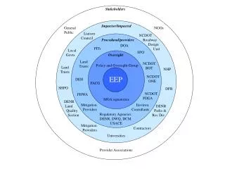
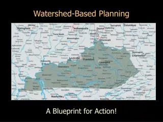
The Ecosystem Enhancement Program (EEP), initiated in July 2003 by a partnership involving the NC Department of Environment & Natural Resources and the U.S. Army Corps of Engineers, focuses on restoring, enhancing, and preserving the functions of wetlands, streams, and riparian buffers across North Carolina. The EEP employs a systematic approach to local watershed planning, identifying key stressors affecting water quality and habitat through multiple phases, including preliminary characterization, detailed assessment, stakeholder engagement, and plan implementation.

E N D
U.S. Army Corps of Engineers Wilmington District Ecosystem Enhancement Program Nationally recognized, innovative, non-regulatory program formed in July 2003 through an agreement sponsored by: NC Department of Environment & Natural Resources NC Department of Transportation U.S. Army Corps of Engineers, Wilmington District
Ecosystem Enhancement Program Mission: To restore, enhance, preserve, and protect the functions associated with wetlands, streams, and streamside buffers including, but not limited to those necessary for the restoration, maintenance, and protection of water quality and riparian habitats throughout North Carolina.
EEP Watershed Planning Scale Subwatershed 14-Digit HU 8-Digit CU River Basin
Local Watershed Planning Selection Criteria For LWP Area • Contain anticipated quantity / types of mitigation projects • Consider willingness of local RPs (and other stakeholders) to work with EEP • Consider scale and potential to evaluate water quality or habitat improvements
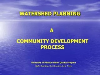
Local Watershed Planning Purpose identify major causes/sources of impacts to water quality, habitat and hydrology and develop strategies for addressing these watershed stressors. Goal ensure that projects are selected and located to achieve maximum long-term improvement to local watershed functions.
Local Watershed Planning: Phase I Preliminary Watershed Characterization • Preliminary characterizationof watershed conditions & functional needs based on best available data/GIS • Products: • Collection and evaluation of existing data • Identification of critical data gaps • Convene Local Advisory Team • Develop Outreach Strategy • Preliminary Findings & Recommendations report
Local Watershed Planning Subwatershed Delineation
Local Watershed Planning, Phase II Detailed Assessment • Detailed assessment of watershed down to reach scale • Products: • Develop GIS datasets • Field data collected and analyzed • Watershed Assessment Report
Local Watershed Planning Field Data • Biological Sampling • Insects • Fish • Algae • Water Quality Sampling • Flow, DO, pH, Temperature, conductivity • Nutrients • Toxicity • Physical Measurements • Riparian Assessment • Channel Morphology • Channel Stability • Hydrology
Local Watershed Planning Stakeholder Process • Identify local liaison/partner • Convene Local Advisory Team • Community outreach / education
Local Watershed Planning, Phase III Developing The Watershed Plan
Local Watershed Planning Matching Management Strategies to Implementation
Local Watershed Planning, Phase IV Implementation Use momentum to move from plan development to implementation
Ecosystem Enhancement Program Watershed Project Implementation • Focus on projects that have the greatest likelihood for improving watershed conditions • Consolidate compensatory mitigation resources in targeted areas to achieve maximum watershed benefit