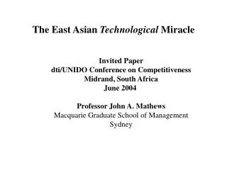
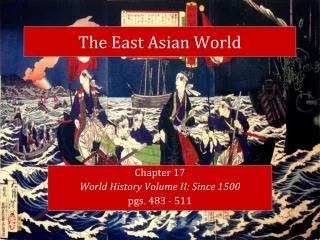
The East Asian Realm
240 likes | 493 Vues
The East Asian Realm. Mongolia. Sea of Japan. N. Korea. China. S. Korea. Hunan Plateau. Himalayas and Tibetan Plateau. Japan. Coastal Plains. Guangdong Plains. Taiwan. Pacific Ocean. Hong Kong. South China Sea. B. China. Geography A factor of unity as well as diversity.

The East Asian Realm
E N D
Presentation Transcript
The East Asian Realm Mongolia Sea of Japan N. Korea China S. Korea Hunan Plateau Himalayas and Tibetan Plateau Japan Coastal Plains Guangdong Plains Taiwan Pacific Ocean Hong Kong South China Sea
B China • Geography • A factor of unity as well as diversity. • 3rd largest country in the world. • Comparable surface with Europe and the United States: • U.S.: 3.6 million square miles. • China: 3.7 million square miles. • It is a lot but not enough. • 65% of the country mountainous. • Arable land represents 12% of the national territory as opposed to 25% for the United States. • Per capita (0.086 hectare) is well below the world average. China United States
China • 1- Huang He (Yellow River). • Can carry up to 40% sediment weight (highest in the world). • Subject to flooding, especially in its delta. • Changed course many times. • 2- Chang Jiang (Yangtze). • Longest river, China’s main street (6,300 km). • Flood of 1998 left 14 million homeless. • 3- Pearl River delta system • Most productive and sustainable ecosystem in the world. • Rice paddies and fish ponds. • 4- Heilong Jiang (Amur). • China's border with Russia. 4 1 2 3
China • Agricultural diversity • North: continental climate growing wheat, sorghum and corn. • South: subtropical climate growing rice. • A China of the West with pastoralism and oasis agriculture. Pasture and oasis Wheat Dominant Rice Dominant Double-crop rice
Japan • Small-sized country; the size of California. • Average-sized population (127 millions). • Very limited array of resources: • Favored the development of trade. • What Japan does not have on its national territory is obtained through trade. • Its industrial corporations and its banks are controlling a significant array of resources. • Domination of the Pacific Asian economy: • Vast national market. • Productive labor force. • Financial power. • Technological innovator.
Japan • Physical constraints • Physical geography increases the territorial exiguity. • 16% of the land is habitable. • Fight against the scarcity of space: • Long narrow valleys. • Concentration of agricultural productivity. • Efficient management of existing agricultural land. • Kanto plain: • 30.5% of the population. • 8.3% of the surface of Japan. • 50% of the flat territory. • Most of the Japanese population lives on an area the size of Indiana. Hokkaido Honshu Kanto Plain Nobi Plain Yamato Plain Shikoku Kyushu
South Korea • Geography • “The shrimp between the whales”. • About the size of Indiana. • Population of 48 million. • Highly homogenous ethnicity and linguistically (100% Korean). • Religiously divided between Christianity (49%) and Buddhism (47%). • 75% urban with 27% of the population living in Seoul (13 million). • 5 million Koreans live oversea: • 1 million in the United States. China North Korea Sea of Japan Demilitarized zone South Korea Japan
Taiwan • Geographical Context • About 150 km (100 miles) from the coast of southeast China. • About the size of Idaho. • Similar constraints than neighboring countries: • 60% of the territory is composed of mountains. • Chungyang Range covers about 50% the total land area. • 25% usable for agriculture. • Bulk of the population lives in the western coastal plain. • Quemoy and Matsu islands: • Used for defensive purposes. Matsu China Taiwan Formosa Strait Quemoy Chungyang Range
Agriculture and GDP Composition by Sector CHINA: Agriculture: rice, potatoes, sorghum, peanuts, tea, millet, barley, cotton, other fibers, oilseed; pork and other livestock products; fish GDP composition by sector : l agriculture: 19% l industry: 48% l services: 33% (1994 est.)
JAPAN: Agriculture: rice, sugar, beets, vegetables, fruit; pork, poultry, dairy products, eggs; world's largest fish catch of 10 million metric tons in 1991 GDP composition by sector : l agriculture: 2.1% l industry: 40.2% l services: 57.7% (1994) NORTH KOREA: Agriculture: rice, corn, potatoes, soybeans, pulses; cattle, pigs, pork, eggs GDP composition by sector : l agriculture: 25% l industry: 60% l services: 15% (1995 est.)
SOUTH KOREA: Agriculture: rice, root crops, barley, vegetables, fruit; cattle, pigs, chickens, milk, eggs; fish catch of 2.9 million metric tons, seventh largest in world GDP composition by sector : l agriculture: 8% l industry: 45% l services: 47% (1991 est.) TAIWAN: Agriculture: rice, wheat, corn, soybeans, vegetables, fruit, tea; pigs, poultry, beef, milk; fish catch increasing, reached 1.4 million metric tons in 1988 GDP composition by sector : l agriculture: 3.6% l industry: 37.3% l services: 59.1% (1994 est.)
North South