Download
1 / 21
210 likes | 362 Vues
Channel Morphology of Red Canyon Wash. Gregory Indivero 31 October 2011. Research Questions. What discharge (cfs) is required to entrain the D 84 (84 th percentile of sediment size distribution) in Red Canyon Wash?

E N D
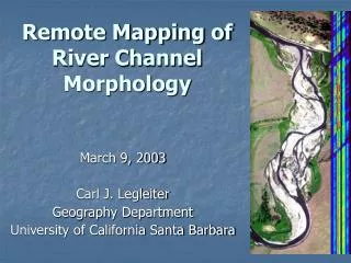
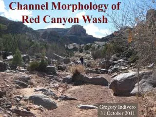
Channel Morphology ofRed Canyon Wash Gregory Indivero 31 October 2011
Research Questions • What discharge (cfs) is required to entrain the D84 (84th percentile of sediment size distribution) in Red Canyon Wash? • What discharge was required to deposit observed flood debris from August 16, 2010 flood?
Location of Red Canyon • Red & Columbus Canyons • Un-gauged, Ephemeral Wash • 5th Largest Drainage of CNM
Satellite Photograph Red Canyon Wash Study Reach Red Canyon Columbus Canyon No Thoroughfare Canyon
Specific Study Reach Site • Fairly Straight Alluvial Channel • 300 Feet Long • ≅ 20 Feet Wide
Methods • Establish Reach & Cross Sections • Survey Thalweg, Flood Debris & Cross Sections • Conduct a Pebble Count at Cross Sections • Create Grain Size Distribution Plots • Solve Shields Equation for Critical Shear Stress, τc • Model Channel With HEC-RAS • -Fluctuate Discharge In Channel Until τc Is Achieved • -Fluctuate Discharge Until Flood Debris Elevation is Achieved
Surveying Long Profile & Cross Sections • Run Tape Measure down the Thalweg • Establish Bench Mark Photo Credits: Gigi Richard
Surveying Long Profile & Cross Sections Cont’d • Surveying the Thalweg • Slope = 0.0261 Photo Credit: Gigi Richard
Surveying Long Profile & Cross Sections Cont’d • Surveying Cross Section 1 • Surveying Cross Section 3 Photo Credits: Gigi Richard
Pebble Count & Grain Size Distribution • 100 Grains Counted At Each Cross Section • Average D84 = 24 mm
Critical Shear Stress, τc • Shields Equation • τc= τ*c(ρs – ρw)gD84 Where: • τ*c = Dimensionless Shear Stress • ρs, ρw = Density of Sediment (Quartz) & Water Respectively • g = Gravitational Constant • D84 = 84th Percentile of Grain Size Distribution • τc= 0.045(9.81 m/s2)(2650-1000 kg/m3)(0.024 m) • τc= 17.48 N/m2
HEC-RAS Results • Channel Forming Discharge = 4 cubic Feet per Second • Frequency = ?? HEC-RAS Model At Cross Section 1 Q = 4 ft3/s Distance From Left Bank (ft)
What about this August 16, 2010 Flood? • What was the discharge of this flow? Photo Credits: Teri Lindaur
What about the flood? • Surveyed High Water Mark Using Flood Debris Indicators Photo Credits: Gigi Richard
HEC-RAS Results for High Water Mark Estimate • Discharge of Flood on August 16, 2010 ≈ 200 cubic feet per second HEC-RAS Model At Cross Section 1 Flood Debris Q = 200 ft3/s Distance From Left Bank (ft)
Red Canyon Wash’s Dry Channel Photo Credits: Greg Indivero
August 16, 2010 Videos Video Credits: Teri Lindaur
Conclusions • How often do these types of flows occur? • Speculation • Historical Events (September 7, 1978 ≈ 2,890 cfs) Photo Credits: Jim Johnson
Acknowledgements • A Big Thank You Goes Out to the following: • Dr. Gigi Richard • Mrs. Teri Lindaur • Mr. Con Trumbull • Ms. HeidlHausner • Mr. Frank Jacobs
References • Arcement, G. J., 1989, Guide for selecting Manning's roughness co-efficients for natural channels and flood plain, USGS water-supply paper: 2339, v. 38. • Cooke, R., Warren, A., Goudie, A., 1993, Desert Geomorphology: University College London, UCL Press Limited, p. 143-167. • Becker, A., DiPema, L, Ladig, K, Wellik, J, and Richard, G., 2007, Channel morphology and channel- forming discharge of No Thoroughfare Canyon, Colorado, Geological Society of America, Abstracts with Programs, Vol. 39, No. 6, p. 306 • Elliott, J.G. and Hammack, L.A., 2000, Entrainment of Riparian Gravel and Cobbles in an Alluvial Reach of a Regulated Canyon River: Regulated Rivers: Research and Management, v. 16, p. 37-50. • Knighton, D., 1998, Fluvial Forms and Processes: A New Perspective. London: Arnold, p. 383 • Richard, G.A., 2004, Flash Flooding at the Colorado National Monument 1921-2003: Colorado National Monument, National Park Service, p. 21 • U.S. Army Corps of Engineers (USACOE), Hydrologic Engineering Center, 2010, HEC-RAS River Analysis System Hydraulic Reference Manual, Version 4.1, U.S. Army Corps of Engineers, Davis, CA, 417 pp. • Van Steeter, M. M., and J. Pitlick. 1998, Geomorphology and endangered fish habitats of the upper Colorado River: historic changes in streamflow, sediment load, and channel morphology. Water Resources Research 34:303-316. • Wilcock, P. R., 2001, Toward a practical method for estimating sediment transport rates in gravel-bed rivers, Earth Surf. Processes Landforms 26, 1395 –1408. • Wilcock, P. R., Pitlick, J., Cui, Y., 2009, Sediment Transport Primer: Estimating Bed-Material Transport in Gravel-bed Rivers, U.S. Dept. of Agriculture, Forest Service, Rocky Mountain Research Station, 78 pp.