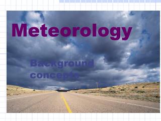
Weather Patterns & Forecasting
This guide explores the Earth's atmospheric layers, including the troposphere, stratosphere, mesosphere, and thermosphere, and their role in weather phenomena. The troposphere, where most weather occurs, features rain, snow, and storms, while the stratosphere contains the protective ozone layer. The mesosphere shields us from meteoroids, and the thermosphere experiences extreme temperatures. The sun drives Earth's weather by heating the atmosphere and influencing air pressure, wind, and humidity. Learn how these factors shape our daily weather and climate patterns.

Weather Patterns & Forecasting
E N D
Presentation Transcript
1. Troposphere • 0-12km • Rain, snow, storms, and most clouds occur in the troposphere • Changes more than any other layer • Layer of the Earth’s atmosphere in which Earth’s weather occurs • Greatest atmospheric pressure occurs here
2. Stratosphere • 12-50km • Contains the ozone layer • Absorbs UV radiation • Upper stratosphere is warmer than the lower stratosphere
3. Mesosphere • 50-80km • Layer of the atmosphere that protects Earth’s surface from being hit by most meteoroids
4. Thermosphere • Above 80km • Extends above Earth’s surface outward into space • Has no definite outer limit • Very hot because sunlight strikes here first • Nitrogen and Oxygen molecules convert this energy into heat
What is Weather? Who does the weather affect? What professions? What types of weather can you describe? Can you explain how it happens?
Weather • Refers to the state of the atmosphere at a specific time and place • Describes conditions such as: • Air pressure • Wind • Temperature • Amount of moisture in the air
What provides the energy that drives Earth’s weather? The Sun
Earth’s Energy • The sun provides almost all of Earth’s energy • Sun’s energy evaporates water into the atmosphere • Eventually, the water falls back to Earth as rain or snow • The sun is also a source of heat energy • Heat from the sun is absorbed by Earth’s surface, which then heats the air above it • Differences in Earth’s surface leads to uneven heating of Earth’s atmosphere
Weather Factors Air temperature Wind Humidity Relative humidity
Air Temperature • The temperature of air influences your daily activities • Air is made up of molecules that are always moving randomly • Even when there’s no wind • Temperature is a measure of the average amount of motion of molecules • When the temperature is high: • Molecules in air move rapidly and it feels warm • When the temperature is low: • Molecules in air move less rapidly and it feels cold
Wind • Air moving in a specific direction is called wind • Wind results because air moves from areas of high pressure to areas of low pressure • Cold air sinks: • High pressure • Warm air rises • Low pressure • Wind must have a speed and a direction
Wind • Direction can be measured using a wind vane • Speed can be measured using an anemometer
Humidity • Amount of water vapor present in the air • Heat evaporates water into the atmosphere • More water vapor can be present when the air is warm than when it is cold
Relative Humidity • A measure of the amount of water vapor present in the air compared to the amount needed for saturation at a specific temperature • Saturation: when enough water vapor is present in the air for condensation • Usually increases before precipitation • If you hear a forecaster say that the relative humidity is 50%, it means that the air contains 50% of the water needed for the air to be saturated
Dew Point • Temperature at which condensation begins • Changes with the amount of water vapor in the air • When air near the ground cools to its dew point, water vapor condenses and forms dew
Forming Clouds • Clouds form as warm air is forced upward, expands, and cools • As the air cools, the amount of water vapor needed for saturation decreases and the relative humidity increases • When relative humidity reaches 100%, the air is saturated • Water vapor soon begins to condense in tiny droplets around small particles such as dust and salt • Billions of these droplets form a cloud
Forming Clouds • Air temperature at its dew point leads to the formation of a cloud at the Earth’s surface
Precipitation • Water falling from clouds • Occurs when cloud droplets combine and grow large enough to fall to Earth • Air temperature determines whether water forms rain, snow, sleet, or hail (4 types of precipitation)
Weather Changes • Because of the movement of air and moisture in the atmosphere, weather constantly changes
Air Masses • Large body of air that has properties similar to the part of Earth’s surface over which it develops • An air mass that develops over land is dry compared with one that develops over water • An air mass that develops over the tropics is warmer than one that develops over northern regions • An air mass can cover thousands of square kilometers
Air Masses • When you observe a change in the weather from one day to the next, it is due to the movement of air masses • The generally move from west to east over the continental United States • Provided the basis for daily weather forecasts
High and Low Pressure Systems • Remember that winds blow from areas of high pressure to areas of low pressure • Cold air sinking: high pressure • Warm air rising: low pressure
Types of winds Local winds Global winds
1. Local winds • Winds that blow over short distances • Caused by the unequal heating of Earth’s surface within a small area • Only form when large-scale winds are weak
2 types of local winds Sea breeze Land breeze
a. Sea breeze • Unequal heating often occurs along the shore of a large body of water • It takes more energy to warm up a body of water than it does to warm up an equal area of land • Land warms up faster than water • This causes the air over the land to become warmer than air over water • This warm air expands and rises • Low pressure area • Cool air blows inland and moves underneath the warm air
b. Land breeze • At night, the process is reversed • Land cools more quickly than water, so the air over the land becomes cooler than the air over the water • As the warmer air over the water expands and rises, cooler air from the land moves beneath it
2. Global winds • Winds that blow steadily from specific directions over long distances • Created by the unequal heating of Earth’s surface over a large area
Global Convection Currents • How do global winds develop? • Temperature differences between the equator and the poles produce giant convection currents in the atmosphere • Warm air rises @ the equator and cold air sinks @ the poles • Pressure is lower @ equator • Pressure is greater near poles • Warm air: low pressure • Cold air: high pressure
Global Convection Currents • The differences in pressure causes winds at Earth’s surface to blow from the poles toward the equator • Winds move from areas of high pressure to areas of low pressure • However, higher in the atmosphere, air flows away from the equator toward the poles • Those air movements produce global winds
The Coriolis Effect • If Earth did not rotate, global winds would blow in a straight line from the pole toward the equator • Because Earth rotates, global winds don’t follow a straight path • As the wind blows, Earth rotates from west to east underneath them • Making it seem as if the winds have curved • The way Earth’s rotation makes winds curve is called the Coriolis effect
The Coriolis Effect • Because of the Coriolis effect: • 1. global winds in the Northern Hemisphere gradually turn toward the right • 2. global winds in the Southern Hemisphere curve toward the left
Global wind belts • The Coriolis effect and other factors combine to produce a pattern of calm areas and wind belts around Earth • Calm areas: • 1. doldrums • 2. horse latitudes • Wind belts: • 1. trade winds • 2. polar easterlies • 3. prevailing westerlies
Calm areas: Doldrums • Regions near the equator with little or no wind
Calm areas: horse latitudes • Latitude: distance from the equator • Warm air that rises to the equator divides and flows both north and south • Horse latitudes: 30°N & S of the equator • Air stops moving toward the poles and sinks
Wind belts: Trade winds • Steadily easterly winds • The cold air over the horse latitudes sinks and produces a region of high pressure • The high pressure causes surface winds to blow both toward the equator and away from it • The winds that blow toward the equator are turned west by the Coriolis effect
Trade Winds • As a result, winds in the Northern Hemisphere between 30°N latitudes and the equator generally glow from the northeast • In the Southern Hemisphere, between 30°S latitudes and the equator, the winds blow from the southeast
Wind belts: prevailing westerlies • In the mid latitudes, between 30° & 60° N & S, winds that blow toward the poles are turned toward the east by the Coriolis effect • Because they blow from the west to the east, they are called prevailing westerlies • Generally blow from the southwest in northern latitudes and from the northwest in southern latitudes • Play an important part in the weather of the U.S.
Wind belts: polar easterlies • Cold air near the poles sinks and flows back toward lower latitudes • The Coriolis effect shifts these polar winds to the west, producing polar easterlies • Polar easterlies meet the prevailing westerlies @ about 60°N and 60°S latitudes • Region called the polar front • The mixing of warm and cold air along the polar front has a major effect on weather in the U.S.