Download
1 / 21
210 likes | 409 Vues
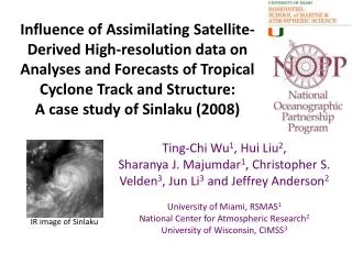
Influence of Assimilating S atellite-Derived High-resolution data on Analyses and Forecasts of Tropical Cyclone Track and Structure: A case study of Sinlaku (2008). Ting-Chi Wu 1 , Hui Liu 2 , Sharanya J. Majumdar 1 , Christopher S. Velden 3 , Jun Li 3 and Jeffrey Anderson 2

E N D
Influence of Assimilating Satellite-Derived High-resolution data on Analyses and Forecasts of Tropical Cyclone Track and Structure: A case study of Sinlaku (2008) Ting-Chi Wu1, Hui Liu2, SharanyaJ. Majumdar1, Christopher S. Velden3, Jun Li3 and Jeffrey Anderson2 University of Miami, RSMAS1 National Center for Atmospheric Research2 University of Wisconsin, CIMSS3 IR image of Sinlaku
Challenges and overall goals • Forecast error covariance of TC and its environment is highly flow-dependent and multivariate. • Use multiple and integrated satellite data sets at their highest resolution to build up an advanced analysis/forecast system for tropical cyclones and their environments. • Seek an optimal assimilation strategy for integrated satellite data, under WRF-DART EnKF framework. • Dynamic variables: Atmospheric Motion Vectors (AMVs), ASCAT surface wind • Thermodynamic variables: Temperature and moisture sounding, Total Precipitable Water (TPW)
Satellite-derived observation types The satellite observation types in TC case AMV IR Temperature and moisture sounding (clear-sky so far) H TPW ASCAT winds Work of Cloudy sky IR soundings is underway.
WRF-DART Cycles • WRF (v3.1.1) - DART (EAKF)with 84 members • 9km moving nest grid with feedback to 27km grid when TC is present in forecast. • Assimilation cycle started 1 September 2008. (one week before genesis) • Analysis variables: U, V, W, PH, T, MU, T2, Q2, TH2, Psfc, U10, V10, Qvapor, Qcloud, Qrain, Qice, Qsnow, CIMSS: Cooperative Institute for Meteorological Satellite Studies
Satellite data: Dynamic 100-251mb 251-400mb 401-700mb 701-999mb Wind vectors from ASCAT are only at sea surface Contour every 200km
Satellite data: Thermodynamic • The coverage of AIRS T/Q soundings are quite remote from Sinlaku at most of the times. • AMSR-E derived TPW has better data coverage through the lifetime of Sinlaku.
Against Independent Obs (I) QuikSCAT-UCF CTL CIMSS(h) CIMSS(h+RS) ASCAT CIMSS(h+RS) is available after 2008/09/10:12Z CIMSS(h+RS) is available after 2008/09/10:12Z
Against Independent Obs (II) Size • CIMSS-bt: Modified JTWC best track from CIMSS-Wisconsin. • As seen in previous slide, assimilating AMVs helps to resolve reasonable TC sizes especially in the early stage of Sinlaku.
Analysis Structure: Azimuthal mean (I) CTL CIMSS(h) ASCAT 2008/09/09:12Z Shading: Vr Contour: Vt Grey line: RMW Shading: W Contour: Divergence
Analysis Structure: Azimuthal mean (II) CTL AIRS-TQ TPW Shading: Relative Vorticity; Contour: Potential temperature
Analysis Increment(Vwind) 2008/09/09:12Z ASCAT CTL CIMSS(h) • It is until 00Z 10 Sep, CTL starts to show cyclonic increment, half day later than CIMSS(h). • For ASCAT, it is around 18Z 10 Sep, 6 hours later than CIMSS(h). Cyclonic increments! W W W E E E
Analysis Structure Spread • Analysis mean and spread of RMW as function of height in 12 hourly intervals. CTL CIMSS(h)CIMSS(h+RS)
Ensemble Forecast from Analyses • 72h forecast from 16 members • Initialized at 00Z September 11, 2008 • ALL combines all satellite-derived observations mentioned above. • ALL is dominated by CIMSS(h+RS). • CTL and TPW erroneously made early landfall in central/south part of Taiwan.
Forecast Track differences (I) 48H 24H 72H • CIMSS(h+RS) has the best ensemble mean track forecast. • Trough to the NE of and ridge to the E of Sinlaku. Shading: 500 mbgeopotential height difference CIMSS(h+RS) – CTL Contour: CTL, CIMSS(h+RS)
Summary • Assimilation of the various satellite data types, particularly AMVs and TPW, using ensemble DA shows potential to improve analyses and forecasts of the hurricane track and intensity. • Assimilating CIMSS hourly AMV exhibits best track and intensity analysis in early stage of Sinlaku. However, the inclusion of Rapid-Scan AMVs has problem with large uncertainty in the later time of Sinlaku that needs further investigation. • The ALL cycles seem to be dominated by CIMSS(h+RS). However, this is preliminary results. More investigation of impacts from individual satellite data type is needed before conducting the ALL cycles.
Current and future work • Investigate the impacts of each satellite-derived data experiment in more depth. • Data denial experiments on AMVs to clarify which layer/region of AMVs has the most impacts on intensity/track. (or ensemble based observation impact first) • Look for advanced diagnostic metrics? • Investigate the linkage between model covariance structure and storm evolution.
Data Denial Experiments By height By distance