Climate Data Analysis
The National Park Service and its I&M Program convened to discuss the profound impacts of climate change on national parks. Featuring insights from climate data analysis experts, this conference highlighted the critical role of parks as relatively undisturbed ecosystems, their geographical distribution, and their significance in understanding environmental trends. Key discussions included projected temperature changes, observational data reliability, and the importance of rigorous data management for long-term climate evaluations. The urgent need to effectively communicate these changes to the public was also emphasized.

Climate Data Analysis
E N D
Presentation Transcript
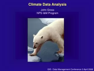
Climate Data Analysis John Gross NPS I&M Program GIS / Data Management Conference 3 April 2008
National Park Service Parks and climate change • Relatively undisturbed • Protected for the future • Broad geographic distribution • Large environmental gradients • Many observations People really care about Parks National Park Service
Projected temperature change IPCC 2007 Working Group 4 FAQ 3.1.
"For us the discussion around climate change is not just a theory; it is a very stark and harsh reality.” Patricia Cochran – Inuit Circumpolar Conference
Months to years Atmospheric Index – SOI, PDO Climate Divisions Climate indices (PDSI) Time Investigator-defined area of interest Station month summary Station summary of day (SOD) Observation (T) minutes regions points Spatial Scale
“Climate tells you what clothes to buy … weather tells you what to wear today!” • Climate is determined by the properties of the Earth system that define the normal range of variation in observation. • Weather responds sensitively to local conditions. Weather forecasts are only useful for short periods into the future.
Months to years Atmospheric Index – SOI, PDO Climate Divisions Many indices (PDSI) Time (roll-your-own area of interest) Monthly station summary Daily station summary (SOD) Observation (T) minutes regions points Spatial Scale
Individual station data is essential This is the basis of our understanding and extrapolation For long-term value, QA/QC and metadata are CRITICAL
Communicating climate • Consider the reference period • 30 year ‘normals’ (often 1971-2000) • Life of station • Since 1895 Climates always change – use a thoughtful reference period http://www.wcc.nrcs.usda.gov/snow/
Individual Station Data and Climate Evaluation • Highly subject to: • Micrometeorological phenomena • Instrument issues – calibration, changes, etc. • Station relocation and site-specific effects • Rigorous QA/QC difficult and time-consuming • Missing values difficult to handle and accomodate • McEachern CHIS report (2007) good example • Metadata is essential • Almost surely need data from an established network
Months to years Atmospheric Index – SOI, PDO Climate Divisions Many indices (PDSI) Time (roll-your-own area of interest) Monthly station summary Daily station summary (SOD) Observation (T) minutes regions points Spatial Scale
Describing climate of an area • Exemplar or ‘indicator’ station(s) • Relatively easy, once stations are selected • Station data – local effects, reliant on single sensor, single-station bias
California Climate Tracker - WRCC Describing climate of an area • Multiple-station index or aggregation • Broader inference • Strength in numbers • More complex analysis problem
NCDC Climate Divisions – To the rescue? • Monthly data from 1895 - present • Temperature, precipitation, heating/cooling degree days • Palmer drought index and related • Standardized precipitation indices • Simple data output to text file or (limited) plots http://www7.ncdc.noaa.gov/CDO/CDODivisionalSelect.jsp
Mapped by climate division With apologies to Hawaii and Alaska …
Apostle Islands National Lakeshore Established Temperatures in Northwest Wisconsin 1970 1910 1990 2010 1950 1930 From http://www.wrcc.dri.edu/spi/divplot1map.html Red line – 12 month average Blue line – 10 year running mean
Red = Good Green = bad Blue = Really bad! Correlation in precipitation between station and climate division Jan-Mar. (K. Wolter and D. Allured 2007)
See: www.cdc.noaa.gov/people/klaus.wolter/ClimateDivisions/
Large-scale climate drivers are important • Climate station inventory reports • Regional Climate Centers papers (WRCC for western states) NEON process: http://web.utk.edu/~jweltzin/SAPOZEO/Hayden090805.htm
Consider regional indices – these may better predict ecological characteristics than local data!
Selected Resources and Activities • Data and analyses • NPClime and climate inventory reports • Climate learning modules – www.meted.ucar.edu • ROMN protocol (in draft) for miscellaneous data handling • National Climatic Data Center (NCDC) – many products • Gridded data – PRISM • NRCS SnoTel, National Drought Mitigation Center, USGS stream flow