Download
1 / 10
100 likes | 217 Vues
This presentation discusses the integration and use of Geographic Information System (GIS) tools in humanitarian settings, specifically for Shelter Cluster members. It highlights the significance of accessible geospatial data, showcases successful data sharing instances such as Batagram District in Pakistan, and shares strategies for small-scale shelter actors to effectively utilize GIS. Emphasis is placed on training NRC staff to leverage GIS and GPS technologies, thereby improving information management and facilitating enhanced decision-making in field operations.

E N D
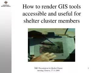
How to render GIS tools accessible and useful for shelter cluster members NRC Presentation for Shelter Cluster meeting, Geneva, 17.11.2006
Use of GIS in a humanitarian setting NRC Presentation for Shelter Cluster meeting, Geneva, 17.11.2006
Sharing geospatial data in a humanitarian setting NRC Presentation for Shelter Cluster meeting, Geneva, 17.11.2006
Result of good data sharing Case: Batagram District. Pakistan 2006 NRC Presentation for Shelter Cluster meeting, Geneva, 17.11.2006
Geospatial data accessibility • The data is accessible to other humanitarian actors • From HIC when data is available • From other main GIS actors (WFP/VAM, UNJLC etc.) with some restrictions • However, some main GIS actors in relief work • are not operational in all conflicts/natural disasters • are not all operational on day one • focus on the overall picture and not on all thematic/geographical areas • are grateful for GIS assistance NRC Presentation for Shelter Cluster meeting, Geneva, 17.11.2006
Geospatial data accessibility, cont. • Therefore, GIS facilities for all shelter actors are important and can facilitate • a complete Information Management by the individual actor • a better way of reporting • internal handling of geoinformation because of confidentiality NRC Presentation for Shelter Cluster meeting, Geneva, 17.11.2006
How small-scale shelter actors can employ GIS • Identification of existing geospatial data available in relevant thematic/geographical area • Selection of relevant existing geospatial data for own work • Identification of additional data needs • Collection, e.g using GPS, of additional data • Data integration of geospatial data from point 2. and 4. • Map production NRC Presentation for Shelter Cluster meeting, Geneva, 17.11.2006
Case:GIS tools for NRC shelter activities • Train trainers in NRC in • identification of existing geospatial data relevant for NRC’s shelter activities • collection of other geospatial data and use of GIS/GPS systems • incorporation of GPS data in a GIS software • map production NRC Presentation for Shelter Cluster meeting, Geneva, 17.11.2006
Expected outcomes • GIS tools established for NRC’s field operations that is • adapted to existing geospatial data from main actors • inexpensive • user friendly • Trained NRC staff use actively GPS and GIS in their daily operations in the field NRC Presentation for Shelter Cluster meeting, Geneva, 17.11.2006
GIS/GPS utility for NRC Free-GIS Utility GeoSpatialData Instructions Free-GPS Utility NRC Presentation for Shelter Cluster meeting, Geneva, 17.11.2006