Download
1 / 19
200 likes | 669 Vues
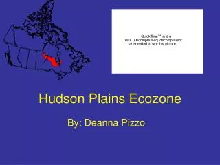
Hudson Plains Ecozone. By: Deanna Pizzo. Table of Contents. Location Climate Geology and Geography Vegetation Animals Soils Humans Climate Graph Hudson Plains Hill shade map and slope map Fly Through Arc scene photo Bibliography. M a n i t o b a. Location.

E N D
Hudson Plains Ecozone By: Deanna Pizzo
Table of Contents • Location • Climate • Geology and Geography • Vegetation • Animals • Soils • Humans • Climate Graph • Hudson Plains Hill shade map and slope map • Fly Through • Arc scene photo • Bibliography
Manitoba Location • The Hudson plains stretch from Manitoba to Quebec along the southern eastern edge of Hudson Bay. Quebec
Climate • Canada contains a quarter of the world's wetlands, and the Hudson Plains ecozone's poor drainage has resulted in the largest continuous wetlands in the world. • Hudson's Bay moderates the temperature in summer, but the ice that covers it in winter prevents most of this; average summer temperatures are 11˚C, but in winter the average temperature is -18˚C. • Precipitation ranges from 400mm in the northwest to 800mm in the southeast. • It has short cool summers and severely cold winters.
Legend 1. Summer Sky 2. Ocean and sea ice 3. Bridges and wetlands 4. Small lake/ponds 5. Bog/fen 6. Coastal river
Geology and Geography • Theterrain here is flat, and the poor drainage encourages the creation of wetlands and bogs. Palaeozoic and Proterozoic sedimentary bedrock slopes gradually towards Hudson Bay.
Vegetation • Vegetation here follows two basic patterns. The first ranges from north to south; in the north, the terrain is treeless tundra, but in the more southern taiga trees appear, getting thicker as you move south. • The second pattern follows altitude. The drainage here is poor, so the trees are only found at the drier higher altitudes, while the lower altitudes lack trees. • Some characteristic tree species are black spruce, white spruce, and tamarack. • Other plants include eriacaceous shrubs, cotton grass, sphagnum moss, northern Labrador tea, and Lapland rosebay.
Legend • 1. Black Spruce • 2. Spruce Bog • 3. Dead Black Spruce • 4. Sedges, mosses, linchens • 5. Rushes, horsetail
Animals • The assortment of animals is highest in summer, when migrating birds appear in huge numbers to breed. • The region is more famous for its biting insect population, which takes advantage of the poor drainage to breed in huge numbers. • A single hectare is estimated to be able to produce ten million black flies, and other biting insects.
Legend • 1.Canada Geese • 2.Lesser Snow Geese • 3.Northern Pintail • 4.Tundra Swan • 5.Atlantic Brant • 6.Willow Ptarmigan • 7.Mallard • 8.Semipalmated Sandpiper • 9.Green-winged Teal • 10.Woodland Caribou • 11.Polar Bear • 12.Black Bear • 13.Beaver • 14.Otter • 15.Moose Antler
Soils • The mineral soils that cover much of the area are finely-textured silt and clay deposited by both marine and glacial processes. Outcrops of the underlying sandstone and shale are rare. • Since glaciation, the flat terrain, impervious soil and poor drainage have promoted the development of wetlands throughout the plains. Web-like or polygon patterns in organic soils are typical of northern wetlands. • In this soil there is very little moisture and minerals because of the poor drainage. There is no topsoil so it is not very good for agriculture and definitely not loam.
The map above is a map of soils for different regions. If you look closely the Hudson Plains is mainly covered by the light blue and brown. That means it is made up of Brunisoic, and Cryscilic.
Humans • A lack of timber and minerals means that tourism and other activities basically explain why there is only 10 000 people who live here make their living.
Legend • 1. Tourism • 2. Hunting, Trapping and Fishing
Climate Graph The average precipitation is 649.7 mm per year. The average temperature is -1.12˚C.
Hudson Plains Slope and the Hillshade Basically both maps are showing you the elevation of the land, like how high or low it is. By analyzing each map I picked up that just like it is known for it has a rather flat terrain.
Hudson Plains Arc Scene In the previous slide I showed you a quick view of the Hudson plains region. While travelling through you could see that it is a rather bump terrain. Although this is not entirely true, the Hudson plains is knows for its flat terrain. It is a pretty dry region also so not very good for agriculture.
Bibliography • http://www.parkwardens.com/zone8/1.html • http://www.ec.gc.ca/soer-ree/English/Vignettes/Terrestrial/hp/default.cfm • http://canadianbiodiversity.mcgill.ca/english/ecozones/hudsonplains/hudsonplains.htm