3. Canadian Shield
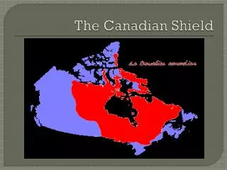
3. Canadian Shield . Largest region that includes most of Quebec, Ontario, northern Manitoba, northern Saskatchewan, Nunavut and half of the NWT. A varied landscape with lots of bog, muskeg, drumlins, eskers and lake basins. .

3. Canadian Shield
E N D
Presentation Transcript
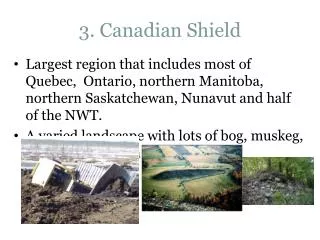
3. Canadian Shield Largest region that includes most of Quebec, Ontario, northern Manitoba, northern Saskatchewan, Nunavut and half of the NWT. A varied landscape with lots of bog, muskeg, drumlins, eskers and lake basins.
Has very rich mining opportunities including nickel, uranium, gold, silver and copper. Mostly covered by Boreal forest (conifer trees) but can also have areas of dense soil were many marshes and bogs are found.
4) Arctic North • The North region is located above the lie of continuous permafrost bordering the Arctic Ocean and Hudson Bay. • Permafrost is soil that remains frozen for more than 2 years. • It includes a major part of the NWT and small parts of the Yukon, Manitoba, Ontario, and Quebec.
Arctic Population and Cities • Over 20 Aboriginal bands live in the region, as well as over 30, 000 Inuit. • Earliest Europeans came around 1500s during the age of exploration.
The search for the Northwest Passage again brought more European attention to the region in the mid-1800s.
The Arctic Economy: Then and Now • Gold discoveries in the Yukon in the 1890s and mining finds in the 1930s brought more significant settlements. • In recent years, oil and gas exploration in the Beaufort Sea and Arctic Ocean have brought more people • Trapping and fishing. • Mineral Resources: gas and oil deposits have been found. • Metallic minerals have also been found, including zinc, iron ore, lead, and, most recently, diamonds
5. St.Lawrence Lowlands Also referred to as the Great Lakes Region Very small region that includes southern tips of Ontario and Quebec. However, includes 50% of Canada’s population. Extremely fertile soils result great agriculture. Some crops that grow well are : tobacco, peaches, cherries, grapes , apples, hay, vegetables, such as carrots, corn, onions, beets, peas and beans
The area is also known for its construction materials. For example: Its clay has been used for brick and tile manufacture, and the sand and gravel deposits are exploited for road metal and construction material. Due to its high population it also is the country’s largest manufacturing area.
6) Atlantic Region Covers 2 percent of Canada’s area. Includes Nova Scotia, New Brunswick, and Prince Edward Island, bound together by fisheries and forests. In total has about 11,200-kilometres of shoreline In the 20th century, the Atlantic provinces faltered with slow economic and population growth. For example, as the fishing industry declined, as did many jobs. Yet, as a new century dawns, offshore oil and gas development promises to quicken the economic pace.
Surface Waters in Canada • Canada has 5 main drainage basins: • Hudson Bay • Arctic Ocean • Atlantic Ocean • Pacific Ocean • Gulf of Mexico • These drainage basins not only cycle water around our country, but also can be used for transportation, opportunities for power (hydro dams), fishing, recreation and provide water for many uses.