Download
1 / 25
260 likes | 377 Vues
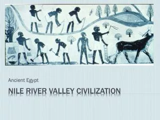
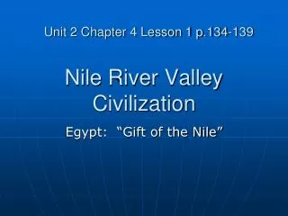
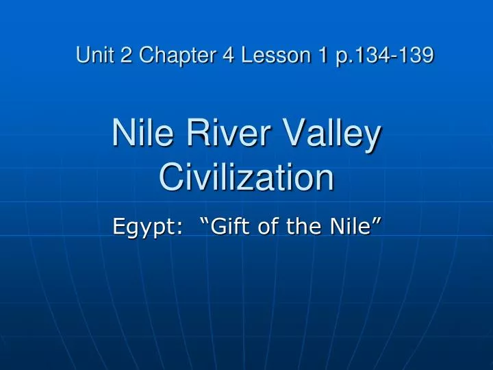
Unit 2 Chapter 4 Lesson 1 p.134-139. Nile River Valley Civilization. Egypt: “Gift of the Nile”. Objectives. Describe the location and geography of the Nile River Explain how geography affected the political, economic, and religious structures of the early civilization of Egypt. Vocabulary.

E N D
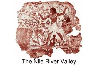
Unit 2 Chapter 4 Lesson 1 p.134-139 Nile River Valley Civilization Egypt: “Gift of the Nile”
Objectives • Describe the location and geography of the Nile River • Explain how geography affected the political, economic, and religious structures of the early civilization of Egypt.
Vocabulary Delta- triangular piece of rich land formed from soil deposited at the mouth of the river Cataracts- waterfalls Arid- dry desert (Sahara) Predict- tell in advance (predict flooding) Afterlife- life after death
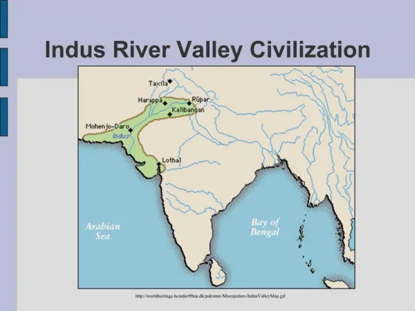
Land of the Nile • Worlds longest river • Flows north from east-central Africa to the Mediterranean Sea • 4160 miles long
Lower Egypt Lies at the mouth of the Nile River at the Mediterranean Sea Mainly considered the Nile Delta
Upper Egypt • South, higher land to south of Cairo • 1st cataract (rapids) to where river fans out
Nile Valley Follows the river for 600 miles Narrow and fertile land
Deserts and Cataracts • Nile runs between desert cliffs in a series of 6 cataracts (waterfalls) • Sahara Desert • Arid or dry land • Land near the Nile was fertile enough to grow crops such as wheat and barley • Heavy Rainfall caused floods • Rivers overflowed their banks • Deposited silt making the soil fertile for farming
Controlling the Nile A. Droughts led to starvation 1. When there was not enough rainfall to overflow the banks, the land would dry up B. Floods led to drowning 1. people 2. crops C. Irrigation to advance farming 1. Egyptians built ditches to bring water to their fields 2. built dams and dikes to control flooding 3. stored water in ponds or pools
Controlling the Nile D. Government Control and Authority 1. Government officials supervised all aspects of irrigation and farming 2. Egyptian leaders authority was based on their ability to provide water for crops 3. Large harvest surpluses were stored a. used in times of droughts b. used to feed laborers on public works projects
A Source of Religion III. A Source of Religion A. To find order in the world around them, Egyptians created stories to explain natural events 1. Gods or Goddesses controlled a specific part of nature a. Egyptians developed beliefs in many Gods b. Like the Sumerians, Egyptians formed a polytheistic religion
A Source of Religion Ra, the sun God 1. Egyptians believed the sun was a god who was born each day and died each night a. this led to the Egyptians belief in the after life Hapi, God of the Flood 1. Egyptians held ceremonies hoping he would reward them with good harvests Osiris, The God of the Next World City Gods 1. As a city grew more important, so did its god
Ra: Sun God Osiris: God of Next World Hapi: God of the Flood
Toward Civilization A. By 3100 BC, Egyptians were developing advanced civilizations 1. Temples to worship their Gods 2. Stone tombs to hold the bodies of rulers who had died a. Wrote on the temples and tombs 3. Made pottery and painted scenes of daily life on it 4. Mined copper for tool making and gold for decorative art B. Farming made advances elsewhere possible 1. Surpluses were carried by donkeys into towns to trade
Toward Civilization C. Trade 1. Sinai Peninsula was crossroads for traders from Egypt and southwestern Asia 2. The Nile River served as a highway connecting Egyptian settlements a. Built ships to navigate the river i. made of wood (from Lebanon) ii. Sails helped to travel against the rivers current iii. All of the Nile (except the cataracts of Nubia) could be traveled and traded on D. Trade Leads to Cities 1. Trade centers emerged as separate cultures and powers a. By 3100 BC, Egypt had two kingdoms: i. Lower Egypt ii. Upper Egypt
GeographyADVANTAGE Advantage over Mesopotamian civilizations: Nile River very predictable in flooding. Tigris/Euphrates Rivers very unpredictable.
Geography • Flooding • Yearly flooding in July • Rain and melted snow traveled from central-east Africa • Navigation • Drift North towards the delta • Sail south with the wind
Geography • Natural Barriers • The desert surroundings reduced contact with other civilizations • The desert also provided a natural barrier that shut out invaders
Summary The physical setting of the Nile River supported permanent settlements and an early civilization in Egypt. The Egyptians developed agricultural techniques, such as irrigation, along the Nile River It was these techniques that permitted the Egyptians to grow surplus food. Over time, Egyptian trade in surpluses allowed the growth of cities
Review Questions What are the major features of the Nile River? Where were the only two locations that the early Egyptians could grow crops of wheat and barley? Why is land in Northern Egypt called Lower Egypt?
Review Answers What are the major features of the Nile River? DELTA, VALLEY, and CATARACTS Where were the only two locations that the early Egyptians could grow crops of wheat and barley? ON THE FERTILE LANDS OF THE NILE DELTA AND THE NILE VALLEY Why is land in Northern Egypt called Lower Egypt? IT WAS LOWER IN ELEVATION THAN THE LAND IN SOUTHERN EGYPT
How did ancient Egyptians control the flooding waters of the Nile? Used irrigation ditches, dams and dikes. (See image on page 136).
Review How did the unpredictability of the Nile’s floods affect early Egyptians’ religious beliefs? Lead the Egyptians to believe that gods and goddesses were responsible for events in nature How did boats make nearly all the Nile usable for trade? With the addition of sails, boats were able to sail upstream against the current and almost all the Nile could be used for trade. How did trade along the Nile support the growth of Egypt? It led to the formation of cities and kingdoms