Download
1 / 23
230 likes | 402 Vues
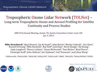
T ropospheric O zone L idar Net work ( TOLNet ) – Long-term Tropospheric Ozone and Aerosol Profiling for Satellite Continuity and Process Studies. AMS 93rd Annual Meeting, Austin, TX, Austin Convention Center r oom 18C Jan. 9, 2013.

E N D
Tropospheric Ozone LidarNetwork (TOLNet) – Long-term Tropospheric Ozone and Aerosol Profiling for Satellite Continuity and Process Studies AMS 93rd Annual Meeting, Austin, TX, Austin Convention Center room 18C Jan. 9, 2013 Mike Newchurch1, Raul Alvarez2, Jay Al-Saadi35, John Burris4, Wesley Cantrell1, Gao Chen5, Russell DeYoung5, Mike Hardesty2, Ray Hoff6, Jack Kaye3, Kevin Knupp1, Shi Kuang1, Andy Langford2, Thierry Leblanc7, Stuart McDermid7, Tom McGee4, Brad Pierce8, ChristophSenff2, John Sullivan4, Jim Szykman9, Gail Tonnesen9, and Lihua Wang1 1UAHuntsville, 2NOAA/ESRL, 3NASA/HQ, 4NASA/GSFC, 5NASA/LaRC,6UMBC, 7NASA/JPL, 8NOAA/NESDIS,9USEPA, http://nsstc.uah.edu/atmchem/
Outline • Introduction • Instruments • Measurements • Data Access • Summary and Future Plan
1. Introduction Motivation of lidar measurements GEO-CAPE will measure tropospheric gases and aerosols at ~8km and hourly resolution. Vertical resolution is on the order of 5-10km in the troposphere. This vertical resolution is inadequate to resolve laminar structures that characterize tropospheric ozone and aerosols. Furthermore, GEO-CAPE information content in the PBL will likely be inadequate to resolve the processes responsible for air quality variability. We seek, therefore, to augment the spaceborne measurements with a ground-based measurement system. Ozonesondes are extensively used in various atmospheric chemistry studies because of their low upfront cost and well-characterized behavior. However, the whole process for a sonde launch typically requires four hours. And four-hour ozonesonde resolution is prohibitively expensive. We therefore consider lidars to provide the necessary spatial and temporal resolution. Three major types of O3 profiling technique JPL-Table Mountain Facility http://tmf-lidar.jpl.nasa.gov/index.htm UAH ozonesonde
1. Introduction TOLNet Objectives Provide high-resolution time-height measurements of ozone and aerosols at a few sites from near surface to upper troposphere for air-quality/photochemical model and satellite retrieval validation; Exploit synergies with EV-I/TEMPO, DISCOVER-AQ, GEO-CAPE, and existing networks, including regulatory surface monitors and thermodynamic profilers, to advance understanding of processes controlling regional air quality and chemistry; Develop recommendations for lowering the cost and improving the robustness of such systems to better enable their possible use in future national networks to address the needs of NASA, NOAA, EPA and State/local AQ agencies.
2. Instrument NOAA Mobile Ozone Lidar NOAA’s TOPAZ (Tunable Optical Profiler for Aerosol and oZone) lidar is a state-of-the-art, compact differential absorption lidar (DIAL) for measuring ozone profiles with high temporal and spatial resolution (Alvarez et al., 2011). The instrument is based on a Nd:YLFpumped Ce:LiCAF ultraviolet laser. TOPAZ emits three wavelengths, that can be tuned from approximately 283 nm to 310 nm. Ozone profiles are typically retrieved at a range resolution of 90 m. Time resolution varies from 10 s to several minutes depending on the atmospheric conditions and the desired precision of the data. Originally designed for airborne operation, the TOPAZ lidar was installed in a truck in January 2012 to permit easy transport to and operation at remote sites (Fig. 1). A two-axis scanner mounted on the roof of the truck permits pointing the laser beam at several shallow elevation angles at a fixed, but changeable azimuth angle. Zenith operation is achieved by moving the scanner mirror out of the laser beam path. By using the scanner to vary the elevation angle, high resolution ozone measurements can be obtained to within 15 m of the surface. Horizontal measurements at different azimuth angles can be performed to study the variability of ozone near the surface. Fig. 1 Truck-based, scanning TOPAZ lidar at the 2012 Uintah Basin study.
2. Instrument UAHuntsville Ground-based O3 lidar TheUAHuntsville O3 lidar system was developed jointly by UAHuntsville and NASA/GSFC [Kuang et al., 2011a]. (Left) Receiver system showing the recent added 1’’ mini receiver to measure ozone between 100 and 1000m altitude; (Right) Raman shifted YAG transmitter replacing previous dye lasers. Located at a 200-m ASL slightly polluted city, this lidar makes ozone retrieval from 0.1 to ~12 km during both daytime and nighttime with a typical integration time from 2 to 10 min. 1’’ receiver (Ch-0) 100m-1km 16’’ receiver (Ch-5) 3-12km 4’’ receiver (Ch-1 and Ch-2) 500m-1.5km, 1-5km Laser outgoing mirror Transmitter Receivers
2. Instrument NASA/GSFC Mobile lidar Data acquisition system Raman cells Telescope The trailer with the hatch doors open for transmission into the atmosphere. View from inside the 40’ trailer. Moving from left to right: the rack for the data acquisition system; the optics module package that houses the narrow band interference filters for the PMT’s, the chopper attached to the telescope, which helps eliminate saturation of the PMT’s; the transmission platform for two 1’’ detectors is mounted directly next to the 18’’ telescope for the near-ground ozone measurements. The two 72’’ Raman cells mounted on the table produce 289 and 299-nm lasers using pressurized hydrogen and deuterium.
2. Instrument NASA/LaRC Mobile lidar NASA Langley is developing an ozone lidar in a trailer that can be easily deployed at locations throughout the U.S. The lidar will produce tunable on and off ozone DIAL laser wavelengths between 280 and 300 nm at 500 Hz each. There is also a 527 nm aerosol channel. The system has an in situ ozone measurement capability which will allow ozone to be profiled from the ground to the lower troposphere.
3. Measurements PBL Ozone Measurements The truck-based TOPAZ lidar was deployed in the February 2012 Uintah Basin study to investigate high wintertime ozone levels observed in the oil and gas fields of northeast Utah. Because very shallow boundary layers created by stable conditions are thought to be a contributing factor to the high ozone, lidar observations were made using elevation angle sequences of 2, 10, and 90 degrees, that were repeated approximately every five minutes. The ozone profiles measured at these three angles are spliced together to create composite vertical profiles extending from 15 m to about 3 km AGL (Fig. 2). The effective vertical resolution of the composite ozone profiles increases with altitude from 3 to 90 m. The ozone time-height cross section in Fig. 3 shows a descending elevated ozone layer that appears to get mixed down to the surface in the late afternoon. Fig.2: Lidar ozone profiles at 2, 10, and 90 degrees elevation, projected vertically and blended together. Each panel shows the same composite profile, expanded form left to right to show the detail in the lower angle measurements close to the surface. Alvarez, R.J., II, et al. : Development and Application of a Compact, Tunable, Solid-State Airborne Ozone Lidar System for Boundary Layer Profiling, J. Atmos. Oceanic Technol.,28, 1258-1272, 2011. Fig. 3: Time height cross section of composite vertical O3 profiles from 15 m to 3 km AGL.
3. Measurements TOPAZ obs in Boulder: STT on 12 April 2012 TOPAZ ozone Surface ozone From compilation by Pat Reddy
3. Measurements An example of O3 Lidar measurement with 2-min resolution Above ground Ozonesonde
3. Measurements A collocated Mobile Integrated Profiling System (MIPS) provides aerosol backscatter, wind/RH/T profiles, and other surface data. O3 Transport through Low-level Jet Ceilometer backscatter Higher increasing rate of the surface O3 before 10AM on Oct. 5 due to the low-level transport on the previous day Oct. 1, 08 Oct. 2, 08 Oct. 3, 08 Oct. 4, 08 [Kuang et al., 2011b] Surface O3 and convective boundary layer height Oct. 5, 08 Oct. 6, 08
UAH Collocated Wind Measurement for O3Flux Calculation Specifications l = 1.55 mm Pulse energy: 10 mJ PRF: 15 kHz Pulse length: 150 ns Gate spacing: 10-50 m Min/max range: 75 m to 10 km Telescope diameter: 75 mm Divergence: 50 mrad PPI, 10 elevation, 1 km range Radial velocity every 23 s Halo Doppler wind lidar Vertically-pointing measurements depict boundary layer structure and evolution
3. Measurements Stratosphere-to-Troposphere Transport [Kuang et al. 2012 JGR] Ozone lidarand ozonesonde measurements, as well as the MPR-observed and model-derived tropopause. Pressure-altitude cross-section of PV (black lines), RH (color contours), and tropopause pressure, at 86.65°W longitude at 1200 UTC 27 April 2010 derived from the NAM model. IPV at 320-K isentropic surface
Comparison of the ‘true’ atm with expected OMI obs Lidarobservation showing large PBL O3 diurnal variations Aug. 4, 2010 Lidar convolved with OMI UV kernel (24 layers): OMI is unable to caputre the highly variable ozone structure in PBL because of its resolution limitation. Lidar convolved with OMI UVVIS kernel (69 layers).
3. Measurements [GMT] WRF-CMAQ/Lidar Comparison Lidar O3 Ozonesonde Modeled by Arastoo Pour-Biazar
4. Data Access http://www-air.larc.nasa.gov/missions/TOLNet/
5. Summary and Future Plan • TOLNet development aims on long-term O3 and aerosol profiling for satellite validation and process studies. • The lidarmeasurements at multiple sties will be used to study the impact of ozone aloft on surface ozone over a diverse range of air-quality environments; evaluate air quality models to improve their simulation and forecasting capabilities; provide high time-resolved observations to begin preparing for TEMPO and GEO-CAPE satellite missions. • Leveraging current instrumentation and expertise provides a cost-effective way to obtain these research observations. • In 2012, we have accomplished most of the hardware development, such as transmitter and receiver upgrade, and mobile platform construction. • In 2013, we plan to make more frequent observations, validate the PBL retrievals with tethered ozonesonde, investigate regional pollution transport using multiple-station lidar data, and support other field campaigns (e.g., DISCOVER-AQ) with mobile lidar.
1. Introduction Why tropospheric O3 is important? • O3 is a precursor of the hydroxyl radical (OH), which controls the lifetime of many gases. • O3 is a strong green gas influencing the climate by its radiative forcing. • O3 is an important pollutant in the surface air.
Comparisons of lidar observations and RAQMS model simulations for 3-7 May 2010 (modeled by Brad Pierce)
UBWOS 2012: TOPAZ composite O3 profiles: 06 – 29 Feb (62 hours of data collected on 14 days)
UBWOS 2012: TOPAZ O3 profile comparison w/tether sonde O3sonde data provided by B. Johnson, P. Cullis, E. Hall, D. Helmig