Download
1 / 35
350 likes | 470 Vues
The paper presents a novel method for automatically identifying road centerlines from geo-referenced data collected via smartphones. With the increasing reliance on digital road maps, timely and accurate updates are essential. This method utilizes an evolutionary algorithm that considers the date of recording, accuracy, and distance to process GPS traces collected from a large dataset. The results show a close alignment with satellite images, demonstrating the effectiveness of the proposed approach for generating and updating digital maps more efficiently.

E N D
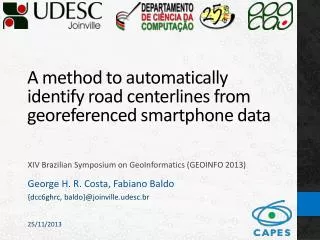
A method to automatically identify road centerlines fromgeoreferenced smartphone data XIV Brazilian Symposium on GeoInformatics (GEOINFO 2013) George H. R. Costa, Fabiano Baldo {dcc6ghrc, baldo}@joinville.udesc.br 25/11/2013
Agenda • Introduction • Objective • Related work • Proposed method • Tests and Results • Conclusion and Future work
Introduction • Digital road maps have gained fundamental role in population’s daily life • Navigation systems etc. • It is essential that maps reflect reality as well as possible • Generated from accurate data; • Periodic updates. • Possible source of data: GPS traces
Introduction • By combining many traces it is possible to generate maps • Example: OpenStreetMap • Users use uploaded traces to create/update maps • However, all map editing is done manually • Automatic solutions would be more effective • Could allow maps to be updated faster • Feasible: [Brüntrup et.al. 2005] and [Cao and Krumm 2009] also support this idea
Challenges • How to obtain the data needed to generate maps? • Smartphones • Contain many sensors, including a GPS receiver • Represent half of the Brazilian cellphone market [GFK 2013] Source: Garmin
Challenges • To create road maps it is necessary to find the roads’ centerlines • How to analyze the traces to identify road centerlines? • Approximated result • Evolutive algorithm Source: author
Objective • Therefore, the objective of this work is to: Propose a method to identify road centerlines using an evolutive algorithm in order to generate and update road maps
Related work • Characteristics gathered from other works: • Independence from initial maps [Brüntrup et.al. 2005; Cao and Krumm2009; Jang et.al. 2010] • Usage of heuristics to remove noise from the traces [Brüntrup et.al. 2005; Cao and Krumm2009;Zhang et.al. 2010; Niu et.al. 2011] • Characteristic introduced by this work: • Traces’ date of recording is taken into account to generate up-to-date maps
Data source Source: author
Preprocessing • Reduces noise; saves all traces to database Source: author
Road centerlines • Query database to get all traces ordered by date and accuracy • Most recent first • Most accurate first Source: author
Road centerlines • For each point k of each trace j (): • Identify nearby points • All points that intersect a buffer around Source: author
Road centerlines • Points with a direction of movement different than are discarded • set • How to analyze the set to find the road centerline? Source: author
Road centerlines • It is assumed that it is only possible to find an approximated solution • Road centerline = weighted combination between: • Date of recording; • Accuracy; • Distance from a candidate solution to all points selected (set). • Chosen algorithm: evolutive algorithm
Road centerlines • : candidate solution • : set of selected points • : influence of time (date of recording) • : influence of accuracy • : influence of distance
Road centerlines • , , : Multiply the value of the corresponding influence to prioritize desired characteristics
Road centerlines • Recent traces: weight closer to 1 • Older traces: weight closer to 0 Influence of Time
Road centerlines Influence of Accuracy Weight Accuracy
Road centerlines Influence of Distance Weight Distance
Road centerlines Closer to highest concentration of points: smallest overall distance Closer to points high better accuracy Source: author
Road centerlines • Evolutive algorithm • 60 generations • 20 candidate solutions per generation • Elitism: 2 best candidate solutions are preserved to the next generation Evolutive algorithm loop: Source: author
Road centerlines • Evolutive algorithm finds centerline close to • Next step: repeat process for • If has already been used, skip to the next point Source: author
Results • Implemented in Python • DB: PostgreSQL + PostGIS • Data collected between 27/01/2013 e 15/06/2013 • 4237 traces • 966698 points
Results • Tests: comparison between • Proposed method’s results • Satellite images • Google Earth • Executed on places with complex road structures
Tests (1) Satellite image Roads intersect Source: Google Earth / author
Tests (1) Points collected (filtered) Source: Google Earth / author
Tests (1) Final result Direction of movement differentiates traces Way centerline It is possible to improve filtering... Source: Google Earth / author
Tests (2) Satellite image Roads with same direction of movement Roads with different direction of movement Source: Google Earth / author
Tests (2) Points collected (filtered) Source: Google Earth / author
Tests (2) Final result It is possible to improve filtering... Direction of movement differentiates traces It is possible to improve parameters... Source: Google Earth / author
Results • Small difference between the satellite images and the method’s results • Average distance (100 points): 2.95 meters • Cannot affirm which one is more accurate • Certain questions cannot be controlled • Ex.: satellite images might be somewhat out of position
Conclusion • Different from similar methods because: • Takes into consideration the influence of the traces’ date of recording; • Collects data using smartphones; • Finds centerlines using evolutive algorithm. • Tests showed little difference to satellite images • It is still possible to optimize parameters to achieve better results
Future work • Improve collected traces’ reliability • Ex.: Kalman Filter • Different update policies for each region • Downtown: more data, only accept better accuracy • Rural areas: less data, accept older data • Mining more information • Traffic lights • Pot holes
Bibliografia • Brüntrup, R. et. al. (2005) “Incremental map generation with GPS traces”. In: Proceedings of the 8th International IEEE Conference on Intelligent Transportation Systems. • Cao, L. e Krumm, J. (2009) “From GPS traces to a routable road map”. In: Proceedings of the 17th ACM SIGSPATIAL International Conference on Advances in Geographic Information Systems. New York, EUA: ACM Press. • Garmin (2010) “Garmin-Asus smartphones reach new markets”. <http://garmin.blogs.com/ my_weblog/2010/09/garmin-asus-around-the-globe.html> (accessed on Nov 22). • GFK (2013) “GfKTEMAX BRASIL T2 2013: Crescimento no mercado com forte influência de materiais de escritório e periféricos”. <http://www.gfk.com/br/news-and-events/press-room/press-releases/Paginas/TEMAX-BRASIL-T2-2013.aspx> (accessed on Nov 18). • Jang, S., Kim, T. e Lee, E. (2010) “Map Generation System with Lightweight GPS Trace Data”. In: International Conference on Advanced Communication Technology. • Niu, Z., Li, S. e Pousaeid, N. (2011) “Road extraction using smart phones GPS”. In: Proceedings of the 2nd International Conference on Computing for Geospatial Research & Applications. New York, EUA: ACM Press. • Zhang, L., Thiemann, F., Sester, M. (2010) “Integration of GPS traces with road map”. In: Proceedings of the 2nd International Workshop On Computational Transportation Science. San Jose, EUA. ACM Press.
A method to automatically identify road centerlines fromgeoreferenced smartphone data XIV Brazilian Symposium on GeoInformatics (GEOINFO 2013) George H. R. Costa, Fabiano Baldo {dcc6ghrc, baldo}@joinville.udesc.br 25/11/2013