Download
1 / 43
430 likes | 534 Vues
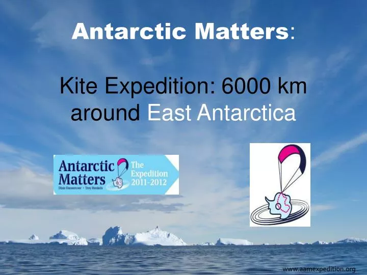
Antarctic Matters : Kite Expedition: 6000 km around East Antarctica. www.aamexpedition.org. Overview of the presentation :. Introduction The expedition members Main targets Masters study to determine the optimal route

E N D
Antarctic Matters:Kite Expedition: 6000 km around East Antarctica www.aamexpedition.org
Overview of the presentation: • Introduction • The expedition members • Main targets • Masters study to determine the optimal route • Meteorological observations along the route and the use of the observations
Introduction • Austral summer of 2011-2012: 120 days • Longest Antarctica expedition ever: 6000km (see image) • Progression: wind power – kites • Meteorological aspect: weather observations on East Antarctica
Introduction • Austral summer of 2011-2012: 120 days • Longest Antarctica expedition ever: 6000km (see image) • Progression: wind power – kites (pictures) • Meteorological aspect: weather observations on East Antarctica
Introduction • Austral summer of 2011-2012: 120 days • Longest Antarctica expedition ever: 6000km (see image) • Progression: wind power – kites (pictures) • Meteorological aspect: weather observations on East Antarctica
Overview of the presentation: • Introduction • The expedition members • Main targets • Masters study to determine the optimal route • Meteorological observations along the route and the use of the observations
Dixie Dansercoer • From Belgium • Polar traveler: • Trans Greenland expeds • Trans Antarctica 4000km • Trans Arctic: Siberia- Greenland
Troy Henkels • Alaska, USA • Worked 18 months in Mcmurdo/South Pole • Mountaineer/extreem kiter
Overview of the presentation: • Introduction • The expedition members • Main targets • Masters study to determine the optimal route • Meteorological observations along the route and the use of the observations
Main Targets • To travel the longest distance in an unsupported way on Antarctica • To establish a new expedition route based on the prevailing wind • To contribute to the research wind systems on East Antarctica • To contribute to the Antarctic Prediction System • Support educational Programs promoting environmental awareness
Overview of the presentation: • Introduction • The expedition members • Main targets • Masters study to determine the optimal route • Meteorological observations along the route and the use of the observations
The Optimal route around East Antarctica Masters degree study by Mathijs Van Asbroek (University of Leuven)
The optimal route • Introduction • Conditions to determine the route • Scores • Result
The optimal route • Introduction • Conditions to determine the route • Scores • Result
Conditions to determine the route • Along fixed checkpoints (image) start: Novolazarevskaja (2500mr) Amundsen-Scott Princess Elisabeth
Conditions to determine the route • Along fixed checkpoints (image) • Favourable wind conditions (image)
Conditions to determine the route • Along fixed checkpoints • Favourable wind conditions • No big elevation changes (image)
Conditions to determine the route • Along fixed checkpoints • Favourable wind conditions • No big elevation changes With those three conditions drawn out a rough traject:
The optimal route • Introduction • Conditions to determine the route • Scores per section 7 (image) • Result
Scores • Comparison: wind direction – movement direction (table)
Scores • Comparison: wind direction – movement direction • Slope gradient (image)
Scores • Comparison: wind direction – movement direction • Slope gradient • Total distance (time 120 days) (image)
Filter for the distance Difference with average route
The optimal route • Introduction • Conditions to determine the route • Scores per section 7 • Result
Overview of the presentation: • Introduction • The expedition members • Main targets • Masters study to determine the optimal route • Meteorological observations along the route and the use of the observations
Meteorological Observations • Introduction • The need for real time observations over East Antarctica • Set up at this point
Meteorological Observations • Introduction • The need for real time observations over East Antarctica • Set up at this point
Meteorological Observations • Introduction • The need for real time observations over East Antarctica • Set up at this point (nxt)
Set up at this point • Continuous readings (T, dd and P) • On several elevation points: 1. surface (on the sledge) 2. on top of the lines (alt 1-200m) 3. in between if possible 4. gps to determine pos, movement and elevation • Camera in top: images of sastrugi
Meteorological Observations • Introduction • The need for real time observations over East Antarctica • Set up at this point (nxt) • Suggestion: - Use of these observations - Compose a protocol/program - Anything to make this data set more valuable