Download
1 / 24
350 likes | 1.1k Vues
Natural Disasters. Natural Disasters. Concept Classification Conclusions. Images: www.docstoc.com/docs/145420347/Unit-19_-Natural-Disasters-part-1---TeacherTube. Concept.

E N D
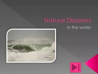
Natural Disasters • Concept • Classification • Conclusions Images: www.docstoc.com/docs/145420347/Unit-19_-Natural-Disasters-part-1---TeacherTube
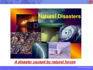
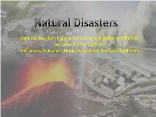
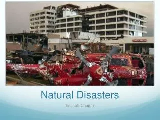
Concept Natural disasters occur in nature as a part of physical phenomena that liberates a great amount of energy. The origin of such phenomena is in principle a consequence of natural forces, however the anthropogenic impact in natural systems may be an important factor that alters atmospheric disasters like floods and hurricanes. Natural disasters are highly destructive because of the increase in human population that encourages development. The larger the number of cities the greater the likelihood of a natural disaster to occur in a populated area.
Causes that increase natural disasters occurrence risk • High volcanic activity • High precipitation • Uncontrolled urban development • Increase of population in dense urban centers
Indian Earthquake damage: http://indyas.hpage.co.in/india-64_73960365.html
Clasification • Erosion • Earthquakes • Hurricanes and tornados • Volcanic eruptions
Erosion and weathering • Due to exposure of soil to the elements. • Affects all landscapes is highly destructive in zones of scarce vegetation and shorelines exposed to strong tidal forces. • Increase shoreline erosion increase risk of development along the coasts.
Types de erosion by origin: • Precipitation • Flooding • Karstic • Marine • Glacial • Wind Image: evidence of channels on Mars :crism.jhuapl.edu/science/geology/channels.php
Erosion due to precipitation • Exposed soil is easily removed by precipitation. • Heavy precipitation events also destabilize slopes creating mudslides via liquefaction of soil layers acting as a lubricant removing large amounts of soil in big slabs that can be really destructive. Soil Erosion: Image: http://pica-pica.wcgame.ru/gravity-erosion.html
Flooding • Sudden flooding events cant remove a significant amount of soil and affecting large areas. • In dry counties flash flooding can occur due to high precipitation and deep and narrow canyons to evacuate the water. Image: http://www.geocities.ws/cnaturals2003/elvent.html
Karst erosion • Groundwater dissolve preferentially certain minerals , e.g., calcite, creating caves systems that may create collapsing and subsiding of the surface. Image: Karst formation: http://imgur.com/oUwXluB
Marine Erosion • Sea action over shoreline soil. • Constant transfer of soil sediment to the sea.. • Sea erosion creates rock exposure in cliffs and platforms that may collapse eventually. Granitic stacks image: http://www.subantarcticislands.com/the_snares_geology_granitic-sea-stacks.html
Glacial erosion • Glaciar movement carves the earth surface in channels of round profile. • The glacier descend may occur across a shoreline generating icebergs that present a risk for navigation. Image http://www.calstatela.edu/dept/geology/G150.htm
Earthquakes • A sudden movement in the earth crust. • Its originated from faults between tectonics plates inside the earth crust, the energy liberated travels in waves. • Earthquakes are detected in seismic stations which can track down the origin via triangulation of multiple detector locations. • Some historical earthquakes : · Lisbon (1755), more than 4000 victims. · California (1906), cause the Great Fire of de San Francisco.
Types of eartquakes • Micro-eartquakes: only registered by seismographs, no evident effects. • Macro-earthquakes: cant be detected by our senses. • The strength of an earthquake varies several orders of magnitude from minimal damage to catastrophic. Image www.coolgeography.co.uk/GCSE/AQA/Restless%20Earth/Earthquakes/Earthquakes%20background.htm
Damage to infrastructure Seismograph Image http://www.bucknell.edu/Images/Depts/Communication/EarthquakeSeismograph.jpg Image http://www.mercedesya.com.ar/noticias/30002099-un-fuerte-temblor-en-chile-llego-a-buenos-aires.htm
Tsunamis • An earthquake can generate highly destructive waves if occurs near the coast or under the ocean. • Tsunami waves travel fast in the open ocean and are shallow. • Near the shore gain elevation and can be extremely destructive if arrive without any warning and without contingency systems. Japan Tsunami 2011 : images.nationalgeographic.com/wpf/media-live/photos/000/332/cache/japan-earthquake-tsunami-nuclear-unforgettable-pictures-wave_33291_600x450.jpg
Cyclones, hurricanes and tornados • Cyclone, originated by a sudden decrease in barometric pressure where big masses of moist air spin, wind speed can achieve hundreds of mph. If occurs in tropical latitude are called hurricanes and can be very destructive due to the increasing number of human development across shorelines and may affect large areas (100’s sq miles). Image http://www.travelers-way.com/uragane.html
Tornados • Tornados occur inland, and are characterized by a smaller area and highly unpredicted course, can create high localized damage and are common in the center/west of the U.S Texas tornado” http://themillercircle.org/2011/06/what-causes-tornadoes/
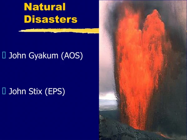
Volcanoes • A volcano is a release valve of Earth mantle’s heat and pressure. • Topographical features in earth crust due to tectonic activity generate ranges of mountains of volcanic origin. Where expulsion of magma, hot gases and ash may occur. Tungurahua volcano eruption 2012 http://www.photosup.biz/img/tungurahua-volcano-eruption-2012.html
Volcano classification • Regarding activity: Active: eruption permanent during human lifetime scales Periodic: eruption may occur over geologic time scales. Inactive: Negligible activity, don’t conduct magma, all vents inactive, low heat energy and pressure consisitent measurements.
Wildfires: Common natural hazards in Utah • Utah weather is dry and during the summer months the incidence of potential wildfire is high, as shown in the risk map. • Local regulations enforce safety rules in dry regions: camp fires, fireworks usage, etc. www.husdal.com/2001/10/31/can-it-really-be-that-dangerous-issues-in-visualization-of-risk-and-vulnerability
Earthquakes: Common natural hazards in Utah • Along the Wasatch fault eartquakes of low intensity , magnitude 4 are common. The risks of a stronger quake is high but cannot be predicted. • Regulations enforce construction codes to prevent damage and human losses. http://www.seis.utah.edu/Seismaps/ut6298.gif
Conclusions • Natural disasters are generated by sudden liberation of energy created by natural forces. Earthquakes and volcanic eruptions represent the continuous release of thermal energy from the interior of the planet. There is not a functional theory that allow prediction of these events. Atmospheric caused disasters like floods and erosion may be exacerbates by alterations in weather and atmospheric composition due to human impact. • The high levels of destruction is due to overpopulation that increases the number of developed places in the world combined by development in areas of high risks like shorelines and river basins due to the improve economic and agricultural factors. • The best way to deal with disasters is educating and enforcing measurements to increase the safety of buildings and planned development in order to avoid zones of high risk.