Advanced MODFLOW Data Modeling in ArcGIS for Groundwater Simulation and Analysis
This document explores the integration of MODFLOW data models with ArcGIS for groundwater simulation. It focuses on the simulation feature dataset including boundary polygons and various geological formations, such as the Turlock Lake Laguna, Mehrten, Valley Springs, and Ione formations. Additionally, it highlights the development of geoprocessing tools for importing, exporting, and visualizing MODFLOW models, facilitating the creation of workflows and custom scripts. This resource is essential for analyzing water demand factors, land use changes, and automating groundwater modeling processes.


Advanced MODFLOW Data Modeling in ArcGIS for Groundwater Simulation and Analysis
E N D
Presentation Transcript
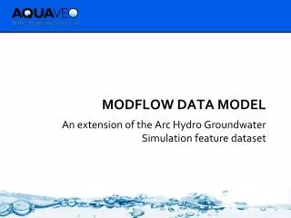
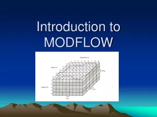
MODFLOW Data Model An extension of the Arc Hydro Groundwater Simulation feature dataset
Boundary Polygon J I
Cell2D and Node2D Features Cell2D Node2D
Riverbank Model Layer 1 • Consists of sands, silts, and clays from floodplain and alluvial deposits • Superjacent ancestral stream channels cut across this formation creating lateral channels of gravels and unconsolidated sediments
Turlock Lake Laguna Formation Model Layers 3,4 and 5 • Predominantly consists of sands, silts, and clays • Superjacent ancestral stream channels cut across this formation, creating lateral channels of gravels and unconsolidated sediments
Mehrten Formation Model Layers 6,7 and 8 • Composed of two dominant units: • Black andesitic sands “salt and pepper sand” and blue and brown clays • Hard gray and black tuff-breccias “lava”
Valley Springs Formation Model Layer 9 • Consists of rhyolite ash, quartz sand , and ashy clay
Ione Formation Model Layer 10 • Consists of sandstone, silts, and clays
MODFLOW Data Model • Data standard for storing MODFLOW models in a GIS database • Importing models built externally • Building new MODFLOW models inside ArcGIS • Custom scripts for analyzing/modifying models can be developed as geoprocessing tools
MODFLOW Analyst Tools • Developed as geoprocessing (GP) tools • Classes of tools • Import • Export • Visualization/Map Layers • Model editing • Building package input • Working with transient input/solutions
Import MODFLOW Model Tool INPUT OUTPUT
Make MODFLOW Features Tool + Or Node2D Cell2D INPUT OUTPUT
Build Package Input • Discretize: • Spatial • Polygons K zones (overlay) • Points K values (interpolate) • Polylines River cells • Points Wells • Temporal • Time Series Stress Periods
Geoprocessing Tools - Workflows • GP tools enable the development of workflows as models or scripts • Extendable – You can create your own workflows • Leverage low-level tools to create new tools
Model Domain Bear River Sierra Nevada Feather River Sacramento River Mokelumne River
Land Use Patterns Master Land Use File Farm Data Change from Non-urban to Urban
Water Unit Demand Factors Agricultural Demand Factors (DWR) • Model Output for Representative Water Years Urban Demand Factors • Normalization Factor based on Water Year Index Monthly Conversion Factors Water Year Index • 2002 ITRC Crop Evapotranspiration • Rates for Eto Zone 14 • ITRC Report 02-001, funded by • CALFED and Agricultural Research • Initiative of California State Univ.
GSSHA Results 1 2 3 4 5 6 7
Automated Workflow GSSHA simulations Recharge coeff. for each STLU for each water year Master Land Use Files Water Unit Demand Factors Water Year Total Recharge GSSHA Simulation Recharge Coeffs Calculate Change in Land Use Calculate Recharge Model Total Applied Water and Precip Calculate Water Demand Calculate Total Applied Water Recharge to MODFLOW Total Flow from Ungaged Watersheds Water Budgeting and Accounting Calculate Demand Summary Lateral Inflow to MODFLOW Distribute Demand
For more information http://www.archydrogw.com (AHGW Wiki page) http://www.aquaveo.com/archydro (Info on tools) Norm Jones njones@aquaveo.com