Download
1 / 50
500 likes | 575 Vues
Discover the key events of the 2010 Atlantic Basin Hurricane Season, which tied for the 2nd most active season in history. From Hurricane Tomas to the rapid formation of major storms, learn about the record-breaking season.

E N D
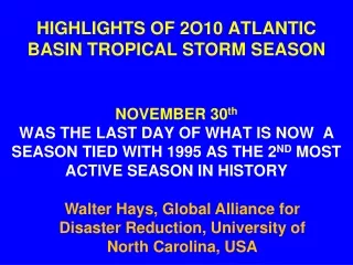
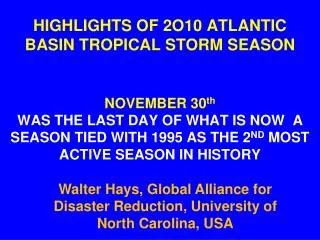
HIGHLIGHTS OF 2O10 ATLANTIC BASIN TROPICAL STORM SEASONNOVEMBER 30thWAS THE LAST DAY OF WHAT IS NOW A SEASON TIED WITH 1995 AS THE 2ND MOST ACTIVE SEASON IN HISTORY Walter Hays, Global Alliance for Disaster Reduction, University of North Carolina, USA
The most active hurricane season in the past 40 years—with 28 storms-- occurred in 2005, forcing the National Hurricane center to use six letters from the Greek alphabet for names.. .
By Sept 26th, the 2010 Atlantic hurricane season, had produced 13 named storms, four more than in 2009 and four more than the average number for a typical season.
Four major storms formed in 20 days, the fastest that four Category 4 hurricanes have ever formed, beating the previous record of 24 days set during the1999 season.
The reason: The Atlantic basin has been registering record high temperatures since March, according to U.S. archives.
By Oct 30th, the 2010 Atlantic hurricane season, had produced 19 named storms, including 12 hurricanes, with one month left in the season.
Miraculously, none of 2010’s storms made landfall in the USA.
ATLANTIC BASIN TROPICAL STORMS AND HURRICANES: 2010 • Alex (H) June 21 • Bonnie July 27 • Colin Aug 3 • Danielle (H) Aug 21 • Earl (H) Aug.29 • Fiona Aug 30
ATLANTIC BASIN TROPICAL STORMS AND HURRICANES: 2010 • Gaston Sept 1 • Hermine Sept 6 • Igor (H) Sept 8 • Julia (H) Sept 12 • Karl (H) Sept 14 • Lisa (H) Sept 20 • Matthew Sept 24
ATLANTIC BASIN TROPICAL STORMS AND HURRICANES: 2010 • Nicole Sept 29 • Otto (H) Oct 6 • Paula (H) OCT 11 • Richard (H) Oct 21
ATLANTIC BASIN TROPICAL STORMS AND HURRICANES: 2010 • Shary (H) Oct 27 • Tomas (H) Oct 29 • Virginie Nov 21? (Never formed) • Walter (Never formed)
--- AND ENDED AS A HURRICANE MAKING LANDFALLS IN BELIZE & MEXICO:JUNE 30
HURRICANE EARL BECAME A CAT 4 STORM A SECOND TIME AS IT HEADED TOWARDS THE EAST COAST OF USA WIND BANDS EXTENDED 200 MI FROM EYE AUGUST 29 – SEPTEMBER 4, 2010
The power of Igor and Julia, two Cat 4 hurricanes moving simultaneously through the Atlantic, was an indication of how warm the Atlantic was. ,”
Bermuda, which is smaller than Igor’s “eye,” dodged a bullet, because Igor, a huge storm, weakened to a CAT 1 storm as it approached and did not make landfall on Bermuda.
Buildings performed well because Bermuda's building codes specify that homes must be built with walls at least 20 cm (8 in) thick, and able to withstand 150 mph (241 kph) gusts and sustained winds of 110 mph (177 kph).
A CAT 1 IGOR LEAVES BERMUDA; HEADS TOWARDS ATLANTIC CANADA: SEPT 20
Karl made landfall twice: first on the Yucatan Peninsula of Mexico as a strong tropical storm, and second near Veracruz, Veracruz State, on the central Mexican Gulf coast, as a major hurricane.
Tropical storm Karl became a Cat 1 hurricane on September 16th.
It was not the best time for a “rainmaker” like Karl to make landfall near Veracruz, because rain had been falling in the Veracruz area since mid-August.
Karl dumped 8 more inches (21.5 cm) of rain in Veracruz within 90 minutes, 31.4 cm in the nearby mountains, causing landslides, and 25.4 cm across the central and southern Gulf coast region before drenching Mexico City.
Karl caused widespread damage in Veracruz: knocking down hundreds of trees, billboards, and power poles, leaving 80 % of the city without electricity, and upending cars.