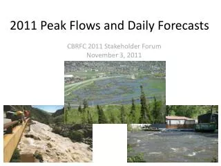
2011 Peak Flows and Daily Forecasts
210 likes | 361 Vues
CBRFC 2011 Stakeholder Forum November 3, 2011. 2011 Peak Flows and Daily Forecasts. OUTLINE. Brief overview of daily and peak flow forecasts Runoff Review North-South tour of spring/summer runoff December storm and Lake Mead. CBRFC Daily/Peak Forecasts. Peak Flow Forecasts

2011 Peak Flows and Daily Forecasts
E N D
Presentation Transcript
CBRFC 2011 Stakeholder Forum November 3, 2011 2011 Peak Flows and Daily Forecasts
OUTLINE • Brief overview of daily and peak flow forecasts • Runoff Review • North-South tour of spring/summer runoff • December storm and Lake Mead
CBRFC Daily/Peak Forecasts Peak Flow Forecasts • Snowmelt Mean Daily Maximum Flow (April-July) • Long Lead-Probabilistic Forecasts • (10%,25%,50%, 75%, 90%) • Issued (at least) monthly from March-June (this year weekly starting April 19) • ~60 forecast points – UNREGULATED and REGULATED • Regulated points HIGHLYimpacted by upstream reservoir operations • Daily Forecasts • Hydrograph time series for future 10 days (deterministic) • 5 days of forecasted precipitation • 10 days of forecasted temperature • Include known future reservoir operations • Issued as least daily by 10 am MT • Updated multiple times a day during high flows or flood events
Daily Forecast Peak Flow Forecasts
2011 Runoff Review • Where did we start? April 1 Peak flow forecasts: • Very significant chances for flooding in Utah, Colorado
Wettest area was northern Colorado • Upper Colorado also very wet • Gunnison divided wet from normal • Dolores, San Juan basins near normal
Yampa River Basin Yampa / White Rivers generally peaked in June Very high (many records) snowpack Cool June somewhat mitigated high flows although rivers flowed high for several weeks Record or near record peaks
DAILY PEAKS
UPPER COLORADO Upper Colorado includes many high elevation basins that peaked late into June or early July Near record snowpack caused high flows High flows were mitigated by cool June temperatures
DAILY PEAKS
REGULATED PEAK FLOW FORECAST • Numerous upstream reservoirs and diversions • Assumptions included: • Many reservoirs spilling • Spills occurring during peaks • Reservoir operations mitigated spills
Gunnison Gunnison basin divided wet conditions to the north and near average to the south. Hwy 50 was a rough dividing line Peaks mostly in early June with continued high flows through June and even July (monsoon moisture)
DAILY PEAKS
SAN JUAN BASIN San Juan Basin much drier with near to below average conditions Peaks mostly in early June with continued high flows through June
DAILY PEAKS
SUMMARY • Runoff characteristics are largely determined by the day-to-day spring weather. • Record snowpack increased the chances for flooding; however, flooding was not widespread • Small snow pack years can flood with the right sequence of spring temperatures • Long lead and daily forecasts performed relatively well
SUMMARY WHERE DID WE GO WRONG? • Areal snow cover • Struggled with some reservoir release schedules • Temperature forecasts in late May/early June were too high causing daily forecasts to be to high WHAT ARE WE DOING TO FIX ERRORS? • Snow covered area project (stay tuned) • Reservoir releases- more information from users!
Pre Holiday Storm: • Lake Mead up ~2 feet from local runoff • Large snow accumulation