Exploring the World's Oceans: Currents, Tides, and Depths
Dive into the mysteries of the Earth's oceans, from the tides and waves to the ocean floor. Learn about ocean currents and their significance in shaping our planet’s climate. Discover fascinating facts like the percentage of the Earth's surface covered in water and the distribution of saltwater versus freshwater. Uncover the secrets of the Atlantic, Pacific, Indian, and Arctic Oceans, including their depths and currents. Explore how currents are measured and their impact on marine life. Gain insights into the importance of ocean currents for biodiversity and ecological balance. Immerse yourself in the wonders of the underwater world!

Exploring the World's Oceans: Currents, Tides, and Depths
E N D
Presentation Transcript
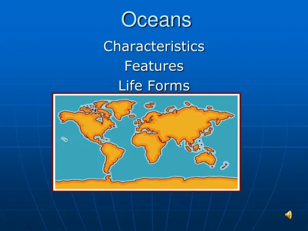
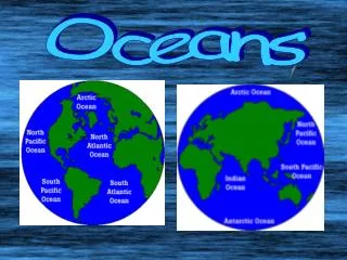
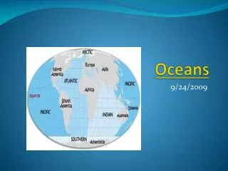
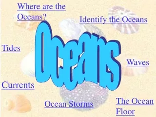
Where are the Oceans? Identify the Oceans Oceans Tides Waves Currents The Ocean Floor Ocean Storms
What percent of the earth’s surface is covered in water? ______________ What percent is land? ___________
What percent of the earth’s water is salt? What percent is fresh? Drop in the Bucket
Area(1,000,000 km²) Volume(1,000,000 km³) Average Depth(m) Maximum Depth(m) Atlantic Ocean 82.4 323.6 3926 9200 Pacific Ocean 165.2 707.6 4282 11,022 Indian Ocean 73.4 291.0 3963 7460 Arctic Ocean 14.1 17.0 1205 4300 World Ocean Facts
There are two principle ways to measure currents: • Eulerian method employs current meters fixed to the sea bottom. Two Impeller Meters
Langrangian method employs drifters, drogues, or floats that are set loose at the sea surface or at predetermined depths and tracked acoustically. The Lagrangian Method
Ben Franklin and the Gulf Stream In the 1750s when Postmaster for the American Colonies, Ben Franklin and Capt. Timothy Folger created the first map of the Gulf Stream to help speed up delivery of mail to and from GB
Types of currents: • Wind-driven currents (surface currents) occur in the uppermost 100 m or less • Density currents (vertical currents) caused by salinity and temperature produce very slow flows in deeper waters.
Surface Currents • Wind blowing over the ocean can move it due to frictional drag. • Waves create necessary roughness for wind to couple with water. • One “rule of thumb” holds that wind blowing for 12 hrs at 100 cm per sec will produce a 2 cm per sec current (about 2-3% of the wind speed)
Top-down drag • Wind acts only on the surface water layer. • This layer will also drag the underlying water, but with less force. • Consequently, there is a diminution of speed downward. • Direction of movement is also influenced by the Coriolis Effect and Ekman Spiral
Coriolis Effect • The French scientist, Gaspard Coriolis, first explained the deflection of objects moving over the surface due to Earth’s rotation. • coriolis experiment • Pete Bethune Whale Wars (26 min)
Ekman Spiral Nansen and others exploring the Arctic noticed that ice and surface currents move at an angle to the wind direction. Ekman first explained the mathematics of this phenomena, and why it decreases with depth to produce the spiral pattern.
Vertical Ocean Currents • Driven by temperature and salinity differences • as water reaches the poles, it cools resulting in evaporation or freezing, leaving remaining water saltier and more dense. In addition, cold water is denser than warm water, causing it to sink (thermohaline circulation).
The Great Ocean Conveyer Why is this important? VIDEO
General Surface Current Patterns • Temperature Distribution • Shape coastlines • Oxygen / Carbon Dioxide Exchange • Distribution of Nutrients (Upwelling and Downwelling) • Pollution Dispersal Plastic Plague Video WHY ARE THESE CURRENTS IMPORTANT?? http://earth.usc.edu/~stott/Catalina/Oceans.html
Circular surface currents patterns Prevailing Westerlies and Trade Winds strongly influence these flows Clockwise rotation in the Northern Hemisphere, counterclockwise in the Southern Gyres http://earth.usc.edu/~stott/Catalina/Oceans.html
Upwelling • Large amounts of nutrient rich water moves up to the surface from the below • Occurs most frequently in areas that experience monsoons and steady winds upwelling demo seamounts
Research 1 ocean current! • Choose 1 of the ocean currents • Is this a warm or cold ocean current? • Name and provide a picture for one ocean organism that relies on the movement of that current • Describe why this current is important for that organism’s survival (diet, migratory patterns, etc) Be descriptive! 6-7 sentences • Provide a map of the location you are describing and describe the pattern of its movement
Create an ocean mural • Use the internet to find 3 fish (from 3 of the 5 ocean zones) Epipelagic, mesopelagic, bathypelagic, abyssopelagic, hadopelagic • Cut and paste a picture of each fish as well as its common name and adaptation for survival in its zone! • Print out, color, cut and add to the mural! TUNA(epipelagic) – Countershaded color to camouflage with sunlight in order to hide from predators/ stalk prey
Review Questions • What are 3 properties of ocean water that vary in different parts of the ocean? temperature, salinity, pressure, gases, density • How does the direction of ocean currents differ north and south of the equator? north-clockwise, south-counterclockwise • What current does the Gulf stream form as it travels north? North Atlantic Drift