
John D. Moore Einstein Fellow Emeritus
E N D
Presentation Transcript
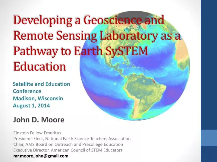
Developing a Geoscience and Remote Sensing Laboratory as a Pathway to Earth SySTEM Education Satellite and Education Conference Madison, Wisconsin August 1, 2014 John D. Moore Einstein Fellow Emeritus President-Elect, National Earth Science Teachers Association Chair, AMS Board on Outreach and Precollege Education Executive Director, American Council of STEM Educators mr.moore.john@gmail.com
National Initiatives • PCAST K-12 STEM Education Report “PREPARE and INSPIRE” • National Academy of Sciences “Successful K-12 STEM Schools” • National Science Foundation “Preparing the Next Generation of STEM Innovators” • Next Generation Science Standards (NGSS) • American Meteorological Society “Earth System STEM Education Policy Statement”
NGSS …Shift in Pedagogy • K–12 Science Education should reflect the Real World Interconnections in Science. • Using all practices and crosscutting concepts to teach all core ideas all year. • Science Concepts build coherently across K–12. • NGSS focus on deeper understanding and application of content. • Science and Engineering are integrated in Science Education from K–12. • Inclusion of the Earth and Space Sciences.
As we face futurenatural and human generated hazards and disasters, the Geosciences have a critical role in the public awareness, safety, and national security of our nation. This past year, we have experienced volcanoes, earthquakes, tsunamis, hurricanes, tornadoes, and severe flooding, yet it is becoming increasing more difficult to find opportunities in K-12 educationfor students to engage in relevant related studies. What implications will this have on the 21st Century workforce? Teachers are using satellite and remote sensing technologies to incorporate imagery, data, and real time observationsin the classroom. Geographic Information Systems content is being taught as a technical skill, and is used to develop “Geospatial Thinking” in problem solving. Today, pre-college students and teachers are collaborating with the commercial aerospace industry and NASA to build “CubeSats”, ready for spaceflight, creating authentic science experiences. Students are engaged in observing the Earth and visualizing their future. Our community has an opportunity to inform policy makers in the development of emerging national STEM Education initiatives. The interdisciplinary nature of our discipline lends itself to providing the required leadership. Therefore, it is imperative that any plan for “Creating a National Strategy for Environmental Intelligence” highlight education as a fundamental component. (The Forum On Earth Observations V , 14 June 2011)
SCIENCE vs. SCIENCE EDUCATION • National Economy • National Security • National Geoscience Related Events
EXPERIENCE and LEADERSHIP
Geoscience Literacy • Earth • Oceans • Atmosphere • Climate • Energy
Earth SySTEM Geosciences Environmental Science Earth System Science
Earth SySTEM Education* Applications of the Geosciences*inScience, Technology, Engineering, and Mathematics (STEM) Education, Earth SySTEM, utilize satellite imagery, remote sensing technology, real-time data, and computer visualizations to facilitate interactions between STEM disciplines. * Geoscience as defined by the NSF … Earth-Oceans-Atmosphere/Space * AMS Earth System STEM Education Policy Statement
Science -Technology -Engineering – MathematicsNext Generation Earth Systems Education
Geoscience and Remote Sensing Laboratory • Real-Time Data • Google Earth Display • Geographic Information System (GIS) • Image Analysis • Study Earth as a System • Monitoring • Field Observations and Data Collection
Students now have the ability to examine a geo-referenced location from the top-down and bottom-up An Integrated “SEES” Earth SySTEM Educational Model SPACE-EARTH : EARTH-SPACE Fosters Geospatial Thinking Identifies geo-referenced data points/sources Incorporates Real-time Data Develops Geoscience and Remote Sensing content and applications
To Observe the Earth and Visualize the Future … A New Era of Observations BLUECUBE Build - Launch - Utilize - Educate
www.nestanet.org • “Making the Case for GeoSTEM Education” • “An Opportunity for Innovation in STEM Education: GeoSTEM” • “GeoSTEM: Establishing a Geoscience and Remote Sensing Laboratory”
It is a miracle that curiosity survives formal education. Albert Einstein JOHN D. MOORE mr.moore.john@gmail.com