Download
1 / 20
210 likes | 338 Vues
The Land Registration Agency of Kyrgyzstan, known as Gosregister, is responsible for land cadastre management, rights registration, and property valuation through its nationwide network of 49 regional offices. Supported by the World Bank and Sida, the agency initiated the development of an open-source cadastre software to revolutionize land management. Integrating modern database systems like PostgreSQL and advanced graphical tools, this software aims to automate business processes and improve data accuracy, addressing previous inefficiencies tied to proprietary systems and manual processes.

E N D
Cadastre software based on Open Source in Kyrgyzstan Alexander Solovov Solution developer
Land Registration Agency • Local name – Gosregister • Responsible for land cadastre, rights registration and property valuation • Has about 49 regional offices countrywide. • One central office, Land use Institute, Agency of cartography and geodesy. • Supported by World Bank and Sida through Swedesurvey agency (Swedesurvey worked before 2009)
Automated registration system (ARS) • Core system for automation of business processes in land registration office. • Developed in 2003 • Based on MS SQL Server 2000 and MS Access (client) • Currently used almost in all offices • Has central database replicated from regional offices, providing external services to the banks, real estate agencies and others
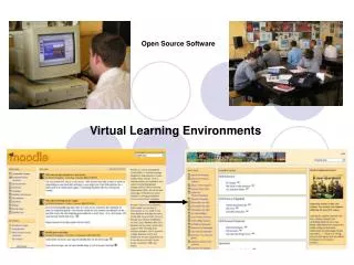
Before introduction of cadastre software • ARS operations on creating new property objects or modifying existing (e.g. amalgamation, subdivision) were implemented in text mode. • ARS didn’t have any spatial data or reference on spatial sources. • In most of the offices paper maps are used to handle geo data. • In some offices various standalone tools are used for mapping (ArcGIS, MapInfo, AutoCAD, etc.) • Usage of standalone tools brings confusion of different versions of data, inconsistency and has a high risk of data loss or damage
Cadastre softwareFirst attempt • In 2007 was initiated a creation of cadastre software in scope of World Bank project. • The following tools and formats were used: • ESRI ArcGIS Engine • Visual C# • Shape files
Disadvantages • Map objects are managed by coordinates only • No graphical tools • No central database and network environment support • High cost per one sit (about $800) • Proprietary code • Difficult to extend
Cadastre software Second attempt • In 2008 Swedesurvey had initiated development of new cadastre software with extended capabilities • Project was targeted on small regional offices whose didn’t have any perspective to get commercial software • Two versions were created in the scope of Swedesurvey project • Third version has been created in 2010 in the scope of World Bank project
Basic requirements • Create a solution, based on Open Source components (free of charge) • Introduce network database support as a central storage of digital maps • Develop graphical tools to manage map objects • Integrate with ARS database and support existing business rules • Move all cartographer functions from ARS to Cadastre software • Extend and improve different functions from previous release • Add new functions
Components • PostgreSQL • PostGIS • SharpMap • GeoAPI.Net • Proj.Net • GDAL • Visual C#
System architecture • Client-server three-tier architecture with well-defined interfaces • Business layer (middle) exposed through web-services • Modular nature of tiers • Works over TCP or HTTP (HTTPS) protocols
Integration with ARS • Integrated with ARS (main database) by Property code (identification number) • Property objects are created or modified in cadastre software and automatically replicated into ARS • Information on owners, rights and restrictions is taken from ARS to display in cadastre software and use in extended search and analysis functions
Core functions • Map layers management and customization • Add, remove layers (raster, shape file, PostgreSQL) • Customization of colors, fills, lines, labels and business objects binding • Map viewing • Simple georeferencing • By World File • By polygon on the map • Applications processing • Moving applications between departments • Applications distribution inside department • Actions are bound to application
Core functions • Spatial analysis • Set of common spatial functions integrated with information from registration database (ARS). Type of owner, type of land, type of usage, cost, etc. • Basic topology verification • Export to shape file or raster formats • Printing forms • Cadastre plan • Land parcel binding • Free printing with customized parameters
Core functions • Advanced search • By map objects • By property parameters • By address • By owners • Property objects operations • Creation • Amalgamation • Subdivision • Liquidation • Buffer • Creation of buffer zones internal or external
Advanced graphical tools • Rule • Point • Arc • Polyline • Polygon • Closed polygon • Internal polygon • On the fly switching between polygon, polyline and arc • Perpendicular
Advanced graphical tools • Parallel • Movement • Rotation • Vertex editing • Amalgamation • Subdivision • Copying • Length and angle • Total station • Linear intersection
Results • Development of the last version was finished in November 2010 • Introduced in the biggest registration office. Two offices are on the plan by the end of 2011 • It was decided to abandon the use of proprietary software and introduce open source solution in all offices gradually • New requirements are prepared for the next release
Thank you for attention! Questions?