Download
1 / 10
100 likes | 198 Vues
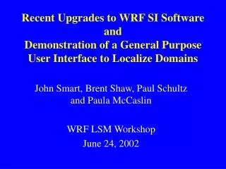
Recent Upgrades to WRF SI Software and Demonstration of a General Purpose User Interface to Localize Domains. John Smart, Brent Shaw, Paul Schultz and Paula McCaslin WRF LSM Workshop June 24, 2002. Funding Agencies for WRFSI Development. AFWA FAA NOAA. topo. WRF-ready init/lbc.

E N D
Recent Upgrades to WRF SI Softwareand Demonstration of a General Purpose User Interface to Localize Domains John Smart, Brent Shaw, Paul Schultz and Paula McCaslin WRF LSM Workshop June 24, 2002
Funding Agencies for WRFSI Development • AFWA • FAA • NOAA
topo WRF-ready init/lbc Grib data (AVN, Eta,RUC) land use others WRFSI Software Components Define Domain Populate the Domain Reformat Data
Recent Upgrades to WRF Standard Initialization Most of the software is very similar to the original v1.0 release (ie., directory setup, installation procedure, and running still the same). Added interpolation to support mass coordinate (v_interp.exe) Added Arakawa-A (now supports both A and C grids) (gridgen_model.exe) SI supports inputs for LSM frozen soil physics. Added RUC grib as background/initialization (grib_prep.exe) Released better (“more automated”) localization procedure (perl scripts). Current tar is WRFSI.TAR.gz wrfsi_20020328.tar.gz which has the mass coordinate interpolation and.
WRFSI Upgrades (Cont) • Developed domain relocalization GUI • Domain configuration • Edits wrfsi.nl “hgridspec” section
WRFSI Upgrades (Cont) • Program gridgen_model now includes: • “new” greenness fraction (0.144 deg resolution); • albedo climatology (from NCEP, 0.144 deg res); • New algorithm for processing albedo, greenness fraction, and soil temperature data tiles: > Smaller (raw) tiles are grouped into a super tile allowing horizontal interpolation methods to be applied, particularly for fields that require land-water mask.
NOTES • More at WRF tutorial on Thur 6-27-02 2pm: “How to set up and run WRF SI” • Latest software has not yet been posted to ftp site although the software is ready for “alpha” testing. • Terrain, land-use, and soil-type are still processed by the same method as in the original release. - aggregation, averaging, dominant category. • Still have as a goal to publish the WRFSI.
Potential Future Work • Nesting • Improve Auto Configure for multiplatform builds • Parallelization • Further Design/Develop the GUI • Build/Install WRFSI • FTP geography data (tar files) • Submit jobs to cron • What got in (to the analyses) • Configure other fortran namelist