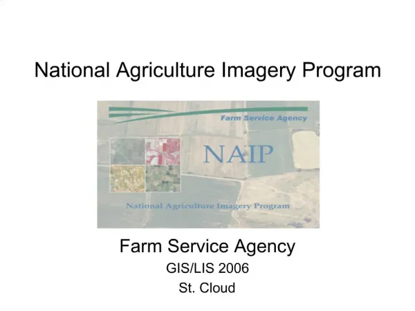
National Agriculture Imagery Program
210 likes | 350 Vues
Homeland Infrastructure Foundation – Level Data (HIFLD) Working Group Meeting September 13-14, 2011. National Agriculture Imagery Program. Shirley Hall GIS Program Manager Farm Service Agency Shirley.Hall@wdc.usda.gov. HIFLD Take -Aways.

National Agriculture Imagery Program
E N D
Presentation Transcript
Homeland Infrastructure Foundation – Level Data (HIFLD) Working Group Meeting September 13-14, 2011 National Agriculture Imagery Program Shirley Hall GIS Program Manager Farm Service Agency Shirley.Hall@wdc.usda.gov
HIFLD Take -Aways • FSA’s current 2012 plans are to collect NAIP in 13 States – this is Agency and partner funding contingent. • FSA and Federal partners will acquire a base 4-band imagery product for priority states. • Additional States are prioritized for acquisition contingent on receipt of additional funding. • Additional Partnership and Buy-up opportunities exist. • Formal written partnership agreement are needed by Jan. 31, 2012 • Deliverables are provided to partners roughly 30* days after the end of the flying season. • Putting it in Perspective: Low cost, high quality product
What Is NAIP? • Annual 1 Meter Resolution Imagery Program • CONUS - Statewide acquisition • “Leaf-On” acquisition • Primarily aerial collection, but satellite imagery is accepted • Public Domain • 3 year or less cycle • Next 3 year cycle begins in 2012
NAIP History • Main program started in 2003 • Two complete cycles of 1-meter imagery over CONUS, third underway • At the end of 2010, all CONUS states had imagery 2 years old or newer • $182 Million invested $134 M FSA (74%) $48 M Partners (26%) • Successful Program Management • Successful cost-share partnership • Successful Federal/Vendor partnership
NAIP – Largest Single Civilian Mapping Program in US History
NAIP is Key to Farm Service Agency and USDA’s Mission • FSA is a land/place based Agency • NAIP is the Base Layer for FSA and other USDA Agencies • NAIP supports day-to-day program administration • farm record maintenance • crop reporting • compliance and monitoring activities • change detection • disaster event preparation, response and reporting • program analysis tool
Who Else Uses NAIP? • Our Funding Partners: USDA Natural Resource Conservation Service and US Forest Service and Department of Interior • Buy-up Partners: State/Fed Government Consortiums • Non-Partnering Federal Users (via Download, Web Service, Media) DOJ, DOD, EPA, and others • Non-Partnering Public Entities • State and Local Governments • Academia • Private industry mapping ventures: ESRI, Google, and others.
NAIP Program Management • Effective central acquisition, management and distribution • Second 3-Year Partnership Underway: 2012-2014 • Projected annual FSA funding at $10.1M • Federal Cost Share Target at $5.6M ($1.87M/3 way) • Annual Schedule is based on • Available Funding • Date of Existing Imagery in Target States • FSA Program Priority
NAIP Program Management • FSA will issue a new Best Value, multi-year contract in 2012 • All requirements in place January 2012 • RFP issued in February • Proposals due mid-March • Source Selection late March
NAIP 2012Base Level Program Requirements • 1 meter resolution • 4-Band is now the base product • Absolute Horizontal Accuracy Specification • 6 meters from “true ground” position • Flying Season • Crop growing season - determined by FSA • <10% cloud cover
NAIP 2012 • Deliverables : Some Changes • 4-band imagery will be the base product • 4-Band Quarter-Quads will be the primary deliverable – 30 days after acquisition/end of flying season • Compressed County Mosaic - secondary deliverable, possibly 45 days after acquisition (as yet TBD) • Compression is now 1:15 – may change, particularly for larger counties • Under discussion – state seam line shapefile
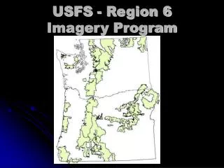
Planned 2012 NAIP • Priority Selection Based On: • Final Funding • Age of Imagery • FSA Mission Req. Oregon California Wyoming Nebraska Texas Missouri Illinois Michigan Mississippi Alabama North Carolina Virginia Maine
Buy-up Options – Procedures • Buy-up Options: • Half Meter Resolution Imagery • Firm, set price determined for each state in 2012 schedule • Based on estimated 2012 base price • Formal Agreement or written commitment needed by January 31, 2012.
Half Meter Project Requirements • Absolute Horizontal Accuracy • 6 meters from “true ground” position • Flying Seasons • Crop growing season - determined by FSA • <10% cloud cover • Deliverables • Quarter Quads in GeoTIFF • Compressed County Mosaics (CCMs) • Currently researching highly compressed ½m mosaics (MG3) or providing standard 1m CCM
NAIP Half-Meter Estimated Cost • Price Estimated at additional 50% of base costs • 1 meter 4-band estimated at $230/quarter quad • Half meter buy-up cost at $115/QQ (50% of base cost) • Total entire half meter project cost at $345/QQ • FSA and federal partners pay base price of $230 • State/Federal partners pays buy-up price of $115 • Estimated prices are based on averaged costs for average difficulty states and are provided for planning purposes only. • State partner agreements will be based on state specific estimates and will be adjusted according to location, terrain and local weather patterns.
Half Meter Buy-up • 2011 Contractor Survey Summary • Interest • All six prime contractors are interested and capable • Acquisition • Risks include additional flight lines at lower altitudes (more flying = higher costs) • Advantages include less airspace restrictions, more aircraft available, more SB subcontract opportunities • Production • Current contractor infrastructure is capable of handling increased workloads associated with ½ meter product • Price • Contractor cost estimates provided an average 50% increase in price for ½ meter product. Variables such as location, terrain, and local weather could impact costs and prices.
Where to Find NAIP • Interactive viewer for all NAIP Imagery: • http://gis.apfo.usda.gov/gisviewer • On Line Ordering System: https://coes.apfo.usda.gov/index.html • Compressed County Mosaics (CCMs) are available through the USDA Geospatial Data Gateway: http://datagateway.nrcs.usda.gov • The most recent year of NAIP Imagery DOQQs is available on an ArcGIS server http://gis.apfo.usda.gov/arcgis/services
NAIP 2012 Contacts • Partnership Information/Agreements • NAIP Partnership Coordinator • Bridget Barlow 801-844-2911 • Bridget.barlow@slc.usda.gov • Contract Technical Information • NAIP Contract Administrator • John Mootz 801-844-2916 • john.mootz@slc.usda.gov