USFS - Region 6 Imagery Program
USFS - Region 6 Imagery Program. USFS - Region 6 Imagery Program. USFS - Region 6 Imagery Program. Landsat TM 25+ scenes downloaded from MRLC Landsat Science collection. Landsat TM mosaics. USFS - Region 6 Imagery Program. NAIP Washington – 2006 Oregon – 2005

USFS - Region 6 Imagery Program
E N D
Presentation Transcript
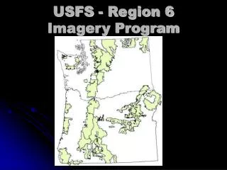
USFS - Region 6 Imagery Program Landsat TM 25+ scenes downloaded from MRLC Landsat Science collection
USFS - Region 6 Imagery Program NAIP Washington – 2006 Oregon – 2005 ½ meter buy-up for entire two states Used extensively by the field and GIS staffs, and by the remote sensing staff (texture)
USFS - Region 6 Imagery Program SPOT, IKONOS, QuickBird nothing purchased in 2008 Resource Photography no new acquisitions one set of reprints ordered (Siuslaw NF) Photogrammetry no projects in 2008
Region 6 SPP2008 Prints Delivered 3524 Prints Scanned 3373 Flight Line Miles 1188 Average Scale 1:6900 Number of Projects 78
Region 6 SPP FY09 Program Of Work Collecting project requests until Dec 1. FY09 budget of $125,000.
Region 6FY09 Program of Work • Four orthorectification projects: • Two on Olympic NF for assisting in • timber planning • Two on Willamette NF for • restoration planning
Region 6FY09 Program of Work Two photogrammetry projects – contour mapping of road material sources
Region 6FY09 Program of Work Major LiDAR acquisitions In Washington and Oregon Puget Sound Lidar Consortium Cyan – completed Oregon Lidar Consortium Grey – planned Blue – contracted Region 6 Red – completed Three major acquisitions on NF lands totaling over 800 square miles. Budgeted 19 person-weeks for LiDAR processing of NF lands