European Community Research on Integrated Projects in Architecture and SDI
Explore EU Framework Programmes funding research contributions to INSPIRE, emphasizing ICT for the Environment, ethical aspects, and multidimensional approaches to system integration and data access policies. Addressing technical challenges and disaster management, orchestrate projects like ORCHESTRA and WIN to improve risk management and spatial data connectivity. Enhance interoperability, ontology standardization, and crisis decision systems for a robust risk and crisis management eco-system.

European Community Research on Integrated Projects in Architecture and SDI
E N D
Presentation Transcript
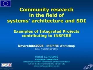
Community research in the field of systems’ architecture and SDIExamples of Integrated Projects contributing to INSPIREEnviroInfo2005 - INSPIRE WorkshopBrno, 7 September 2005Michel SCHOUPPEEuropean CommissionDirectorate General Information Society and MediaICT for the Environment (DG INFSO. G5)michel.schouppe@cec.eu.int
Community ResearchEU Framework Programmes • Main instrument to fund Community research (EU Treaty) • Pluri-annual since the 80ies; ongoing 6th FP: 2002-2006 • R&D in support of EU policies and EU RTD policy (ERA) • Calls for proposals addressing thematic priorities • Peer-reviewed by external evaluators • Implemented notably through trans-national,collaborative research • Different instruments for knowledge creation,coordination, innovation and dissemination Including ICT for the Environment Including Integrated Projects
Ethical aspects, science-society dialogue Training RTD 4 RTD 5 Management RTD 1 RTD 3 RTD 2 Demonstration Technology transfer, exploitation FP6 Integrated Projects • Integration of the critical mass and resources needed NOT just few sub-projects sharing a common management and dissemination structure • Holistic approach of a complex, multi-dimensional issue • “Europe to take the lead and set standards in this field” NOT just a big Specific Targeted REsearch Project
Current situationOrganisations & Procedures • Information and computational resources are spread over many levels of administration. • Various organisations operate legacy systems in isolation. • Many of them are reluctant to changing their existing systems. • An integrated infrastructure which requires large re-engineering efforts of existing systems usually fails. • Organisations are reluctant to grant data access to other organisations. • A data policy for sharing data is required (e.g. INSPIRE)
Current situationTechnical issues • Information resources are extremely heterogeneous. • in terms of semantics, information models, internal architectures, technical implementation and so forth. • Existing information is hard to access;Cross-system search remains problematic. • Search, navigation, retrieval often stops at a high level. • Often, individual search interfaces are developed for individual domains and business processes and do not understand others. • Users have to manually search different systems. • Existing information is hard to integrate; Cross-use of information is virtually not happening. • Spatial and non-spatial information in two different information worlds. • Multi-linguality and multi-terminology remains an obstacle
ICT for the Environment(IST Call 2, 2003) • Focus on “Improving Risk Management” • Objective: “… to foster the emergence of a European info-structure and service platforms which will facilitate the use of interoperable components and sub-systems …” • Focus on: “… Research to help the development of a European info-structure and associated services for crisis management. In particular, actions to improve co-ordination towards the harmonisation and standardisation of ontologies and sophisticated metadata architectures taking into account the requirements developed under the INSPIRE initiative …” • Integrated Projects “… shall help develop, principally, common open platforms for software and services supporting distributed information and decision systems for risk and crisis management…”
Disaster Management Cycle • Prevention and Mitigation • Hazard prediction and modeling • Risk assessment and mapping • Spatial Planning • Structural non structural measures • Public Awareness & Education.. • Preparedness • Scenarios development • Emergency Planning • Training • Alert • Real time monitoring • & forecasting • Early warning • Secure &dependable telecom • Scenario identification • all media alarm • Reconstruction • Spatial planning • Re-establishing life-lines transport &communication infrastructure • Response • Dispatching of resources • Emergency telecom • Situational awareness • Command control coordination • Information dissemination • Early damage assessment • Emergency healthcare • Post Disaster • Lessons learnt • Scenario update • Socio-economic and environmental • impact assessment
Two Integrated ProjectsORCHESTRA and WIN ORCHESTRA To design, implement, validate an Open Software Architecture for Risk management Spatial and non-spatial data Multi-risk (fires, floods, man-made disasters, oil spills)across boundaries of organisations and regionsFrom September 2004 till August 2007 The Wide Information Network (WIN) Project
Distributed ServicesCommon principles Risk management infostructure core services are about easily connecting to net-centric services Service #1 Service #n Service #4 Service #2 Service #3 backup o.s. o.s. o.s. o.s. CASCADED SERVERS Perspective: access to information and services if & when required Distributed plug ‘n play of information, meta information and service components
Common Architecture Principles • Focus on existing systems, making them interoperable and filling the gaps • Scope for broad information domains with varying data standards and service requirements • Exploitation of current/emerging open ICT and geospatial standards (W3C, OMG, OGC, ISO, WSI...) • Consideration of the semantic and multilingual issues within Europe’s environmental information-based systems • Results will feed back to standard bodies for global consensus agreement
Use of ontologiesto enhance interoperability Focus will notably be on: • Syntactic interoperability to allow physical connectivity through exploiting common syntax and structural levels • Semantic interoperability to build general agreement on the eaning that is given to labels assigned to features • Ontologies to specify conceptualization in a domain of knowledge (i.e. different risk domains) • Mapping of ontologies: inter-operability between information sources (i.e. multi-risk scenarios)
Service-Oriented Architecture (SOA) Towards a Service-Oriented Architecture • Natural progression following the advent of XML and Web Services on the Internet platform Loose coupling • Location transparency • Based on open standards • Best flexibility if combined with OpenGIS
Generic services • Generic services will be developed that are building blocks for many risk management applications • Generic means useful for more than 1 application, and not tied to a specific location. • Risk management applications can easily be build on top of these generic services, by integration of location specific information with the generic services • Risk management applications build using the info structure should be interoperable and easier to integrate into multi-risk, cross border situations
Step-wise approach ORCHESTRA and WIN will contribute validated approaches for enhanced technical and semantic interoperability to INSPIRE and GMES • Agreement to follow common design principles • Agreement to jointly work on common terminologies • Participation in the drafting/piloting of INSPIRE Implementing rules, especially in the risk management domain • Spatial Data Interest Communities (SDIC) • Initial focus on Implementing Rules expected to be adopted in 2007(creation and up-dating of the metadata, network services, third parties use of the upload services, monitoring and reporting, access and right of use of spatial data sets and services for Community institutions and bodies) • Later contributions on Implementing Rules expected to be adopted in 2009(use of spatial data sets and services by third parties, harmonised spatial data specifications of Annex I and for the exchange of Annex I, II and III) • Cooperation with GMES services (2008+) • Future use of the WIN/ORCHESTRA architecture by GMES services • Collaboration with ESA on interfaces with space data observations
Thank you for listening • ORCHESTRA: http://www.eu-orchestra.org • WIN: http://www.win-eu.org • INSPIRE: http://www.ec-gis.org/inspire/ • GEO: http://earthobservations.org/ • GMES: http://www.gmes.info/ • EU-MEDIN: http://www.eu-medin.org • FP7: http://www.cordis.lu/fp7 • Information Society Technologies (IST): • http://europa.eu.int/information_society • http://www.cordis.lu/ist/ • DG INFSO Unit “ICT for the Environment” • http://www.cordis.lu/ist/so/risk-management/home.html • -Mailbox: INFSO - G5@cec.eu.int