Download
1 / 39
400 likes | 550 Vues
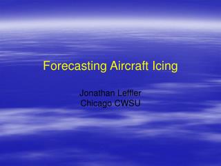
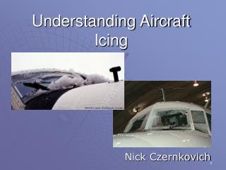
Forecasting Aircraft Icing Jonathan Leffler Chicago CWSU. Agenda. Definitions (review) Considerations Synoptic Conditions Methodology Mitigation Procedures Icing Products & Reporting Final Thoughts. Definitions. Types

E N D
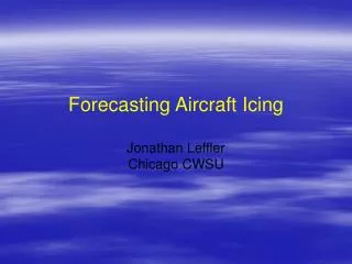
Forecasting Aircraft Icing Jonathan Leffler Chicago CWSU
Agenda • Definitions (review) • Considerations • Synoptic Conditions • Methodology • Mitigation Procedures • Icing Products & Reporting • Final Thoughts
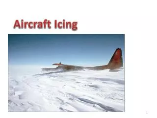
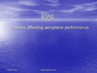
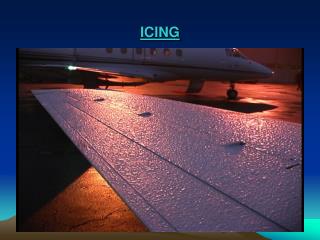
Definitions • Types • Rime: Whole droplet rapidly freezes, traps air, forms brittle, opaque, milky-colored ice. Most common form. • Clear: Small part of drop freezes, rest smears along surface, less opaque, denser than rime. Greatest threat. • Mixed: Combination of rime + clear. Can appear as layers of opaque and clear. Accumulates like clear, more difficult to remove than rime. Common Temperature Ranges * Icing typically not found < -20 C to -25 C due to the minimal availability of supercooled liquid
Definitions • Rates of Accumulation • Trace: Typically not hazardous to flight. De-icing, anti-icing and altitude change normally not required < 1 hr. • Light: Occasional use of de-icing or anti-icing is required to remove or prevent accumulation. Could become problematic if duration > 1 hr. • Moderate: Short encounter can be hazardous. Use of de-icing or anti-icing equipment is necessary and heading/altitude change normally required. • Severe: De-icing or anti-icing equipment cannot control or remove hazard. Immediate heading/altitude change required.
Considerations • Seasonality: Fall through Spring, Summer TS • Supercooled large drops (solid ↔ liquid, e.g. FZRA) • Liquid water content, not ice content (hard to measure) • Temperature advection (warm/cold), 0 C & -20/-25 C • Droplet Size (rain/drizzle/cloud) • Depth & duration of moisture (horizontally/vertically) • PIREPS! What has already been reported?
Considerations Frequency of icing type occurrence
Synoptic Conditions Cold Front • Usually not widespread • Faster moving • Clear more than Rime • Heavier ice w/Cu vs St Warm Front • More widespread clouds • Longer residency • Rime more than Clear • Heaviest in FZRA
Synoptic Conditions Freezing Precip = Highest Threat • Snowflake to raindrop phase transition • Generates supercooled large drops (SLDs) • Greater moisture availability • Clear ice freezing process (dense, hard to remove) • Rapid accumulation →Severe
Synoptic Conditions 40-45 hr/yr 30-35 hr/yr
Methodology • Satellite: Visible & Infrared • Surface moisture contamination (snow cover) • Cloud type (stratus vs cumulus) • Observations • Surface precipitation type (DZ, RA, SN) • Heavy moisture in dendritic “snow” zone tends to scrub supercooled droplets (more freezing process) • Cloud base & height • Radar + Sounding: Bright Band Height • AWIPS 4-Panel Interrogation (NWS) - Initial Areas • BUFKIT Soundings (Work/Home) - Refined Areas
Methodology ~ 050-070 SLD Threat MOD or greater potential 0 C
020-050 SFC-020 100-140 050-100
SFC-020 ? ?
020-050 ? Lake Effect ?
Sampling Locations 075 Snow Zone RUC 18Z - KORD T + 4 (22Z) *Forecast* 015
075 Snow Zone RUC 18Z - KORD T + 9 (03Z) *Forecast* 015
055 Snow Zone 035 RUC 22Z - KORD T + 0 *Analysis*
The Forecast ISOL LGT ICGICIP AOB 070.
The Results What does MOD ICG look like? ISOL LGT ICGICIP AOB 070.
180 LGT Snow Zone 130 MOD RUC 18Z - KORD T + 4 (22Z) FWA 01 Feb/21Z 010
180 Snow Zone LGT 130 MOD SLD Threat CMI 01 Feb/21Z 005
Mitigation Procedures • Ascend into colder layer (< -20 C), typically safest based on accumulation potential • Descend into warmer layer (> 0 C), but caution... • Lateral into FEW/SCT deck vs BKN/OVC deck Cold soaked skin = delayed warming and susceptible to icing with increased moisture
Icing Products & Reporting http://aviationweather.gov/adds
Icing Products & Reporting Graphical AIRMETS http://aviationweather.gov/products/gairmet
Icing Products & Reporting AIRMETS/SIGMETS
Icing Products & Reporting PIREPS Java Tool
Icing Products & Reporting http://aviationweather.gov/adds
Icing Products & Reporting Current Icing Potential (CIP) Forecast Icing Potential (FIP) CIP / FIP = Help pages on how icing analyses and forecasts are done
Icing Products & Reporting Experimental Icing Products
Icing Products & Reporting Experimental Icing Products
Icing Products & Reporting Experimental Icing Products
Final Thoughts • Icing can be a deadly aviation hazard if not planned for in advance. • Icing is subjective, however there are objective ways to forecast potential. We need your PIREPS! • Lots of web-based tools to help you flight plan • Graphics and literature courtesy AFWA TN-98/002 • Special thanks to Robb Kaczmarek (Chicago CWSU) and Paul Merzlock (NWS Romeoville) for technical advice and support