Download
1 / 45
460 likes | 662 Vues
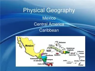
Intro to Physical Geography. The Physical Earth. Lithosphere – made up of the Earth’s crust and solid upper mantle. Hydrosphere – More than 70% of the Earth’s surface is covered by water. Atmosphere – Around the Earth is an envelope of gases known as the atmosphere.

E N D
The Physical Earth • Lithosphere – made up of the Earth’s crust and solid upper mantle. • Hydrosphere – More than 70% of the Earth’s surface is covered by water. • Atmosphere – Around the Earth is an envelope of gases known as the atmosphere. • Biosphere – refers to all life on Earth
Lithosphere • The Earth’s crust forms a thick skin around the Earth. • Broken up into tectonic plates • The movement of these plates shapes the Earth’s surface.
Plate Movement • From Pangaea to the Modern Continents
Plate Movement cont. • Earth 100 Million Years From Now
A Special Surprise! Plate Boundary Rap
Mountain Building • When two land plates (Continental Plates) slowly push into one another, they fold upwards, creating mountain chains. What type of plate boundary is this? Convergent
Seafloor Spreading and Rift Valleys • In the middle of the Atlantic Ocean, the separation of plates is causing the seafloor to spread. • As the plates move apart, magma rises up through cracks in the ocean floor, creating a mountain ridge.
Volcanoes In a place where tectonic plates diverge or where one plate dives under another, pressure in the Earth’s mantle is reduced and some of the hot, solid rock turns to liquid This liquid (MAGMA) is looking for a weakness in the Earth’s crust to vent.
Volcanoes • When the magma breaks through and reaches the earth’s surface, it is called LAVA. • Most volcanoes are located on the border of plates
Ring of fire • Ring of Fire
Weathering • The wearing down of rocks at the Earth’s surface by wind water ice and living things.
Erosion • The process by which rock sand and soil and broken down and carried away. 2 minutes
The same forces that erode one place can deposit particles and sediment in another. Rivers carry sediment downstream and deposit the sediment where the river meets the ocean DELTA Ocean waves can bring sand to a beach Deposition
Weathering breaks down rocks • Broken down rocks mix with decaying plantsand animals (humus), water, fungi, bacteria etc. • Different types of soil • Texture • Ability to hold water • Ability to support vegetation Soil: A building process
Mountains - often formed by the collision of tectonic plates, can be thousands of feet high in elevation Plateau – a flat highland whose sides drop suddenly because of erosion Valleys – long, low areas between mountain ranges, hills or uplands, often created by erosion Canyon – a deep gorge or ravine between cliffs, often carved by a river Landforms
More than 70% of the Earth’s surface is covered by water • 97% of this water is in the oceans • Most of the remaining 3% is frozen in the polar ice caps • Less than 1% is found in the Atmosphere, ground water, lakes or streams Hydrosphere
Ocean currents occur at the surface and below • @ the Equator the Earth’s rotation pushes surface water toward the west – sets in motion large circular surface currents • Water heated by the sun moves toward the poles • The Gulf Stream carries warm water towards Great Britain making it warmer than it normally would be • Under the surface, cold water sinks, then slowly moves toward the Equator, pushing warmer water away • This water slowly absorbs heat • Circulation takes hundreds of years Currents
The envelope of gases surrounding the Earth • Absorbs solar radiation • Moderates temperature • Distributes water The Atmosphere
High-Latitude Climates – Polar • near the poles • Very cold • Mid-Latitude Climates – Temperate • Warm summers • Cool winters • Low-Latitude Climates - Tropical Climate Regions
Temperate Deciduous Forest • Develop in Temperate/ mid-latitude zones • Ample rainfall • Moderate temperatures with cool winters • Leaves change colors in fall • Trees lose leaves in winter • Wide range of plant and animal life Biomes
Tropical Rain Forest • Develop in Tropical/ low-latitude zones • Ample rainfall • Warm temperatures year round • Large trees form Canopy • Abundant and diverse plant and animal life Biomes
Grasslands/ Savannas/ Steppes • Exist where climate is drier • Not enough rain to support large amount of trees • Dominated by grasses • Large grazing animals – cattle, antelope, bison *Savannas are grasslands with some trees (Africa) Biomes
Desert • Receive less than 10” of rainfall per year • Tropical/ low-latitudes • Vegetation that has adapted to the lack of water (cacti) and store water in their stem Biomes
Tundra • Found closer to the polar to the polar regions • Permafrost – permanently frozen soil • Grasses and small shrubs • Trees cannot grow Biomes