Measuring Coastal Marsh Vegetation Structure Using Multi-Angular Remote Sensing
This study explores the use of multi-angular remote sensing to retrieve Leaf Area Index (LAI) for coastal marshes. The research investigates ground cover conditions, vegetation structure parameters, and their implications for marsh health. We conducted field measurements at Blackwater National Wildlife Refuge, focusing on LAI retrieval methods through satellite data and ground campaigns. By integrating various data sources, we aim to enhance understanding of marsh ecosystems affected by invasive species and environmental changes, facilitating improved management practices.

Measuring Coastal Marsh Vegetation Structure Using Multi-Angular Remote Sensing
E N D
Presentation Transcript
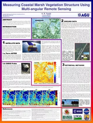
0 1 2 km N W E S 30 24 18 12 6 Difference relative to nadir (%) 0 -6 -12 -18 -24 -30 36o 0o -36o -55o 10 8 6 W m-2 nm-1 sr-1 (x 104) 4 2 0 Measuring Coastal Marsh Vegetation Structure Using Multi-angular Remote Sensing K. R. Turpie University of Maryland Department of Geography kturpie@geog.umd.edu Fall 2007 Meeting of the American Geophysical Union San Francisco, California December 10-14 2 GROUND DATA ABSTRACT Off-nadir radiometry can provide useful information about ground cover conditions, including vegetation structure parameters. It is hypothesized that remote sensing from multiple viewing angles could provide leaf area index (LAI) for coastal marshes. This poster introduces a study that focuses on possible methods of retrieving LAI using space-based instruments and measurements in the field. Three components of this effort are described. INTRODUCTION Marshes play an important role in coastal hydrology, geochemical cycling, erosion control, and provide essential habitat for many coastal flora and fauna. However, coastal marshes are affected by invasive species, sea-level rise, fire, and other natural and anthropogenic disturbances. Efforts have been made to assess and monitor these landscapes to understand their vital processes and to aid in management. However, traversing marshes can be quite difficult, making large-scale, in situ evaluation challenging. Remote sensing techniques offer an efficient approach to quantify changes in marsh vegetation. Leaf area index (LAI), defined as the ratio of one-sided leaf area to unit of ground area, can be used to tie vegetation structure to photosynthesis and radiation absorption. To understand how LAI can be retrieved for marsh vegetation using multi-angle remotes sensing, this study has three main components: 1) satellite data, 2) ground data, and 3) retrieval methods. The ground data component of this study involves at least one field campaign, the first of which was completed this past 2007 growing cycle. Measurements were taken in the Blackwater National Wildlife Refuge, which is part of the Chesapeake Marshland National Wildlife Refuge Complex under management of the U.S. Fish and Wildlife Service. The region is mostly covered by monospecific canopies of grass, sedge, and rush. The site has moderate to high saline conditions (14-15 ppt) and heavily broken up by ponds and channels, with significant signs of inundation from sea level rise (Kearney et al 1998, Rogers 2004). Several thousand high resolution reflectance spectra (450-900 nm) were collected along a 1.6 km segment of Maple Dam Road (from about Shorters Wharf to the red rectangle on the map on the left). Three runs were made collecting data at nadir for comparison to satellite. Two of those runs include measurements taken at ±45°. On the third trip, measurements were also taken at 60° in the backscatter direction (pointing northward up the road). In the first two trips, measurements were taken with an ASD Hand Held spectrometer with 23° and 10° IFOV and 68 ms integration time while the vehicle moved at about 10 mph. GPS readings were taken with a Garmin Etrex receiver at the starting and stopping points. This spectrometer was suspended over the marsh with a 3.6 m boom. On the third trip, the spectrometer used was an Ocean Optics USB2000+ with 100 mm aperture and L2 collection lens, and as set for a 2 ms integration time and a 50 sample average. Transect The USB2000+ was equipped with a 15° aperture Gershun tube and a 500 m optical cable suspended 5.3 m from the road with more sophisticated rigging. The vehicle moved at about 10 mph, while GPS readings were sampled continuously every second. In all runs, a Spectralon white reference was used to calibrate reflectance. LAI measurements were taken every 1/10 of a mile, once in September and once in early October. A LICOR LAI-2000 was used with a 90° reticle with the opening directed to the left or right of the user. The measurements were 1 SATELLITE DATA made on the ground (within a few hours of the overpass) and LAI measurements that were made within two weeks of the scene. The ground data was taken along Maple Dam Road (see map above). Additional work will be needed to reduce sources of noise. Although the atmospheric reflectance is low in the NIR, some contribution to the vegetation bi-directional reflectance distribution function (BRDF) can be expected and so atmospheric effect should be removed. This can be done using the field radiometry or a radiative transfer model. In addition, spatial distribution of ponds and other bodies of water in a pixel could reduce variation in the vegetation BRDF (see description for component 3 of this study). Figure 1 shows the difference in radiance relative to nadir in the ASTER scene. The image matches the gold rectangle in the map above. An increase in radiance with viewing angle is expected for this kind of cover (Sandmeier et al, 1999). Areas with a dense pond and channel distribution show lower increases off nadir than higher elevations heavily populated by common reed (Phagmites communis). Water shows a decrease (blue) from reduced specular reflection in the nadir view. taken in the late afternoon to avoid direct sunlight. Likewise the wand was aligned in the direction of the sun (low on the horizon) so that the reticle would occluded it. The scheme for each LAI measurement involved one reference measurement taken above the canopy for every four samples taken below. This component of the study evaluates multi-angular imagery from spaceborne instruments with relatively high spatial resolution (15-20 m at nadir), specifically the Advanced Spaceborne Thermal Emission and Reflection Radiometer (ASTER) aboard the NASA spacecraft Terra or the Compact High Resolution Imaging Spectometer (CHRIS) aboard the Project for On-Board Autonomy (Proba) for applicability to LAI retrieval over coastal marsh systems. 1.a Terra ASTER The ASTER instrument was launched in 1999 aboard the NASA Terra spacecraft. ASTER has 14 bands covering the range from visible to the thermal infrared. There are two visible bands and a pair of stereographic near-infrared (NIR) bands with about 15 meters resolution at nadir. One of the stereographic bands points at nadir (3N) and the other looks backwards (3B) at 27.4°. FIGURE 3 - Shown is a segment of the Maple Dam Road transect in the Blackwater Marsh National Wildlife Refuge. The image matches the red rectangle in the map above. The inset photos show the two booms used to support the two spectrometers. Maple Dam Road Artist rendition of the NASA Terra spacecraft in orbit. Courtesy of NASA. Ocean Optics USB2000+ One ASTER scene was collected over the Blackwater Marsh National Wildlife Refuge on 4 September 2007. This will be used in this study primarily to validate retrieval methods (can a model predict 3B and 3N given ground LAI?) and geolocation the CHRIS data. However, because marsh landscape is relatively flat, the stereographic bands might also provide valuable information about LAI. To test this hypothesis, the ASTER data will be compared to radiometric measurements ASD H-H 4 Sept 2007 1.b CHRIS Proba The Compact High Resolution Imaging Spectometer (CHRIS) aboard the Project for On-Board Autonomy (Proba) is a programmable spectroradiometer that has high spatial (17-20 m at nadir) and spectral resolution (18 bands for visible to NIR for mode 3a) (Barnsley et al, 2004). Twelve acquisitions over the Blackwater Marsh National Wildlife Refuge and a second site about 20 km SE were obtained, however, only four would determined suitable or use in the study (three over the Blackwater Marsh itself). Mode 3a was selected for these acquisitions because of the high gain settings would be useful for the lower reflectance common to marshland. The five nominal viewing angles are nadir, ±36°, and ±55°. 3 RETRIEVAL METHODS In this component of the study a method to retrieve marsh LAI is developed from the multi-angular data collected. The work will begin with a statistical analysis to look for any functional relationship between the sampled BRDF (satellite and ground measurements) and LAI measured on the ground. However, a more promising approach would be to develop a canopy reflectance model that is dependent primarily on LAI (Qi et al 2004). Water strongly affects the BRDF for wetlands and can make conventional retrieval methods, such as the inversion of radiative transfer models, problematic. Given the relatively high reflectance of vegetation to water, away from specular reflectance directions, finding the mean gap probability from the multiple views may be possible and geometric-optical methods can be applied (Ross 1981; Campbell and Norman 1989). More recent work by Tang et al (2007) produced LAI to an accuracy of 82% by integrating over a mean gap probability based on kernel models and a directional normalized difference vegetation index (NDVI). Inversion of radiative transfer models, including models such as the Scatter by Arbitrarily Inclined Leaves (SAIL) model (Verhoef 1984) or the New Advanced Discrete Model (NADIM) (Gobron et all 1997), have been shown to be effective for other types of land cover, and may work for the marsh with an adjustment for water reflectance. An intriguing strategy was also described by Qi et al (1995) where empirical and radiative transfer models were daisy-chained so that very few parameters were needed to obtain an LAI measurement. This study will explore performance of this strategies once they are modified to account for the aquatic substrate as a Fresnel reflector (Ahmed and Fraser 1982; Mobley 1994). After modification for the specular effect of water, sensitivity analysis will also be done to identify key parameters and noise sources. The augmented methodology will then be parameterized using ground data available from this and other studies. Plant reflectance and transmittance for two dominant marsh species that can be used in the model parameterization have been provided by the USGS (Ramsey and Rangoonwala 2004; 2005). Soil and water samples were taken from the study site to obtain their spectra as needed. BRDF data of marsh vegetation taken by Schill et al (2004) will be used to train and verify the retrieval methodology. Given its lower noise level, the ASTER 3B data will be used to validate the model in the forward direction. The in situ LAI data will be used to validate the retrieval in the inverse direction with satellite (e.g., CHRIS) and ground data as input. In addition to the effect of water within the canopy, the presence of open water within a pixel must also be accounted for (see Figure 4 below). Sufficiently large bodies of water (i.e., width several times the canopy height), could significantly alter the BRDF within a pixel. When the BRDF is strongly influence by open water, a spectral unmixing scheme off-nadir might improve retrieval of LAI from the vegetation component of the signal. This step will require more bands and careful atmospheric correction. Artist rendition of the Proba spacecraft. Courtesy of ESA. Atmospheric correction of the data is being done using algorithms developed by Luis Guanter (Guanter et al. 2004). Geolocation is being of the data is being done using image to image registration with the ASTER image described above. USGS photo quads are also available to supplement geolocation is necessary. Data will be compared to ground measurements taken during September and October 2007. Having samples of the vegetation BRDF sampled at more viewing angles will afford more options to retrieve vegetation structure information. Although, very few acquisitions had the study site in all five views because of pointing drift, clouds, or processing error, at least two were close enough to ground measurements to be useful. The availability of hyperspectral data for these views also opens opportunities to explore spectral effects across the BRDF, especially in the presence of water. FIGURE 1 - Radiance difference between ASTER 3N and 3B Figure 2 shows also an increase in the vegetation BRDF at 780 nm (band 15) with increasing viewing angle. The image matches the region within the gold rectangle in the map found a the top of the poster. Again, low plants over more broken landscape shows a smaller effect than the taller, higher elevation grasses. The view at 55° was incorrectly processed and excluded. FIGURE 4 - Depicted are the major components of reflectance observed in the marsh, within and without the vegetation canopy. CANOPY OPEN WATER Air-Water Interface WATER FIGURE 2 - At-sensor radiance for four nominal viewing angles of CHRIS Proba on 1 Sept 2007. SOIL References Ramsey, E.W. III, Rangoonwala, A., (2004). Remote sensing and the optical properties of the narrow cylindrical leaves of Juncus Roemerianus. IEEE Transactions on Geoscience and Remote Sensing, 42(5), pp 1064-1075. Ramsey, E.W., III, Rangoonwala, A., (2005). Leaf optical property changes associate with the occurrence of Spartina alterniflora dieback in coastal Louisiana related to remote sensing mapping. Photogrammetric Engineering & Remote Sensing, 71(3), pp 299-311. Rogers, A.S., (2004b). The influence of landscape position on coastal marsh loss. PhD Thesis. University of Maryland, College Park. 255 pp. Ross, J., (1981). The Radiation Regime and Architecture of Plant Stands. The Hague; W. Junk. Sandmeier, S., Muller, C., Hosgood, B., Andreoli, G., (1998). Sensitivity analysis and quality assessment of laboratory BRDF data. Remote Sensing of Environment, 64, pp 176-191. Sandmeier, S., Middleton, E.M., Deering, D.W., Qin, W., (1999). The potential of hyperspectral bidirectional distribution function data for grass canopy characterization. Journal of Geophysical Research, 104(D8), pp 9547-9560. Schill, S.R., Jensen, J.R., Raber, G.T., Porter, D.E., (2004). Temporal modeling of bidirectional reflection distribution function (BRDF) in coastal vegetation. GIScience and Remote Sensing. 41(2), pp 116-135. Tang, S., Chen, J.M., Zhu, Q., Li, X., Chen, M., Sun, R., Zhou, Y., Deng, F., Xie, D., (2007). LAI inversion algorithm based on directional reflectance kernels, Journal of Environmental Management, 85, pp 638-648. Verhoef, W. (1984). Light Scattering by Leaf Layers With Application to Canopy Reflectance Modeling: The SAIL Model. Remote Sensing of Environment. 16, 125-141. USGS, and Japan ASTER Program (2007), ASTER scene AST_L1B_003_09042007014700_25165, 1B, USGS, Sioux Falls, 9/04/2007. Ahmad, Z., Fraser, R.S., (1982). An iterative radiative transfer code for ocean-atmosphere systems. Journal of the Atmospheric Sciences. 39, pp 656-665. Barnsley, M.J., Settle, J.J., Cutter, M.A., Lobb, D.R., Teston, F., (2004). The PROBA/CHRIS Mission: a low-cost smallsat for hyperspectral multiangle observations of the earth surface and atmosphere, IEEE Transactions on Geoscience and Remote Sensing, 42(7), pp 1512-1520. Campbell, G.S., Norman, J.M., (1989). The description and measurement of plant canopy structure. In Plant canopies: their growth, form and function. Russell, G., Marshall, B., Jarvis, P.G., eds., Cambridge University Press, Cambridge. pp 1-19. Gobron, N., Pinty, B., Verstaete, M.M., Govaerts, Y., (1997). A semidiscrete model for the scattering of light in vegetation. Journal of Geophysical Research, 102(D8), pp 9431-8446. Guanter, L., Alonso, L., Moreno, J., (2004). Atmospheric correction of CHRIS/PROBA data acquired in the SPARC campaign. Proceedings of the 2nd CHRIS/Proba Workshop, ESA/ESRIN, Franscati, Italy. 28-30 April (ESA SP-578, July 2004). Kearney, M.S., Grace, R.E., Stevenson,J.C., (1988). Marsh loss in the Nanticoke Estuary, Chesapeake Bay, Geographical Review, 78(2), pp 205-220. Mobley, C.D., (1994). Light and Water: Radiative Transfer in Natural Waters. Academic Press, 592 pages. Qi, J., Cabot,F., Moran, M.S., Dedieu, G., (1995). Biophysical Parameter estimations using multidirectional spectral measurements. Remote Sensing Enviroment, 54, pp 71-83.