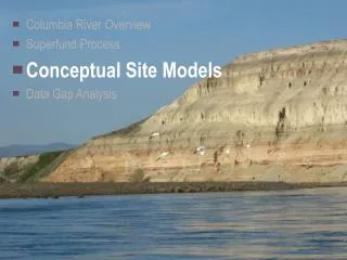
Columbia River Overview Superfund Process Conceptual Site Models Data Gap Analysis
180 likes | 312 Vues
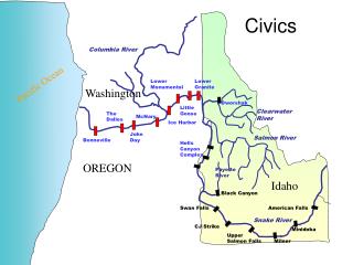
Columbia River Overview Superfund Process Conceptual Site Models Data Gap Analysis. Columbia River Surface Water Hydrology Plays a Critical Role in Sedimentation. Flow rates High flows within the Hanford section results in minimum sedimentation Major river confluences Yakima Snake

Columbia River Overview Superfund Process Conceptual Site Models Data Gap Analysis
E N D
Presentation Transcript
Columbia River Overview • Superfund Process • Conceptual Site Models • Data Gap Analysis
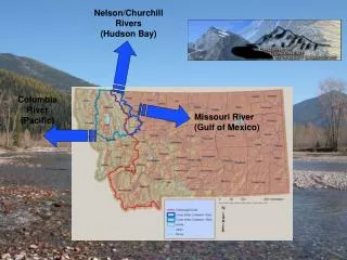
Columbia River Surface Water Hydrology Plays a Critical Role in Sedimentation • Flow rates • High flows within the Hanford section results in minimum sedimentation • Major river confluences • Yakima • Snake • Walla Walla
S S S S S S S S S S S The Majority of the Hanford Reach is a Non-Depositional Area
S S S S S S S S S S S The Majority of the Hanford Reach is a Non-Depositional Area
1188 2366 568 USGS Annual Statistics Estimated Suspended Sediment Load (tons/day) Average Flow (cfs) Suspended Load (Kg/m3) River Columbia (Priest Rapids Dam) 117,480 0.00375 Snake 54,830 0.016 Yakima 3,512 0.06
Columbia Snake Flow average 117,480 cfs (1188 tons/day) Yakima Walla Walla
Columbia Snake Yakima Flow average 54,830 cfs (2,366 tons/day) Walla Walla
Columbia Snake Yakima Walla Walla Flow average 13,512 cfs (568 tons/day)
Columbia Snake Yakima Walla Walla Flow average 568 cfs
90 ft Water McNary Dam currently has approximately 30ft of sediment • Average Annual Deposit Rate is 2 to 7 in/yr } 2000 Est. 30 ft Sediment 1990 1980 1970 1960 1950
Conceptual Exposure Model What is a CEM? • Sources • Migration pathways • Receptors • Exposures
Sources of Contaminants to the River • Upriver Sources • Hanford Reach Sources • Downriver Sources
Generic Hanford Conceptual Site Model Historic cooling water discharge Reactors/ Operational Areas GW seeps
Conceptual Site Model – Cross Section Receptors Source Cooling water Cross section illustrates: • Sources • Migration pathways • Receptors: people, benthic, fish, etc. • Potential Exposure Points Columbia River
Site Conceptual Model – Recreational Islands Source Receptors Cooling water Columbia River Columbia River
Conceptual Site Model – Richland Area Industrial discharge Water Intake Structure Industry House Irrigation discharge Agriculture Beach Columbia River Water supply Water supply
Green line Hanford Site 100/300 Study Area and Inter-Area CRC Study Area Study Area Cross-Section West East Columbia River