Download
1 / 8
90 likes | 150 Vues
Explore flood risk management in the London Borough of Lewisham, detailing reasons for risk, historical floods, awareness initiatives, and zoning information. Learn about risks, potential causes, and measures taken to mitigate the impact of flooding in the area.

E N D
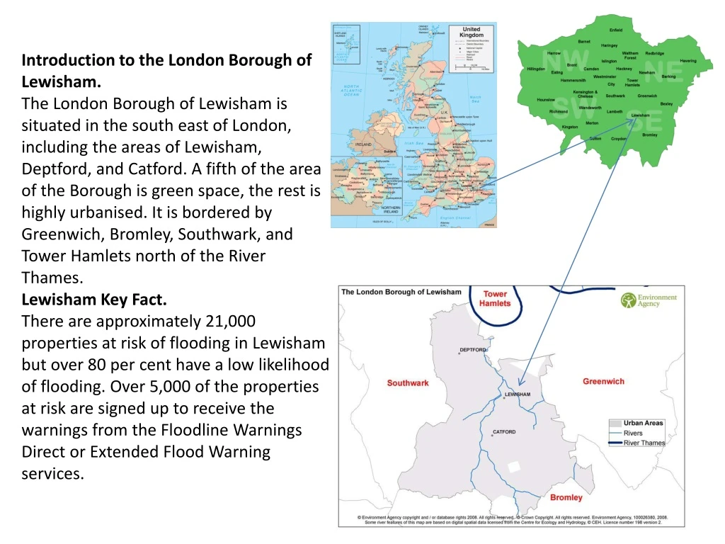
Introduction to the London Borough of Lewisham.The London Borough of Lewisham is situated in the south east of London, including the areas of Lewisham, Deptford, and Catford. A fifth of the area of the Borough is green space, the rest is highly urbanised. It is bordered by Greenwich, Bromley, Southwark, and Tower Hamlets north of the River Thames.Lewisham Key Fact.There are approximately 21,000 properties at risk of flooding in Lewisham but over 80 per cent have a low likelihood of flooding. Over 5,000 of the properties at risk are signed up to receive the warnings from the Floodline Warnings Direct or Extended Flood Warning services.
Flood risk and Flood zones. Reasons for risk. Low lying land. Many rivers and streams in a small area - a high drainage density. River Thames – is tidal. Global warming – wetter summers and winters. Impermeable surfaces – urbanisation – a population of approx. 250,000.
Increased speed of water flow e.g. sloping roofs, storm drains Steep-sided channel River confluences (increase amount of water arriving in a short time). Impermeable Drainage Basin – e.g. concrete in urban areas Coincidence with high tide Causes of Flooding Land drainage e.g. for agriculture, housing Extreme weather e.g. a month’s rainfall in 2 hours (Boscastle) High rainfall previously saturating ground Deforestation
Flood risk and Flood zones. • In Lewisham there are approximately 21,000 properties at risk of flooding from river and tidal sources. • This equates to 16 per cent of all properties in the Borough. • For the properties at risk of flooding, 8 per cent are classified as having a significant likelihood of flooding. • 83 per cent which are classified as having a low likelihood of flooding. The remainder have a moderate likelihood of flooding.
The London Borough of Lewisham has some land within flood zones 2 and 3. • Flood zone 2 represents the 1 in 1000 year probability of flooding. • Flood zone 3 represents the 1 in 100 year probability of flooding. • The area of land within flood zones 2 and 3 is predominantly around in the North of the Borough, where the risk is tidal flooding from the Thames. • Other areas include the land around the river Ravensbourne and river Pool, extending to the south of the Borough and the Quaggy, extending towards the east of the Borough.
Historical floods. Fluvial (river) and tidal flood events • Flooding has not occurred in Lewisham since 1968, when there was large scale flooding through Lewisham and Catford town centres. • There was also some flooding around Bell Green, Southend and Grove Park. This was flooding from the River Ravensbourne. • Previous flood events occurred in 1928 and 1965. In 1928, there was some overtopping of the tidal defences by the River Thames which caused some flooding in the north of the Borough. • The event in 1965 was similar to 1968 but on a much smaller scale.
Risk awareness. • Flood warning • In the Borough of Lewisham there were 5,083 properties registered to receive flood warnings as of June 2010. • Of these 4,539 properties were identified by the Environment Agency as being in areas of flood risk. If flooding is expected the residents of these properties will receive an automatic warning from the Extended Direct Warnings (EDW) service via their landline telephone. • The residents of the remaining 544 properties registered to receive flood warnings opted to receive them from Flood Warnings Direct (FWD). The Environment Agency offers this free flood warning service, which gives advance warning of flooding via phone, text, email, pager or fax. • Sign up for free flood warnings at http://www.environment-agency.gov.uk/homeandleisure/floods/38289.aspx