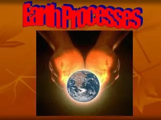
Anthropogenic Processes and Features :
Anthropogenic Processes and Features :. Agents, dynamics, and the results of human-facilitated processes [ vs. “natural” ( geologic ) processes ]. There be dragons . Objectives. The participant will be able to:

Anthropogenic Processes and Features :
E N D
Presentation Transcript
Anthropogenic Processes and Features : Agents, dynamics, and the results of human-facilitated processes [ vs. “natural” ( geologic ) processes ]. There be dragons ...
Objectives The participant will be able to: • Identify anthropogenic “processes”, Anthroscapes, Anthropogenic Landforms, Anthropogenic Microfeatures, and associated “Parent Materials”. • Diagram cross-sections, ( topography, stratigraphy, soil hydrology and pedology ) typical for anthropogenic sequences. • Successfully complete quizzes / exercises. • Actively apply gained knowledge on field trips.
Anthropogenic Processes and Features : Agents, dynamics, and the results of human-facilitated processes [ vs. “natural” ( geologic ) processes ]. - Relatively new ( NRCS & in general ) - Widespread, permanent changes, ICOMANTH - Anthropocene proposal
Anthropogenic Processes and Features : Agents, dynamics, and the results of human-facilitated processes. Erosion? Transport? Deposition?ExcavationMechanical Emplacement ( long-term storage ) ( movement, temporary storage ) ( removal )
Anthropogenic Features Removal headwall openpit mine gravel pit ( voids, modified features ) Transport tailings pond ditch ( dynamic deposits and landforms ) Deposition burial mound sanitary landfill mine spoil ( stable landforms and sediment bodies )
( NASA id ISSO13 – E-63766) Anthropogenic Features: tailings pond, openpit mine, headwalls Berkley Pit, etc. Butte MT
Anthropogenic Features & Processes[ discrete, artificial (human-made), earth-surface features ] • Sediments: coarse to fine grained, spoil material, construction debris; texture & morphology depends upon human activity ( bulk material extraction, energy generation, sediment retention, etc.). Materials don’t follow natural deposition processes, patterns (predictability). • Landscapes, Landforms, Microfeatures: proposed • Features: artificial levee, openpit mine, tillage features, spoil pile
+ r e l a t I ve sca l e Landscapes * (e.g. dune field ) Landforms * ( e.g. dune ) Anthropogenic Features * - presently not scale defined - ( e.g. road bed ) Microfeatures * ( e.g. slip face ) - Proposed new structure for “Anthropogenic Features” in NASIS Anthroscapes ( Eswaran, et al., 2005 ) ( e.g. urban land?? ) Anthropogenic Landforms ( e.g. quarry ) Anthropogenic Microfeatures ( e.g. road bed ) Schoeneberger & Scheyer (2005)
anthroscape a) A human-modified “landscape” of substantial and permanent alterations (removal, additions, or reorganization) of the physical shape and /or internal stratigraphy of the land, associated with management for habitation, commerce, food or fiber production, recreation, or other human activities that have substantively altered water flow and sediment transport across or within the regolith.b) A category in NASIS and the Geomorphic Description System for large, human-modified areas.
Anthroscape Types (proposed) • Urban anthroscapes • Suburban anthroscapes • Reclaimed land anthroscapes • Agricultural anthroscapes • Others ?
urban anthroscape An anthroscape dominated by management for commerce or habitation with extensive complexes of impervious surfaces, buildings, or roads, and comparatively minor areas of nominally or non-modified soilscapes in greenspace (yards, parks, riparian buffers).
suburban anthroscape An anthroscape due to management for habitation or commerce that includes extensive areas dominated by nominally or non-modified soilscapes in greenspace (yards, parks, riparian buffers), with substantial but secondary areas of impervious surfaces, buildings and roads.
reclaimed mineland anthroscape An anthroscape due to restoration efforts of a large surface mine (e.g., coal mine). This includes extensive areas dominated by profoundly displaced and radically re-shaped soilscapes resulting from restoration activities; may include minor areas of impervious surfaces, buildings and roads.
N Reclaimed mineland Anthroscape : openpit (strip) mine (coal),reclaimed land North Antelope Rochelle mine, Powder River Basin, WY North Antelope Rochelle Mine Complex coal seams 1 mile Black Thunder Mine Complex ( NASA #17057 )
agricultural anthroscapes An anthroscape due to agricultural management for food, fiber or forage production,that have substantively altered water flow and sediment transport across and within the regolith (e.g., leveled land). Commonly excludes areas of minor alterations (e.g. shallow plowing) that are easily obscured or obliterated by natural bio-, pedo-, or cryoturbation.
Likely that regional practices will lead to identifying practical subtypes of anthroscapes. • Ex: conservation terraces. • hillslope terrace anthroscape – An anthroscape dominated by complexes of massive, nearly vertical berms or walls and artificial terraces on hillsides), due to erosion control management for food or fiber production.
artificial collapsed depression -- artificial levee -- beveled cut -- borrow pit -- burial mound -- cut ( road, railroad ) -- cutbank -- ditch -- dump -- fill -- floodway -- gravel pit -- impact crater -- __ etc. openpit mine -- pond ( human-made ) -- quarry -- railroad bed -- reclaimed land -- rice paddy -- road bed -- road cut-- sand pit -- sanitary landfill -- scalped area -- sewage lagoon -- skid trail -- spoil bank -- etc. D)Anthropogenic Features[ discrete, artificial (human-made), earth-surface features ]
( reclaimed ) mine spoils ^A graded (bulldozed) capping material ^1C1 ^1C2 randomly mixed, (bulldozed), graded, “return” material ^2C2 / ^2C3 dried, shrunken, high-clay tailings slime (red), capped with (yellow) sandy fill water-lain sediments 3C spoil Lee Daniels, VA spoil / slough
urban modification of landscapes scalped area, residual soil SW MO
surface mines (2007) W VA NASA
openpit mine – A relatively large depression resulting from the excavation of material and redistribution of overburden associated with surficial mining operations. Compare – quarry, surface mine. SW & GG Schoeneberger Anthropogenic Features: openpit mine, spoil piles, road bed Peabody Coal Mine, Black Mesa, AZ
N dry tailings ponds Ajo, AZ spoil piles 1 mile ( NASA #9317 ) Anthropogenic Feature : openpit mine( 130 m deep ) ; spoil pile( tailings / containment ponds) New Cornelia Mine, Ajo, AZ
N Anthropogenic Feature : openpit (strip) mine ( coal ), reclaimed land North Antelope Rochelle mine, Powder River Basin, WY North Antelope Rochelle Mine Complex coal seams 1 mile Black Thunder Mine Complex ( NASA #17057 )
reclaimed land active strip spoil piles Schoeneberger Anthropogenic Features: road bed, spoil pile, reclaimed land, openpit minePeabody Coal Mine; Black Mesa, AZ
Anthropogenic Feature: dredge spoil bank(gold-mining dredge spoil piles) Lat AK 65.1°N, Lon 147.5°W (NAD83 WGS84)
Wysocki Anthropogenic Feature: limestonequarry(Silurian Limestone / Niagara “escarpment”) Schoolcraft CO., MI
Unreclaimed strip mining (coal) in Pennsylvanian-aged sedimentary rock. Overlain by Pre-Illinoisan till and Peoria loess Boone Co., central MO W US 63 Can you find the surface mine? What visual clues do you see?
Closer view, with 20’ contours added. Locate probable headwall, spoil piles Boone Co., MO W
Schoeneberger Stop 12: road cut pyritic sedimentary bedrock (acid drainage) Univ. Park, PA
Schoeneberger “yellow-boy” jarosite (yellow/brown flocculate sludge) in acid drainage roadside treatment pond
Consider: petroleum contaminants, aerial extent Schoeneberger Anthropogenic Feature: oilfield / natural gas drill pads western CO
“urbanland”, canals , spoil banks Map . Unit # Name . 6 Carteret soils, low 10 dredge spoil 18 Carteret soils, high w water Pender Co., Soil Survey Outer Banks, NC 1977
Schoeneberger Anthropogenic Feature: drained marsh FL
Schoeneberger LF: stormwaterdetention pond Law School construction site PSU (arboretum)
Large bioswale (constructed recharge / infiltration area) IL
J. Nemechek Landform: flooded rice paddies (constructed recharge / infiltration area) Afghanistan
URBAN SOILS Putting some Order onto Disorder Tim Craul NRCS, PA
rough crowd : SGI - PA, 2008 Dr. Richard Perizek Tim Craul John Chibirka
Soil Design Protocols for Landscape Architects & Contractors. By Timothy A. Craul & Phillip J. Craul
Definition of an Urban Soil “A soil material having a non-agricultural, man-made surface layer more than 50 cm thick, that has been produced by mixing, filling, or by contamination of land surfaces in urban and suburban areas.” Bockheim, 1974
Urban Soil Formation We determine the parent material We modify the topology We affect the micro-climate We decide the vegetation We reset the soil formation clock Tim Craul, NRCS, PA
Urban Soil Parent Material Based on site history. The order in which fill or excavation occurs The variability from truckload to truckload of fill. Vertical variability is based on how the material was spread (compacted, cascaded?). The extent of truncation of the natural soil. truncated soil ( upper horizons )scalped area ( most / all ) Tim Craul, NRCS, PA
THE MATERIAL VARIES FROM TRUCKLOAD TO TRUCKLOAD Tim Craul, NRCS, PA
THE USUAL SOIL MAPPING FOR URBAN AREAS aerial (plan view) cross-section Tim Craul, NRCS, PA
vs. WHAT DETAILED SOIL SAMPLING REVEALED Water found preferred pathways and flowed there. This can cause instability of the fill. Tim Craul, NRCS, PA