Download
1 / 11
110 likes | 344 Vues
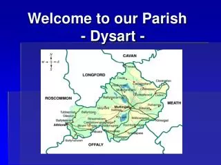
Welcome to our Parish - Dysart -. Dysart . Dysart is a small village about 6 miles south west of Mullingar. It is situated close to Lough Ennell. The area around Lough Ennell is known as Lilliput & was made famous by Jonathan Swift in his book ‘Gulliver’s Travels’.

E N D
Dysart Dysart is a small village about 6 miles south west of Mullingar. It is situated close to Lough Ennell. The area around Lough Ennell is known as Lilliput & was made famous by Jonathan Swift in his book ‘Gulliver’s Travels’ ‘Dysart’ is the English translation of the Irish word ‘Diseart’. It is taken from the name of the ancient parish ‘Diseart Maoltuile’, which may be translated as ‘The Quiet Peaceful Residence of Maoltuile’. Maoltuile was a local saint, a hermit, who lived in Dysart about 200 years after St. Patrick’s time. A holy well bearing Maoltuile’s name can be seen close to the Lilliput road in Dysart.
Our Parish Dysart was once part of the Parish of Churchtown & Dysart. The church in Churchtown was closed in 1825 & a new one was built in Loughanavalley. The parish is now known as Dysart and Loughanavalley. The original church in Dysart was located about 100m away from the present church and was thatched. It was used as a school during the week.
Our Church Our Church was built in 1854 by Fr. Maguire and was dedicated to St. Patrick. It was built in the corner of Dunican’s field. Records tell us that it was short on space as there were 2 huts at the entrance gate, 1 of which belonged to a Weaver
Schools in Dysart 1. The first school in Dysart was situated behind the Church. A site was obtained from Sir Francis Hopkins & a grant of £25 was obtained from the estate of Mr. James Hevey, Mullingar, who made provision in his Will, for education in the Parish of Dysart. The school was 6 feet from the back wall of the Church and it meant that sunlight could not enter through the windows on that side. The school had to be erected in this position because all the sites that Fr. Maguire applied for at that time were denied to him. This school was demolished in 1947 when a new school was built on the Castletown road.
Schools in Dysart 2 Reverand James Conway was appointed parish priest in Dysart Loughanavalley in 1937. He secured a site, a gift from D.E.Williams for a new school. The new school was completed in 1943 at a cost of £1 500. It was built of mass concrete, red brick, pebble dash & slate with tile & timber floors.
Schools in Dysart 3 Our new school was built in 2006. The old school was in very bad repair as well as being very cramped. Our new school cost €500 000 to build. The Department of Education & Science provided €350 000 to the B.O.M. who then built the school under a scheme known as the ‘Devolved Grant’. Our school is built on Parish land, in front of the Parochial House. It is about 50 m away from the ‘Old School’ & is named ‘Scoil Pádraig Naofa’
Areas of interest in Dysart There are many areas of historical interest in Dysart. In olden times it was inhabited by the Royal Kings of Ireland. Their most famous seat was at nearby Uisneach. They also has a fort on the shores of Lough Ennell called ‘Dún na Sciath’ & about 300m from the shore is a crannóg called ‘Cró Inis’.
Hill of Uisneach The Hill of Uisneach is five miles west of Lough Ennell. From Uisneach it is said that you can see 20 of the thirty two counties in Ireland (on a clear day!). It is known as the centre of Ireland and from here the island was divided into it's provinces. This is marked by a great rock over 20’ high near the rim of the plateau on top called ‘Aill na Meeran’. According to tradition the stone was marked with four lines depicting North, South, East & West. It was the ancient seat of the Royal Kings of Meath. This stone, also known as the Cat Stone, is said to resemble a cat watching a mouse. It is a huge limestone boulder almost six metres high which is estimated to weigh over 30 ton. Steeped in ancient Irish History and folklore, the Hill of Uisneach, is the sacred site of the ancient goddess, Eri, from which Ireland gets her name. Legend says that Eri is buried underneath the cat stone.
The importance of Uisneach in early times is reflected in the large number of monuments – almost twenty – mostly ring forts which are scattered around and upon it. Uisneach is one of the oldest sites of druid hill fires & the famous Feast of ‘Bealtaine’ began on Uisneach once the first fire was lit. The hill and surrounding land is regarded as the spiritual and physical centre of Ireland. Uisneach has also been famous as a meeting place in pre history, as a place of cattle rituals and other ‘May Day’ assemblies, and in more recent times as the meeting place for an important 12th century synod. St. Patrick and St. Brigid have important connections with the Hill, it being claimed that it was here St. Brigid received the veil from St. Patrck.