Download

1 / 25
250 likes | 350 Vues
This report presents a data-driven approach to enhance the selection and upgrading of roadway guardrails, focusing on risk assessment and safety evaluation methods. It highlights the necessity for clarifying public and agency values regarding guardrail placement, addressing high concerns in Virginia compared to national norms. The methodology includes a comprehensive review of existing practices, development of quantitative and qualitative assessment tools, and a tradeoff methodology to prioritize sites for guardrail installation, ensuring effective use of limited funding.

E N D
RISK-BASED MANAGEMENT OF GUARDRAILS: SITE SELECTION AND UPGRADING Presented to Project Steering Committee by The Center for Risk Management of Engineering Systems February 23, 2000
Agenda • Introduction • Data driven approach to risk assessment • Data representation for site screening • Multiple objectives in the selection among candidate projects • Discussion
Project Team Center for Risk Management of Engineering Systems James H. Lambert, Research Assistant Professor of Systems Engineering Yacov Y. Haimes, Quarles Professor of Systems Engineering and Civil Engineering and Center Director Jeffrey A. Baker, BS/MS Student Capstone Team Christian Baldwin Irene Jacoub Mike Raker VDOT Richmond District Travis Bridewell, District Traffic Engineer, Richmond District Jeff Wilkinson, Transportation Engineer, Traffic Engineering Section, Richmond District Baron Gissendaner
Project Team (cont.) Virginia Transportation Research Council Wayne S. Ferguson, Research Manager Steering Committee Steve Edwards, Transportation Engineer Senior, Traffic Engineering Division, Central Office Paul Kelley, Transportation Engineer, Location and Design Division, Central Office Charlie Kilpatrick, Fredericksburg Resident Engineer, Fredericksburg District Bob McCarty, Senior Field Operations Engineer, Federal Highway Administration - Richmond Ginger Quinn, District Safety Officer, Traffic Engineering Section, Salem District Nancy Berry, Transportation Engineering Program Supervisor, Location and Design Division, Central Office Additional Current and Former Resident Engineers Bill Bushman Angela Tucker Willie Gentry Alan Leatherwood
Problem Statement • Public and transportation-agency values concerning the location of roadway guardrails are in need of clarification • The concerns of Virginians for adequate guardrails are high relative to the national norms • Current practice in some VDOT Districts for selecting locations for new guardrails is based on citizen complaints, a general knowledge of roadway needs from local engineers, and accident history
Problem Statement (cont.) • Kentucky has developed a hazard-index point system (Kentucky Transportation Center Report KTC-89-39 "Warrants and Guidelines for Installation of Guardrail") • There are hundreds of candidate locations on the thirteen-county secondary system of Richmond District • Particular locations in New Kent and Charles City County have been the focus of a related preliminary study in Richmond District
Purpose and Scope The effort will adopt quantitative and qualitative factors/endpoints and develop associated cost-benefit-risk tradeoff methodology to support the preliminary screening and subsequent evaluation of guardrail site selection and upgrading with limited available funding
Purpose and Scope (cont.) • Four associated objectives: • Review and evaluation of what others have done • Adoption of assessment methods and quantitative and qualitative factors/endpoints • Development of a tradeoff methodology • Specification and prototype development of databases • Acknowledge that guardrails sometimes increase danger to vehicles
A Data Driven Approach to Risk Assessment and Safety Evaluation of Guardrail
Motivation A data driven approach to assessing risk and evaluating safety of candidate guardrail locations by determining data uses for screening and evaluation phases, identifying data needs, and evaluating data collection methods.
Screening • Select corridors to examine
Evaluation • Select locations along given corridor
Data Needs • Screening • Guardrail inventory • % unprotected hazards • % guardrail coverage • % substandard guardrail • Accident history • FO accidents per DVMT • Fatalities caused by FO accidents • ADT • Complaint record
Data Needs (cont.) • Evaluation • Cost (installation, upgrade) • Length of hazard • Severity of hazard • Shoulder width • Slope • Curvature
Accident Statistics • Disadvantages • Unreported accidents • Severity iceberg • First and most harmful event • Fatalities do not occur frequently enough to be statistically predictive • Random nature of road accidents (Adams, 1996), (Michie and Bronsted, 1994)
Accident Statistics (cont.) • Advantages • Available and assessable • Factual • Public interest (Adams, 1996), (Michie and Bronsted, 1994)
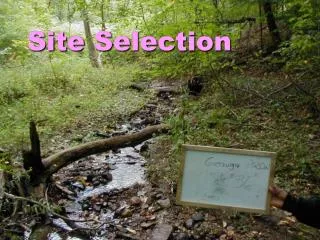
New Kent Case Study • Initial Data Collection • Routes 609-622 • Corridor Analysis • Corridors for which guardrail inventory is available • Routes 33, 106, 249, 273
Corridor Analysis • Compare routes for frequency and severity of accidents • Select routes that have greatest accidents/miles • Compare results with current guardrail inventory • Advantages • Reduce random chance associated with accidents • Use summary statistics available in HTRIS
Corridor Analysis (cont.) • Disadvantages • Overlooks role of hazardous locations • Many locations of mediocre severity vs. one location of very high severity
Objective Develop a graphical tool for a guardrail and hazard inventory system for resource allocation and decision making
Access to the New Kent Guardrail Data • Graphically represent what resident engineers know using an electronic map indicating the locations of: • Guardrails • Obstacles • Accidents • Complaints, etc.
Electronic Map • Layered spatial data, creating different views • Regional view • Zone view • Corridor view • Site view