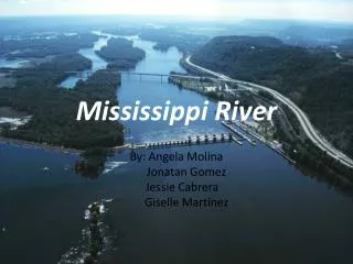
THE MISSISSIPPI RIVER
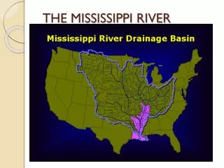
THE MISSISSIPPI RIVER . General facts:. Third largest drainage basin in the World The Mississippi drains 1/3 of USA and a small part of Canada . Second longest river in the United States: 2,340 miles (3,770 km)

THE MISSISSIPPI RIVER
E N D
Presentation Transcript
General facts: • Third largest drainage basin in the World • The Mississippi drains 1/3 of USA and a small part of Canada. • Second longest river in the United States: 2,340 miles (3,770 km) • The longest river, a Mississippi tributary, is the Missouri: 2,540 miles (4,090 km).
Location Source of the M River ND MN MT SD WI WY IA NE PA CO OH IL IN KS WV MO KY OK TN AR NM MS LA TX Mouth of M Gulfe of Mexico
Courses Mississippi upper course Mississippi lower course
Discharge: • Annual average rate: 7,000 -20,000 m³/s. • Mississippi has only 9% the flow of the Amazon River but is nearly twice that of the Columbia River and almost 6 times the volume of the Colorado River.
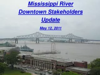
Importance and use of M • Nation's most productive agricultural and industrial regions. • Nation's chief navigable water route. • Animals and plants including freshwater fishes, birds, deer, raccoons, otters, mink, and a variety of forest trees.
The BIG 6 • 1997 National Wildlife Refuge System Improvement Act • Hunting, fishing, wildlife observation and photography, and environmental education and interpretation as "priority public uses”
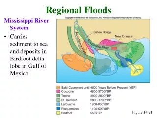
Threats to the Mississippi River • Sediments The Louisiana coast is rapidly sinking into the Gulf, as the re-nourishing sediments no longer pass through the coastal marshes and wetlands. Some 16,000 acres of wetlands are lost there every year, totaling 80% of all wetland losses nationally. • PollutionAll municipal, industrial and agricultural runoff from the entire river basin is eventually deposited into the Gulf near the Louisiana Coast.: a massive dead zone off the Louisiana coast. 5,000 square miles each year since 1985 • Habitat Alteration Landowners dependent on the Army Corps of Engineers for flood control, and destroying floodplain-associated habitats such as bottomland forests critical to many species of nesting and migrating birds.
Mississippi flood problems • Frequency of flooding: almost annual • Magnitude of flooding: major floods every 5 to 10 years; extreme flood: 40 years • Causes of flooding:heavy rainfall in Appalachian Moutains • Consequences of flooding: wide alluvial floodplain, death, habitat evacuation, livestock and crops lost, services destroyed. • Case study: the great flood of 1993 (video) http://www.youtube.com/watch?v=ZIXioecWiJs
Mississippi flood control • Main policy: “hold by levees”. • New schemes: dams and storage reservoirs, afforestation • By cutting through meanders • Large spillways • The flow of the major tributaries had been controlled by a series of dams.
Effectiveness of flood control • Levees alone are not sufficient: Great flood of 1993. • An effective method: to construct coordinated groups of dams and reservoirs • E.g: The Hoover Dam on the Colorado River, the reservoirs in the Miami Conservancy District, and dams of the Tennessee Valley Authority.
Presentation by • Banteaymolu Alebachew • Danamona Andrianarimanana.