Chapter 48: The Biosphere
760 likes | 782 Vues
Chapter 48: The Biosphere. Factors that Affect Distribution. Geologic history Topography Climate Species interactions. Biosphere. Sum total of the places in which organisms live Includes portions of the hydrosphere, lithosphere, and atmosphere. Climate.

Chapter 48: The Biosphere
E N D
Presentation Transcript
Factors that Affect Distribution • Geologic history • Topography • Climate • Species interactions
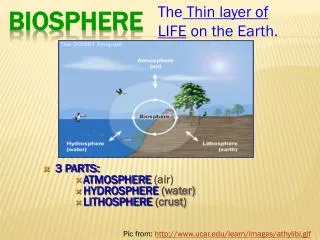
Biosphere • Sum total of the places in which organisms live • Includes portions of the hydrosphere, lithosphere, and atmosphere
Climate • Average weather condition in a region • Affected by: • amount of incoming solar radiation • prevailing winds • elevation
The Atmosphere • Three layers • Outer mesosphere • Middle stratosphere (includes ozone layer) • Inner troposphere (where air is warmed by the greenhouse effect)
Ozone Layer • Region 17 to 27 kilometers above sea level in the stratosphere • Molecules of ozone absorb most layers of ultraviolet light • Protects living organisms from excess exposure to UV light
Warming the Atmosphere • Solar energy warms the atmosphere and sets global air circulation patterns in motion Figure 48.3 Page 868
Rotation and Wind Direction • Earth rotates faster under the air at the equator than it does at the poles • Deflection east and west Figure 48.2 Page 868
Seasonal Variation • Northern end of Earth’s axis tilts toward sun in June and away in December • Difference in tilt causes differences in sunlight intensity and day length • The greater the distance from the equator, the more pronounced the seasonal changes
cold cool temperature warm temperature tropical (equator) tropical warm temperature cool temperature cold March 231/2º June December September Fig. 48-4, p.869
Pollutants • Substances with which an ecosystem has had no prior evolutionary experience • No adaptive mechanisms are in place to deal with them
Air Pollutants • Carbon oxides • Sulfur oxides • Nitrogen oxides • Volatile organic compounds • Photochemical oxidants • Suspended particles
Industrial Smog • Gray-air smog • Forms over cities that burn large amounts of coal and heavy fuel oils; mainly in developing countries • Main components are sulfur oxides and suspended particles
Photochemical smog • Brown-air smog • Forms when sunlight interacts with components from automobile exhaust • Nitrogen oxides are the main culprits • Hot days contribute to formation
Thermal Inversion • Weather pattern in which a layer of cool, dense air is trapped beneath a layer of warm air cool air warm inversion air cool air Figure 48-7 Page 870
Acid Deposition • Affects much of eastern North America • Caused by the release of sulfur and nitrogen oxides • Coal-burning power plants and motor vehicles are major sources
South America Antarctica Ozone Thinning • In early spring and summer ozone layer over Antarctica thins • Seasonal loss of ozone is at highest level ever recorded Figure 48-6 Page 870
Effect of Ozone Thinning • Increased amount of UV radiation reaches Earth’s surface • UV damages DNA and negatively affects human health • UV also affects plants, lowers primary productivity
Protecting the Ozone Layer • CFC production has been halted in developed countries, will be phased out in developing countries • Methyl bromide will be phased out • Even with bans it will take more than 50 years for ozone levels to recover
Ocean Currents • Upper waters move in currents that distribute nutrients and affect regional climates Figure 48-10 Page 872
Rain Shadow • Air rises on the windward side, loses moisture before passing over the mountain Figure 48.11 Page 873
Monsoons • A pattern of wind circulation that changes seasonally • Affect continents north and south of warm-water oceans • Can cause seasonal variation in rains
Coastal Breezes • Breeze blows in direction of warmer region • Direction varies with time of day Night Afternoon
Biogeographic Realms • Six areas in which plants and animals are somewhat similar • Maintain their identity because of climate and physical barriers that tend to maintain isolation between species
Biomes • Regions of land characterized by habitat conditions and community structure • Distinctive biomes prevail at certain latitudes and elevations
Soil Characteristics • Amount of humus • pH • Degree of aeration • Ability to hold or drain water • Mineral content
Soil Profiles • Layer structure of soil • Soil characteristics determine what plants will grow and how well Rainforest Desert Grassland Figure 48.13 Page 876
Deserts • Less than 10 centimeters annual rainfall, high level of evaporation • Tend to occur at 30 degrees north and south and in rain shadows • One-third of land surface is arid or semiarid
Dry Shrublands and Woodlands • Semiarid regions with cooler, wet winters and hot, dry summers • Tend to occur in western or southern coastal regions between latitudes of 30 and 40 degrees
Forest Biomes Tall trees form a continuous canopy • Evergreen broadleaves in tropical latitudes • Deciduous broadleaves in most temperate latitudes • Evergreen conifers at high temperate elevations and at high latitudes
Deforestation • Removal of all trees from large tracts of land • 38 million acres logged each year • Wood is used for fuel, lumber • Land is cleared for grazing or crops
Effects of Deforestation • Increased leaching and soil erosion • Increased flooding and sedimentation of downstream rivers • Regional precipitation declines • Possible amplification of the greenhouse effect
Regions of Deforestation • Rates of forest loss are greatest in Brazil, Indonesia, Mexico, and Columbia • Highly mechanized logging is proceeding in temperate forests of the United States and Canada