Enhanced Thunderstorm Outlook and Severe Weather Status Report for Minnesota
This report presents the enhanced thunderstorm and severe weather outlook from the Storm Prediction Center (SPC) for May 18-19. The document includes a detailed overview of watch probabilities, graphical convective and fire weather outlooks for Days 3-8, and a status report by Minnesota counties currently under severe weather threat. Areas affected include notable counties such as Aitkin, Benton, Carlton, and more. For further information, please contact Joseph Schaefer at NOAA.

Enhanced Thunderstorm Outlook and Severe Weather Status Report for Minnesota
E N D
Presentation Transcript
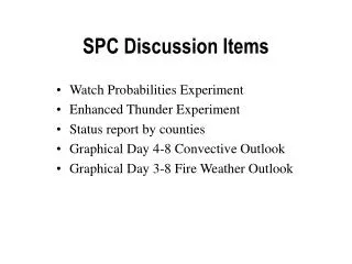
SPC Discussion Items • Watch Probabilities Experiment • Enhanced Thunder Experiment • Status report by counties • Graphical Day 4-8 Convective Outlook • Graphical Day 3-8 Fire Weather Outlook
SPC General thunder Forecast 1300UTC 18 May – 1200Z 19 May
Enhanced General Thunder 1300UTC 18 May – 0000Z 19 May
Enhanced General Thunder 0000UTC 19 May – 1200Z 19 May
Status report by counties WOUS20 KWNS 080736 WWASPC SPC WW-A 080740 MNZ000-SDZ000-WIZ000-LSZ000-080840- STATUS REPORT ON WW 407 SEVERE WEATHER THREAT CONTINUES RIGHT OF A LINE FROM 40 ENE BKX TO 30 NE AXN TO 10 NNW ELO. FOR ADDITIONAL INFORMATION SEE MESOSCALE DISCUSSION 1138 ISSUED AT 0709 UTC. ..JPR..06/08/04 ATTN...WFO...DLH...MPX...ABR... && SEVERE WEATHER THREAT CONTINUES FOR THE FOLLOWING AREAS: ---MORE TEXT---
---PREVIOUS TEXT--- && SEVERE WEATHER THREAT CONTINUES FOR THE FOLLOWING AREAS: MNC001-009-017-023-025-031-035-059-065-067-075-085-093-095-097- 115-129-137-141-145-171-080840- MN . MINNESOTA COUNTIES INCLUDED ARE AITKIN BENTON CARLTON CHIPPEWA CHISAGO COOK CROW WING ISANTI KANABEC KANDIYOHI LAKE MCLEOD MEEKER MILLE LACS MORRISON PINE RENVILLE ST. LOUIS SHERBURNE STEARNS WRIGHT $$ ---NEXT STATE---
Requested Enhancement – Indicate Watch Type ---PREVIOUS TEXT--- && STATUS REPORT ON WS 407 SEVERE WEATHER THREAT CONTINUES FOR THE FOLLOWING AREAS: MNC001-009-017-023-025-031-035-059-065-067-075-085-093-095-097- 115-129-137-141-145-171-080840- MN . MINNESOTA COUNTIES INCLUDED ARE AITKIN BENTON CARLTON CHIPPEWA CHISAGO COOK CROW WING ISANTI KANABEC KANDIYOHI LAKE MCLEOD MEEKER MILLE LACS MORRISON PINE RENVILLE ST. LOUIS SHERBURNE STEARNS WRIGHT $$ ---NEXT STATE---
Extended Convective Outlooks – Days 4 through 8 & Extended Fire Weather Outlooks – Days 3 through 8
Please send any additional thoughts to: joseph.schaefer@noaa.gov