Download
1 / 22
220 likes | 373 Vues
This guide, crafted for the Notre Dame Pilot Initiative, offers a comprehensive overview of aviation weather essentials. It covers key components such as METAR, TAF, and PIREP reports, crucial for safe flying. The document includes examples of weather reports, forecasts, and warnings, such as AIRMETs and SIGMETs, enabling pilots to better understand and interpret weather information. Whether you’re a student pilot or an aviation professional, this resource will enhance your flying skills by teaching you how to effectively manage and respond to varying weather conditions.

E N D
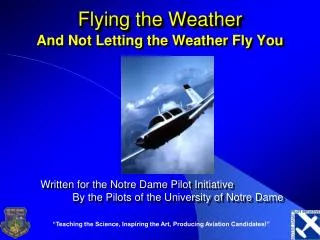
Flying the Weather And Not Letting the Weather Fly You Written for the Notre Dame Pilot Initiative By the Pilots of the University of Notre Dame “Teaching the Science, Inspiring the Art, Producing Aviation Candidates!”
Roadmap • Weather Reports • Weather Problems • Weather Briefing Sources
Aviation Routine Weather Report (METAR) KSBN 171551Z 08015G20KT 10SM FEW030 SCT060 OVC085 13/07 A3028 RMK AO2 RAB22E38 Airport Day/Time Temp/ Dewpnt Wind Visibility Clouds Altimeter Remarks • Components of METARs • South Bend • 17th day of the month, taken at 1551 Zulu Time (GMT) • Wind from 080° at 15 gusting to 20 Knots • 10 Statute Miles Visibility • Few clouds at 3000 feet, scattered 6000, overcast 8500 • Temp 13° C / Dewpoint 7°C • 30.28 inches of Hg • 2nd level ASOS / Rain began 22 minutes after the hour and ended 38 minutes past the hour
METAR Examples METAR KSBN 130554Z 30010KT 10SM OVC045 M04/M11 A3002 RMK AO2 SLP178 METAR KSBN 130454Z 30010KT 10SM FEW037 OVC050 M04/M09 A3002 RMK AO2 SNE0355B25E28 METAR KSBN 130354Z 31012KT 9SM -SN BKN029 OVC038 M03/M08 A3003 RMK AO2 SNE16B34 SPECI KSBN 130417Z 31011KT 10SM BKN031 BKN040 OVC055 M04/M08 A3002 RMK AO2 SNE0355 METAR KIAD 081055Z AUTO/COR 21019G27KT 1/2SM R04R/3000FT -SN FG SCT011 OVC015 01/M02 A2945 RMK PK WND 19029/16 SLP045 T00081016
Terminal Aerodrome Forecast (TAF) TAF KSBN 171145Z 171212 VRB03KT 2 SM SCT030 BKN080 TEMPO 1517 SHRA Day/Time Airport Valid Wind Visibility Ceilings Temporarily FM2200 13009KT 1SM OVC030 BECMG0210 NSW BKN030 • Components of TAF • South Bend • 17th day of the month, predicted at 1145 Zulu Time (GMT) • Valid from 1200-1200 on the 17th • Wind variable at 3 knots • 2 Statute Miles Visibility • Scattered 3000, Broken 8000 • Temporarily between 1500-1700 Rain Showers • From 2200 Wind 130 at 9 Kts, 1 SM visibility, overcast 3000 • Between 0200-1000, No Significant Weather, Ceiling Broken 3000 Wx / Ceiling From Wind / Visibility / Ceiling Becoming
TAF Examples TAF KSBN 130537Z 130606 30009KT P6SM OVC040 FM0900 27009KT P6SM BKN040 FM1400 22014KT P6SM SCT040 BKN100 TAF KORD 130520Z 130606 30009KT P6SM BKN035 FM0800 28009KT P6SM SCT035 SCT250 FM1200 25008KT P6SM SCT150 BKN200 FM1600 23012G22KT P6SM BKN150 FM0200 28011KT P6SM SCT015 TAF KAZO 130520Z 130606 27008KT P6SM -SHSN OVC050 TEMPO 0610 4SM -SHSN SCT015 BKN025 FM1400 24013G22KT 5SM -SHSN BKN035 OVC100 FM0000 24008KT P6SM -SHSN BKN035
Pilot Report (PIREP) /OV GIJ /TM 2200 /FL090 TP/PA28 /SK 008 BKN 016 /TA -3 /WV2725 /TB LGT /IC NEG Flight Level Type A/C Temp Aloft Wind Aloft Over Time Sky Cover Turbulence Icing • Components of PIREPs • Gipper • Reported at 2200 Zulu Time (GMT) • Flight Level 090 (9000 Feet) • Piper Cherokee • Broken Layer between 800 and 1600 feet • Temp -3° C • Wind from 270° at 25 • Light Turbulence / Negative Icing
PIREP Examples UA /OV FLW090022/TM 0534/FL095/TP C172/SK SKC/WX FV99SM/TB NEG UA /OV MZB/TM 0547/FL295/TP MD80/TA M43/WV 27211KT/TB NEG UA /OV HYP090028/TM 0639/FL220/TP MD80/TB MDT UA /OV FRA320015/TM 0604/FL200/TP A320/TB MDT/RM NORCAL
Winds Aloft Forecast ******** FD Winds Aloft Forecast ******** DATA BASED ON 130000Z VALID 130600Z FOR USE 0500-0900Z. TEMPS NEG ABV 24000 FT 3000 6000 9000 12000 18000 24000 30000 34000 39000 FWA 3315 3113-16 3119-19 3221-23 3226-31 3232-42 344752 345252 334851 JOT 3114 3114-14 3323-16 3428-21 3548-30 3673-39 861450 369655 346952 MKG 3015 3013-16 3220-18 3223-22 3338-33 3455-42 860151 358655 346353 • First 2 Digits: TRUE Wind Direction • Second 2 Digits: Wind Speed • Third 2 Digits: Temperature
AIRMET (WA) • Warn of hazards primarily to small aircraft • Classifications • Tango – Turbulence • Sierra – IFR Weather & Mountain Obscuration • Zulu - Icing
AIRMET Example ******** AIRMETs ******** CHIS WA 130334 AMD AIRMET SIERRA UPDT 1 FOR IFR AND MTN OBSCN VALID UNTIL 130900 . AIRMET IFR...MN IA...UPDT FROM 30WNW MSP TO 50W ODI TO 50SE MCW TO 20SSW MCW TO 40NE RWF TO 30WNW MSP OCNL CIG BLW 010 AND/OR VIS BLW 3SM PCPN/BR. CONDS ENDG 05-07Z. . AIRMET IFR...LM MI IN FROM 50NNE MKG TO 30NE GRR TO 20ENE GIJ TO 30WSW GIJ TO 30NW MKG TO 50NNE MKG OCNL CIG BLW 010 AND/OR VIS BLW 3SM PCPN/BR. CONDS ENDG 07-09Z.
SIGMET (WS) and Convective SIGMET (WST) • SIGMET • Warn of conditions that could be dangerous to all aircraft • Severe Icing • Severe Turbulence • Convective SIGMET • Observations and/or forecasts that warn of conditions associated with thunderstorms • Tornados • Large Hail • Embedded Thunderstorms
Additional Weather Services • Area Forecasts (FA) • Summary of weather over a large area • Issued 3 times a day • 12 hour forecast, + 6 hour categorical outlook • 4 Sections: • Product Header, Precautionary Statements, Synposis, VFR Clouds/Weather • Transcribed Weather Broadcast (TWEB) • Route forecast covering 25 miles either side of a particular route • Hazardous In-Flight Weather Advisory Services (HIWAS) • Continuous broadcast of in-flight weather advisories • Automatic Terminal Information Service (ATIS) • Continuous broadcast of recorded information at certain airports containing weather information, runway(s) in use, and other pertinent remarks
Weather Charts • Weather Depiction Chart • Information from METARs • Broad overview of flying conditions • Surface Analysis Chart • Location of pressure systems and fronts • Isobars • Radar Summary Chart • Shows areas and direction of heavy precipitation • Low-Level Significant Weather Prognostic Chart • 4 Panels • Forecasts of surface and weather up to 24,000 MSL
Weather Charts • Convective Outlook (AC) • Forecasts possibility for general, as well as severe, thunderstorm activity during the following 24 hours • Radar Weather Reports (SD) • Textual position and intensity of thunderstorm cells
Aviation sources FSS 800-WX-BRIEF DUAT(S) www.duat(s).com AOPA www.aopa.org ADDS Aviation Digital Data Service adds.aviationweather.gov Non Aviation-sources Weather channel www.weather.com Accuweather www.accuweather.com Intellicast www.intellicast.com Unisys www.weather.unisys.com Sources of Aviation Weather
Briefings • Standard Briefing • Full Briefing • See Table 18-1 on p. 395 • Outlook Briefing • More than 6 hours away • Abbreviated Briefing • Intended to supplement or update previous information
VFR Problems Low Ceilings Forecast trends Few (<10%) Scattered (10-15%) Broken (60-90%) Overcast (>90%) Low Visibility Temp/Dewpoint spread High Winds Pressure gradient Spacing of isobars IFR Problems Structural ice Above freezing level Rime ice Clear ice T-storms Embedded Need radar or stormscope Fog Aviation Weather Problems
Problems for both IFR/VFR • Thunderstorms • Avoid by 20 nm • Turbulence • Caused by: • Unstable air • Warming from the ground • Friction with the ground • Ridge effects • Mountain waves • Frontal effects • Carburetor ice
What can the prudent pilot do? • While still on the ground • Get actualweather (overall & hourly) • Check trends (wind direction, ceiling, visibility.) • Is actual similar to forecast? • In the air • Always have an “out” • 180 degree turn • Climb/descend • Know terrain • Maintain basic instrument skills • Explain your problem to ATC & ask for help • Call Flight Watch for WX updates Call Flight Watch on 122.0 between 0600L and 2200L when above 5000 MSL!