Download
1 / 17
170 likes | 382 Vues
An Overview of the GOES-R Program. Greg Mandt GOES-R System Program Director 2011 Satellite Direct Readout Conference April 5, 2011. Continuity of GOES Operational Satellite Program. GOES-R Mission Overview.

E N D
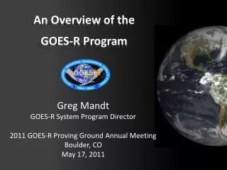
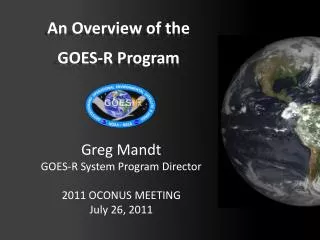
An Overview of theGOES-R Program Greg Mandt GOES-R System Program Director 2011 Satellite Direct Readout Conference April 5, 2011
GOES-R Mission Overview GOES-R is the next generation of GOES satellites that will provide a major improvement in quality, quantity, and timeliness of data collected. Earth Pointing In-Situ Sun Pointing Spare Visual & IR Imagery Lightning Mapping Space Weather Monitoring Solar Imaging • Advanced Baseline Imager (ABI) • Geostationary Lightning Mapper (GLM) • Space Environment in-Situ Sensor Suite (SEISS) • Magnetometer • Solar Ultra-Violet Imager (SUVI) • Extreme UV/X-Ray Irradiance Sensors (EXIS) • New and improved capabilities for: • decreased lead times for severe weather warnings • better storm tracking capabilities • solar, space weather, and climate analyses • advanced products for aviation, transportation, commerce
System Design Review complete Launch Readiness Oct. 2015 Spacecraft Spacecraft SDR complete Instruments 5 Instrument contracts underway EXIS, SUVI, SEISS, and GLM have all passed CDR Core contract awarded to Harris Corp. Core SRR complete 80% delivery of baseline product algorithms RBU lease awarded Development Integration and Testing
GOES-R Spacecraft Specifications • Size: ~5.5 meters (from launch vehicle interface to top of ABI) • Mass: Satellite (spacecraft and payloads) dry mass <2800kg • Power Capacity: >4000W at end-of-life (includes accounting for limited array degradation) • Spacecraft on-orbit life of 15 years with orbit East-West and North-South position maintained to within +/-0.1 degree • 3-axis stabilized Extreme UV/X-ray Irradiance Sensor (EXIS) Solar UV Imager (SUVI) Magnetometer Space EnvironmentIn-situ Suite (SEISS) Geostationary Lightning Mapper (GLM) Advanced Baseline Imager (ABI) Lockheed Martin Space Systems Co (LMSSC) of Newtown, PA is primary contractor
Advanced Baseline Imager (ABI) Specifications • 16 channel imager • Improves upon current capabilities in spectral information (3X), spatial coverage (4X), and temporal resolution (5X) • Improves every product from current GOES Imager and will offer new products for severe weather forecasting, fire and smoke monitoring, volcanic ash advisories, and more ABI Proto-Type Model (PTM) ITT Corporation of Ft. Wayne, IN is primary contractor The Advanced Baseline Imager (ABI) on the GOES-R Series: Tim Schmit – Tue, April 5, 1:45 pm
Geostationary Lightning Mapper (GLM) Metering tube Sensor Unit Mechanical Support Structure Optical Assembly Specifications • Detects total lightning: in-cloud, cloud-to-cloud, and cloud-to-ground • 70-90% flash detection day and night • Near uniform spatial resolution • Aids in forecasting severe storms and tornado activity, and convective weather impacts on aviation safety and efficiency • Currently no ocean coverage, and limited land coverage in dead zones Lockheed Martin Advanced Technology Corp of Palo Alto, CA is primary contractor High Impact Weather Forecasts & Warnings with the Geostationary Lightning Mapper: Steve Goodman – Tue, April 5, 2:00 pm
Space Weather Instruments Space Environment Impacts Earth! • Instruments provide early warning • Communications satellites / power grids • Voice and data blackouts over poles • Communications blackouts • Aviation routing • Astronaut safety • Solar storms can expose astronauts to equivalent of 8 chest X-rays EXIS Mass Model EHIS DPU MPS-Lo MPS-Hi SGPS SEISS Brassboard Units SUVI Structural Assembly
GOES-R SystemOperational View 137o 75o BEACONS HRIT/EMWIN, GRB • MM • EM • PG (L0, L1B, L2+ GLM, GRB, KPP) • PD GEOLUT Fairmont, WV Suitland, MD SARSAT Wallops, VA WAN WCDAS Data Collection Platforms (DCP) DCPC LAN DCS DCPR RBU NSOF L1b, L0, L2+ GLM,GRB • MM • EM • PG • PD LAN DRGS LAN DCS L2+ Data and Products Mission Management ProductGeneration GOES-R Access Subsystem (part of PDA) Data and Products User Community Enterprise Management MM: Mission Management EM: Enterprise Management PG: Product Generation PD: Product Distribution PDA: Product Dist. & Access System Product Distribution
GOES Rebroadcast and Unique Payload Services • GRB – GOES Rebroadcast (GRB) • GRB will contain the Level 1b data from each of the GOES-R Series instruments and is the GOES-R Series version of today’s GOES Variable format (GVAR). • Information Network (HRIT/EMWIN) • New high data rate (400 Kbps) • Combination of today’s LRIT (Low Rate Information Transmission) and EMWIN services; • Delivers selected imagery, charts, other environmental data products, and text messages (NWS Watches and Warnings) to hemispheric users. • Data Collection System (DCS) • GOES-R spacecraft relay data transmissions for nearly 30,000 in-situ environmental data platforms from across the hemisphere. • GOES-R will support 300 bps, 1200 bps, and CDMA platforms. • SARSAT • All GOES-R satellites support the Search and Rescue Satellite Aided Tracking (SARSAT) service by relaying distress signals from in-situ Emergency Position Indicating Radio Beacons (EPIRBs) and other transmitting devices.
Direct Readout Comparisons NOAA Report on the Development of the GOES-R Access Subsystem (GAS) and Future Products: Reginald Lawrence, Tues, Apr 5, 2:45 pm HRIT/EMWIN Prototype Demonstration : Craig Keeler, Tues, Apr 5, 5:30pm
GOES Rebroadcast (GRB) Data Transition • Full set of level 1b products, including data from all ABI channels and the other GOES-R instruments (GLM, MAG, SEISS, SUVI, EXIS). • GOES users must acquire new hardware, or upgrade their existing GVAR systems in order to receive GOES-R data. • Existing GVAR systems will need new receiver antenna hardware, as well as new signal demodulation hardware and computer hardware so that they are able to handle the large amount of GOES-R data. • CLASS will provide permanent archive for GOES-R data as part of its mission to be the single data repository for NOAA. GOES-R Rebroadcast Services: Satya Kalluri– Tue, April 5, 2:30 pm
GOES-R Changes Since 2008 DRO • No eGVAR (Emulated GOES Variable Data) • Program will work with users to transition directly to GRB • GOES-R L band frequency shift • Presidential Broadband Initiative Breakout Session: Transition from GOES to GOES-R: GVAR, GRB, GAS: Thu, April 7, 3:30 pm
Training and Education • Online training modules • http://meted.ucar.edu/goes_r/envmon/ • http://cimss.ssec.wisc.edu/satmet/ • http://rammb.cira.colostate.edu/visit/video/goesr101/player.html • http://rammb.cira.colostate.edu/training/shymet/forecaster_intro.asp
GOES-R Proving Ground GOES-R Proving Ground Talks: Tues, April 5, 3:30 – 5:15 pm
7th GOES Users’ Conference Joint with 36th Annual NWA Meeting in Birmingham, AL Oct. 15-21, 2011 at the Wynfrey Hotel Visit: http://www.goes-r.gov or http://www.nwas.org/meetings for more info! Deadline for poster abstracts: June 1
Thank you! Any ???