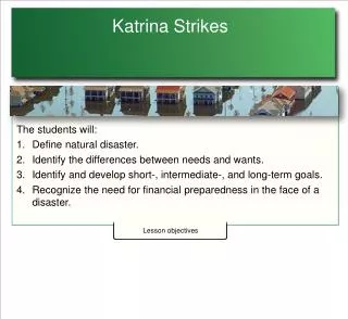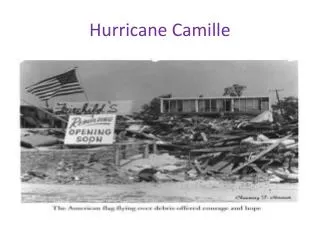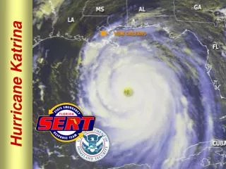
Katrina vs. Camille
Katrina vs. Camille. While close reading the two articles create a chart of similarities and differences among the two hurricanes After creating the chart, write a two paragraph essay comparing and contrasting the two hurricanes. MS ’ s Landform Regions. Yazoo Basin.

Katrina vs. Camille
E N D
Presentation Transcript
Katrina vs. Camille • While close reading the two articles create a chart of similarities and differences among the two hurricanes • After creating the chart, write a two paragraph essay comparing and contrasting the two hurricanes.
Yazoo Basin • More commonly known as the Delta, it is a flat, alluvial plain that runs along the MS. River. • Alluvial soil is deposited by floods. • This is the richest agricultural area of MS. • The Delta is protected by a system of levees that were built by the Army Corp of Engineers. • A levee is a soil bank built along a river to prevent flooding.
Loess and Brown Loam Hills • The Loess and Brown Loam Hills were formed by prehistoric dust storms. • Loess Soil is deposited by the wind. • Loam is soil composed of clay, sand and some organic matter. • Erosion is a huge problem for this area. • Kudzu was brought in to control the erosion and became an even bigger problem.
Tombigbee Hills • The Tombigbee Hills are also known as the Tenn-Tom Hills. • This region is the most rugged area of the state. • Woodall Mountain is located in this region. • At 806 ftabove sea level, Woodall Mountain is the highest point in the state.
Black Prairie • This region takes its name from the dark, fertile soil of the area. • This is the largest prairie region of MS. • A prairie is an area of rolling grasslands.
Pontotoc Ridge • The Pontotoc Ridge is a narrow strip of land composed of fertile, sandy loam that is excellent for orchards.
Flatwoods • The Flatwoods is a narrow strip of land with very poor soil. • It is an mainly an area of forests, pastures, hay fields and some small farms.
North Central Hills • This area is also known as the Red Clay Hills because of its soil. • This region relies on the lumber industry and livestock raising.
Jackson Prairie • The Jackson Prairie is similar to the Tombigbee Prairie but has more woodland areas. • Jackson, the capital of MS, is located within this area. • The economy of this region is based largely on trade, commerce and small industry.
Pine Hills • This region is also known as the Piney Woods or the Pine Belt and takes its name from the pine forests that cover most of the region. • The lumber industry is the main economic activity of the region.
Coastal Meadows • This region of MS was the first to be settled by Europeans because it was accessible by sea. • Fishing and tourism has long been the main economic activities of the coastal meadows. • The MS Gulf Coast has the world’s largest man-made beach.
Landform regions of the State • MS lies within the Gulf Coastal Plain region of the United States • Within the state, there are ten distinct landform regions
II. Soil • Cotton has always been one of the most important crops grown in MS. • Soil is composed of air, water, minerals, plant particles, and very small animals • MS has four general soil regions 1) Hills 2) Alluvial Plain 3) Loess Hills 4) Black Prairie • Most of the cotton grown in MS is grown in the more fertile soil areas in the Delta and Black Prairie.
III. Energy and Mineral Resources • MS’s energy and mineral resources include petroleum, natural gas, gravel, sand, iron ore, clay, coal, lignite, and limestone IV. Biota • Flora refers to the natural vegetation of the land • 55 percent of MS is forested • Some of the most prevalent forest vegetation in MS are the Oak, Hickory, and Pine trees • Fauna refers to the animal life on a particular area