Download
1 / 50
500 likes | 516 Vues
Explore the interplay of solid Earth, rivers, beaches, and oceans. Understand the processes shaping landscapes worldwide. Lectures, labs, and field trips provide hands-on learning experiences. Enhance your knowledge of geomorphology and marine geology. Join us to unravel Earth's mysteries!

E N D
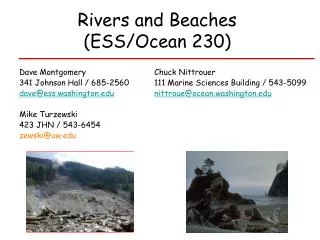
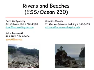
Rivers and Beaches (ESS/Ocean 230) Dave Montgomery Chuck Nittrouer 341 Johnson Hall / 685-2560111 Marine Sciences Building / 543-5099 dave@ess.washington.edunittroue@ocean.washington.edu Mike Turzewski 423 JHN / 543-6454 zewski@uw.edu
Geomorphology Professor, Dept of Earth & Space Sciences Ph.D., University of California, Berkeley Dave Montgomery studies the evolution of topography and the influence of geomorphological processes on ecological systems and human societies. His work includes studies of the evolution and near-extirpation of salmon, fluvial and hillslope processes in mountain drainage basins, the evolution of mountain ranges (Cascades, Andes, and Himalaya), and the analysis of digital topography of Earth and Mars.
Marine Geology and Geophysics Professor, School of Oceanography and Dept of Earth & Space Sciences Ph.D., University of Washington Chuck's research interests include the modern and ancient formation of sedimentary strata in continental-margin environments. Ongoing research includes coastal areas near the Amazon and Mekong Rivers, tidewater glaciers in Patagonia, and the impacts of dam removal from the Elwha River. Other recent studies have been completed in New Guinea-Australia, the Mediterranean, and off Antarctic and Alaskan glaciers.
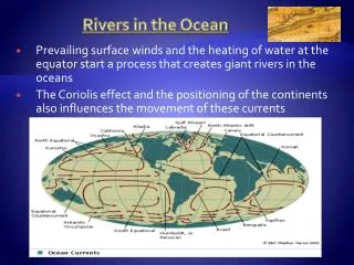
Topics to be covered Earth Surface Processes Mountains RiversBeaches Ocean Holistic view, including: 1) Solid Earth 2) Atmosphere Linkages of all these will be an emphasis of the course.
In order for there to be mountains, rocks must be uplifted above sea level. If uplift continued unopposed there would be no limit to how high mountain ranges can get.
Mountain streams receive material from hillslopes and transport it to rivers
Nearshore processes redistribute sediment along beaches and coastlines
Types of beaches reflect differences in sediment sources and transport
Earth Surface = where we live Recent Dramatic examples: Centralia rainfall landslides flooding New Orleans/Galveston hurricane wind stormsurge Indonesia / Japan earthquake submarine landslide tsunami emphasis on understanding fundamental processes, but shock and awe will come with some examples
Rivers and beaches are part of sediment transfer systems. • What forms them? • What are the processes that maintain them? • Why are there different types of rivers and beaches? • What controls their distribution across Earth’s surface?
We’ll use 1 equation in this class I - O = DS Input minus output equals change in storage. Also known as conservation of mass (D means change in something)
Time and Place Lectures: M,W & F 1:30 - 2:20 75 Johnson Hall Labs (5 credit): W 2:30 - 3:20 111 Johnson Hall 3 or 5 credits (Natural World) Lab Fee: $30 for 3 units; $50 for 5 units Website: http://gis.ess.washington.edu/grg/courses/ess230/index.html
Exams and Grading 30 Oct (W) Mid-Term Exam, during class 9 Dec (M) Final Exam 2:30 – 4:20 (PM) Grading: 3 credits 5 credits midterm = 40% 35% field trip/labs = 20% 30% final = 40% 35% No make-up field trips, No extra credit
Field Trips A 2 Oct (Wed) Puget Sound Cruise B1 9 Oct (Wed) Nisqually River watershed B2 16 Oct (Wed) Nisqually River watershed C 19-20 Oct (Sat & Sun) Olympic Peninsula Beaches For 3 credits; fieldtrip B is required. You are welcome to participate in additional field trips, if space is available. For 5 credits; all field trips required. Email Mike to reserve your space on trip B zewski@uw.edu
Labs/Field Trip Write Ups A field trip write up is due after each field trip, as indicated on the course syllabus. No credit if more than 2 days late…
Field Trip A Working cruise on Puget Sound with Research Vessel Thompson, UW’s oceanographic research vessel Wednesday 2 October All day (no class or lab)
Cruise on Puget Sound in Elliot Bay Sample bottom sediments, measure water salinity and temperature, and map bathymetry
Duwamish delta 4-m resolution, 5x VE depth in m
depth in meters Nisqually Delta, 5x VE 3-m resolution, looking SW
Field Trip B Trip from Mt. Rainier downstream to Nisqually River delta Either Wednesday October 9 or Wednesday October 16 All day
Nisqually River Delta Mt. Rainier
Follow river system down through mountain streams and into large rivers
End at delta system where Nisqually River empties into Puget Sound
Field Trip C Rivers and beaches of the Olympic Peninsula 19 - 20 October Saturday and Sunday; Overnight camping in the field on Saturday night.
Field Trip Tips Bring clothes for bad weather (rain, cold, wind) -- even if it doesn’t seem like you’ll need them!
Please Note The course puts a high premium on the learning that comes from field observations. Participation in field trips is required to get credit for field trips. There are no make-up trips or alternate work that can be substituted for the trips.
If you miss one, your options are: • For 3-credit registrants: • If you miss Field Trip B, you can go on Field Trip C; • 2) you can take a zero for the field trip; • 3) you can drop the course. • For 5-credit registrants: • If you miss a trip, you can drop to 3 credits; • 2) you can take a zero in the missed trip; • 3) you can drop the course.
Field Trip A will be held on a Wednesday (2 Oct). Field Trip B will be held twice, both on Wednesdays (9 and 16 Oct). If you need a note explaining your absence from other classes, please contact Chuck or Dave at least a week before the trip. Contact Mike (zewski@uw.edu) to sign-up for Field Trip B on either 9 or 16 Oct. Reservations will be limited for each day, and will be accepted on a first-come basis.
Field Trips A 2 Oct (Wed) Puget Sound cruise B1 9 Oct (Wed) Nisqually River watershed B2 16 Oct (Wed) Nisqually River watershed C 19-20 Oct (Sat & Sun) Olympic Peninsula rivers and beaches For 3 credits; fieldtrip B is required. You are welcome to participate in additional field trips, if space is available. For 5 credits; all field trips required. Email Mike to reserve your space on trip B zewski@uw.edu
Source to Sink A different way of seeing landscapes…
The Rock Cycle Material eroded from mountains enters streams and rivers and is delivered to coastal environments, from where it is moved to deeper sedimentary basins that get shoved back into mountains through processes of rock uplift.
What we see as rivers and beaches are rest stops for sediment moving through the eroding half of the rock cycle.
Framework for this Class Rock uplift Mountains Mountains Mountain Streams Mountain Streams Rivers Rivers Estuaries Estuaries Beaches Beaches Off-shore depositional basins Off-shore depositional basins Rock uplift.