Download
1 / 23
230 likes | 396 Vues
Software Options for Operational GIS in Professional Environments. Summary. Major Software Platforms Elements of individual Platforms Fully Integrative Software Platforms Predominantly Image Analysis Software Platforms Issues to be considered. Image Analysis ERDAS Imagine ( Leica )

E N D
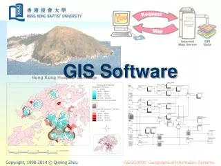
Software Options for Operational GIS in Professional Environments
Summary • Major Software Platforms • Elements of individual Platforms • Fully Integrative Software Platforms • Predominantly Image Analysis Software • Platforms • Issues to be considered
Image Analysis • ERDAS Imagine (Leica) • Geomatica (PCI Geomatics) • ENVI (ITT visuals) • Definiens Professional • Google Earth Major Platforms (not exhaustive) Raster/Vector Integration • ESRI ArcGIS • Geomedia (Intergraph) • IDRISI • Maptitude • GRASS • MapInfo (Pitney Bowes) • AutoCAD • Microstation
ESRI • Market Leader • Extensive Format Support • Flexible Functionality for different users • Extensive Analysis Toolset • Database Management of various data types • Extensive Support, Trainig, and Knowledge Base
Supports many data types • Extensive Analysis Toolset • Direct access to major geospatial/CAD Data Formats • Incorporates industry-standard relational databases • Regularly updated with full support • Training GeoMedia
IDRISI • Open Code • Single Packaged Product • Sophisticated Raster based analysis • Raster analysis toolset • Extensive Vector-based data input and output through CartaLinx
Maptitude • Cad & GIS • Import/Export options • Address Matching Feature • Suited for Readily Available Datasets
GRASS 6.2 Geographic Resources Analysis Support System (GRASS) • Raster/Vector capabilities • New topological 2D/3D vector engine and support for vector network analysis • First UNIX GIS • UNIX Functionality • Open Code • Global User Base
MapInfo (Pitney Bowes Software) • Mapping Functionality • Limited GIS Functionality • Traditionally Visual Basic • Flexible Applications • Global base • Strong Dissemination Tool
AutoCAD Map • Sophisticated GIS/CAD integration • Grid, Projection, & Topology Support • Extensive Database options • Vector/Raster display and Analysis • Menu-based • Costly
Microstation • Largely US and European Use • Cad-Based Mapping • Limited Analysis Features • Limited Data Format Integration & Georeferencing • Simple Google Earth/Google SketchUp Interface
Image Analysis Software • Major platforms -ERDAS Imagine (Leica), ENVI (ITT Solutions) Geomatica (PCI Geomatics) & Definiens • Google -for broad based applications • Raster-based analysis becoming commonplace in census mapping operations • Many Image analysis software can integrate vector data for refined image analysis • Imagery becoming cheaper and faster to process and integrate with existing vector datasets
ERDAS IMAGINE 9.1 • Raster-based software designed to extract information from images. • Handles extensive collections of geospatial data • Provides client-side interaction with spatially aware databases • Extends to topological editing of spatial databases • Vector layer support
Handles extensive collections of geospatial data formats • Provides client-side interaction with spatially aware databases • Full map production capabilities • Attribute management tools for viewing, editing, querying and analysis of attributes • Extensive image processing capabilities Geomatica(PCI Geomatics)
ENVI 4.3 (ITT Solutions) • Integrates raster imagery with geographic information systems • Vector layers can be overlain onto image data, to easily compare raster and vector information. • Relatively extensive support & knowledge base • Reads vector formats (ArcView shp, ARC/INFO interchange, DXF, Microstation/Intergraph DGN files, USGS DLG files and more) • Linear feature extractor automatically digitizes everything between the seed points, faithfully following curves, jumping gaps, and snapping vectors if desired
ENVI 4.3 (ITT Solutions) Feature extraction tool can be used on any linear feature, from roads to coastlines, and saves large amounts of time over traditional point-by-point digitizing.
Definiens • Highly sophisticated automated user defined feature extraction • Extract geo-information from any kind of remote sensing imagery • Data Management Connectivity to ArcGIS Server • Load and save vector data to and from databases • Simultaneously update different locations of one large dataset • Update portions of large vector datasets • Extension for ArcGIS • Allows ArcCatalog to define a collection of maps as a Definiens’ workspace • enables users to review and edit Definiens’ workspace entries
Google Earth • Free Imagery! However… (Cost associated feature upgrades) • Global Coverage • Democratizing Access • User Friendly • Large Knowledge Base • Useful for Quick Display of Raster & Vector Data
Several External tools and methods for image integration into various GIS platforms exist • Google Maps Image Downloader • Georeference to Graticule • Local Knowledge Control Points Google Earth
Issues to be considered • Cost • Upgrades • LAN configuration • Training needs • Ease of installation • Maintenance • Documentation and manuals • Help-line and vendor support • Means of making patches for support • Workforce
Summary • Many commercial suppliers exists • Evaluate your goals within the census and adopt technologies accordingly • Evaluate the interoperability of software to best suit both current and future needs • Collaborate with different agencies and staff on the preferred software platform • An informed choice is the best choice!
A Complex Process which a savvy GIS consumer should research, select, test, and question before the purchase of a system is made.