Download
1 / 16
160 likes | 311 Vues
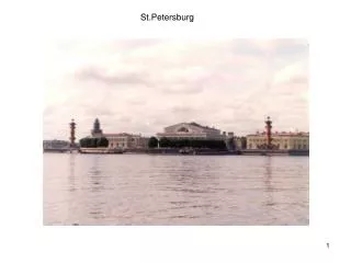
Lyudmila Lebedeva 1,2 , Olga Semenova 2,3 1 St.Petersburg State University 2 Hydrograph Model Research Group 3 State Hydrological Institute, St. Petersburg, Russia.

E N D
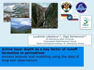
Lyudmila Lebedeva1,2, Olga Semenova2,3 1St.Petersburg State University 2Hydrograph Model Research Group 3State Hydrological Institute, St. Petersburg, Russia Active layer depth as a key factor of runoff formation in permafrost: process analysis and modelling using the data of long-tem observations
Objectives Establishment of observations database for the period 1948 – 1990 To analyze the patterns of distribution of active layer depth in different landscapes To assess the main factors determining active layer depth To estimate physical properties of the soil strata and simulate the process of soil freezing and thawing in different landscapes To simulate runoff using the same set of parameters as in active layer depth modelling
Study area Kolyma water-balance station (KWBS) – small research watershed (22 km2) in the upper Kolyma river; observations since 1948 • Mean annual temperature – -11,60C • Precipitation – 314 mm/year • Open wood, bare rocks • Continuous permafrost • High-mountain relief • Representative for the • North-East of Russia Watershed boundaries Meteorological Station Rain gauge Recording rain gauge Pit gauge Snow survey line Cryopedometer Evaporation plot Pan evaporation plot Snow evaporation plot Water balance plot Fig.1. Sketch of the KWBS
Hydrograph Model R • Deterministic distributed model of runoff formation processes • Single model structure for watersheds of any scale • Adequacy to natural processes while looking for the simplest solutions • Minimum of manual calibration • Forcing data: precipitation, temperature, relative humidity • Output results: runoff, soil and snow state variables, full water balance
Landscapes The landscapes vary with altitude from stone debris to swamp forest Fig.2. The main landscapes of KWBS
Active layer depth in different landscapes Lower part of the slope: Upper part of the slope: • peaty ground • swamp larch forest • rock debris • absence of vegetation clay slate
Soil properties The main parameters for simulation soil thawing and freezing processes in the Hydrograph model are physical soil properties
Slope aspect Slope aspect in mountain relief of KWBS controls both landscape and active layer depth because of different solar radiation income Fig.3. Domination of north- and south-facing slopes within KWBS Fig.2. The main landscapes of KWBS Fig.4. Direct solar radiation income during the year for north-and south-facing slopes Northern aspect Southern aspect
Active layer depth modelling Site 2 (subcatchment Yuzhny): • North-facing slope • Sphagnum, shrubs • Soil profile – peat, clay loam, clay slate • Active layer depth up to 0.7 m Site 1 (subcatchment Severny): • South-facing slope • Absence of vegetation • Rock debris • Active layer depth up to 1.7 m m Fig.5. Observed and calculated active layer depth in two landscapes, KWBS
Runoff modelling – slope scale Subcatchment Severny: • 0.41 km2 • South-facing slope • Sparse vegetation • Thin soils and rock debris Subcatchment Yuzhny: • 0.27 km2 • North-facing slope • Moss, shrubs, open wood • Soil profile – peat, clay loam, clay slate Fig.7. Observed and simulated runoff, Severny, 1981–1982 Fig.8. Observed and simulated runoff, Yuzhny, 1981–1982
Runoff modelling at the Kontaktovy watershed (21,7 km2) Different slope aspects, soil and vegetation were combined into 3 runoff formation complexes (RFC) For each RFC the set of parameters verified against active layer depth and runoff in subcatchments was used
Conclusions • Active layer depth has high variability and is determined mainly by landscape • The landscapes vary consecutively from stone debris with no vegetation in the top of the slope to swamp forest next to the stream body • The main parameters for computing water and heat dynamic in soils are its physical properties • Long-term observations accompanied with description of soil and vegetation properties may serve as a base for reliable estimation of the model parameters which can be transferred to the basins with limited data
Acknowledgements This study was conducted within the research grant provided by Russian-German Otto-Schmidt Laboratory for Polar and Marine research in 2010 The attendance to EGU 2011 was made possible with additional support of Russian-German Otto-Schmidt Laboratory for Polar and Marine research
Hydrograph Model Research Group www.hydrograph-model.ru
More results in the Canadian discontinuous permafrost environment on… Thu, 07 Apr, 11:30–11:45, Room 38 EGU2011-4813 “Parameterisation by combination of different levels of process-based model physical complexity” by Pomeroy, Semenova, Lebedeva and Fang Thank you for attention!

![Mr. Ye Myint Naing [yemyintnaing@gmail] STATE MARINE TECHNICAL UNIVERSITY, ST.PETERSBURG](https://cdn1.slideserve.com/2386968/slide1-dt.jpg)
![Statistics [1/2,3/2]](https://cdn2.slideserve.com/4297614/statistics-1-2-3-2-dt.jpg)